Wednesday, May 25, 2022

Talking about Nonnewaug (Woodbury CT)

 (For the nice fellow at the Senior Center yesterday)


My street address includes a Paugussett Place Name

That some people think is the name of the road

That the local high school is on,

   But it isn’t

  - and the man who looks at my driver’s license 

(so I can vote)

Knows that. 

He says: “Chief Nonnewaug - he’s buried over by there somewhere.”

And I have to answer truthfully, 

So I say “Well, no - not anymore.”

“But there’s that plaque that says that,” he says.

Sachem Nonnewaug, he was known as,” I say, walking away...


I could have talked for a while about that, but I didn't.

I feel like I owe the fellow an apology for not explaining further, 

So here's some other things I've said about that name, "Nonnewaug:"


From 2005: http://nonnewaugfalls.blogspot.com/2010/09/word-nonnewaug.html

http://nonnewaugfalls.blogspot.com/2010/08/nonnawauk-9.html

https://wakinguponturtleisland.blogspot.com/2021/12/nonnewaug-fresh-water-fishing-place.html

https://wakinguponturtleisland.blogspot.com/2021/04/update-on-nonnewaug.html

Monday, May 23, 2022

Stone Shelters in the Sierras and New England

Posted on May 11, 2022 by Thorson Robert

Stone Shelter in White Mountains, CA, USA in the glacial high Sierras. Elizabeth Wing.

      "Years ago," writes Robert Thorson, "I was traveling through the small town of Putre in northern Chile, when I saw something astonishing.  The shape, size, and composition of its ancient stone walls in the high Andes at an elevation of 3500 meters (11,060 feet) were remarkably similar to those I’d seen in the lowland hills of interior New England. Though the inhabitants of pre-Columbian South America were raising camelids rather than sheep and cows, and though they were worlds apart from post-Columbian North American Yankees, their primitive farmstead stonework was remarkably similar.  Why?  Because the same three fundamental factors came together in time and space: the need to enclose grazing animals in heavily glaciated terrain underlain by crystalline igneous and(or) high-grade metamorphic rock.

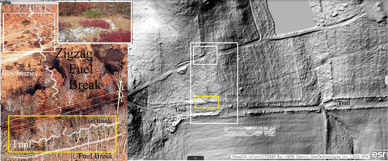
    Similarly, The Distinctively Basque Stone Shelters of California’s White Mountainsare remarkably similar to some I’ve seen in New England because the same three factors were controlling the outcome: animal enclosure, glaciated terrain, and hard crystalline rock.  This new, 2022, article by Michael R. Wing, Elizabeth H. Wing, and Amin M. Al-Jamal, describes the shelters built during the mid 19th century to protect sheep grazing in the high meadows of the White Mountains of high eastern Sierras of California. The phrase “distinctly Basque” refers not to a cultural style of construction, but to the certain historic knowledge that they were built by Basque (or adjacent French) herders.

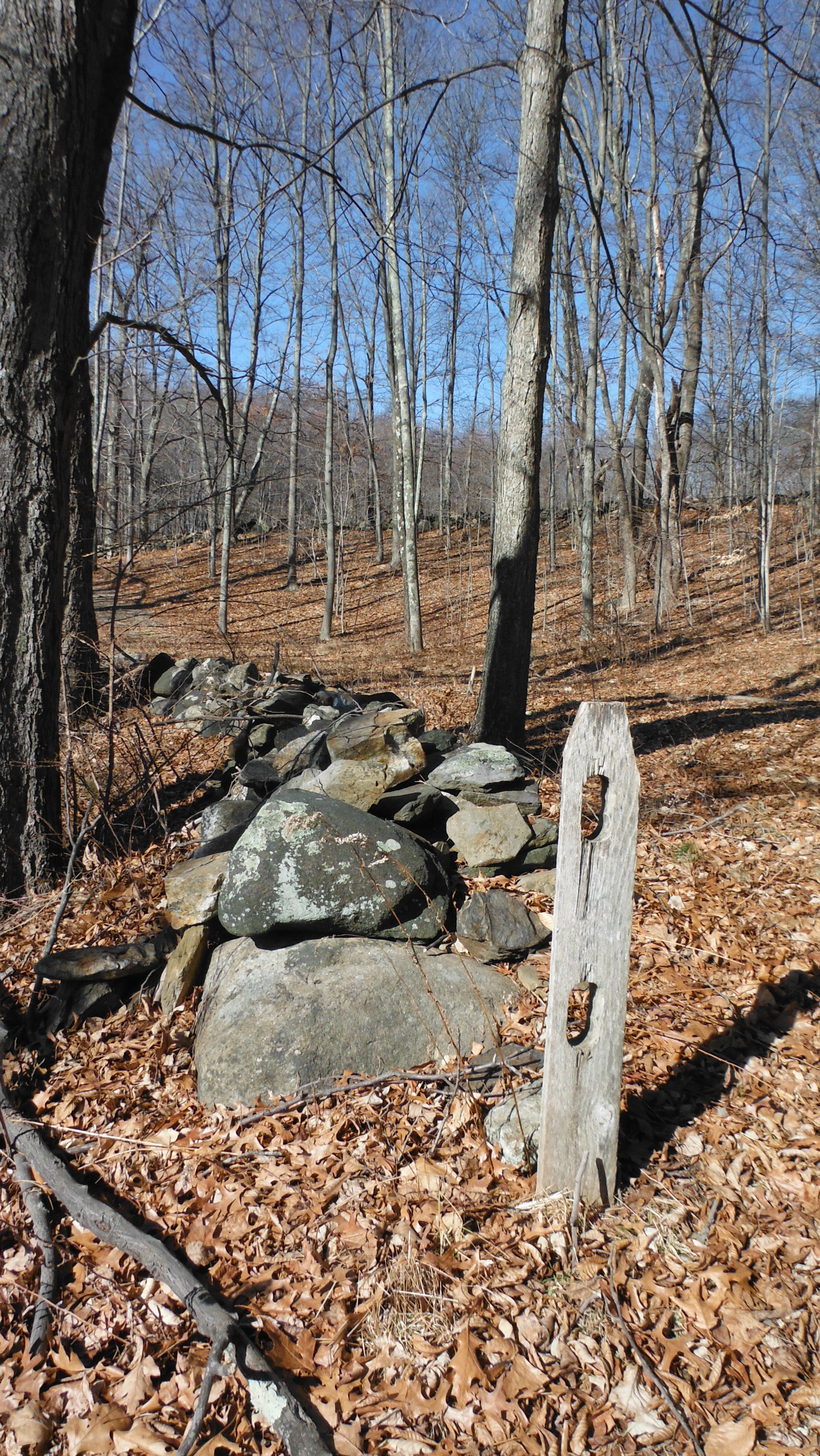
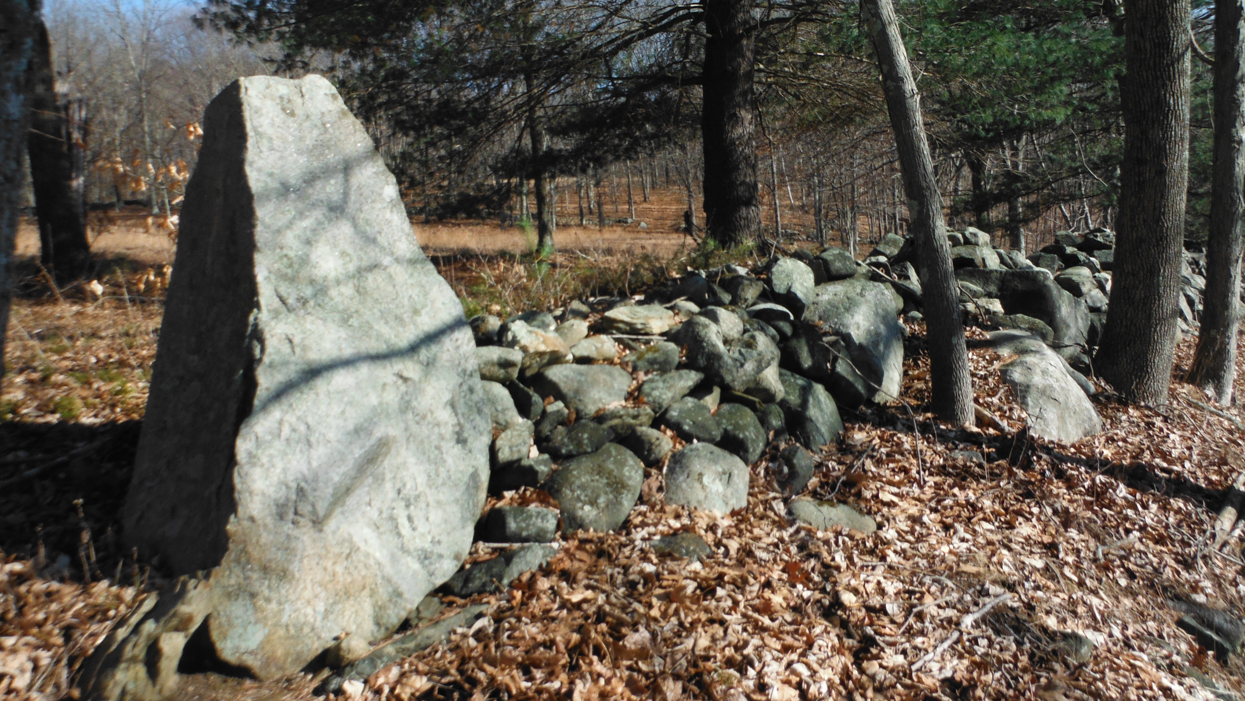
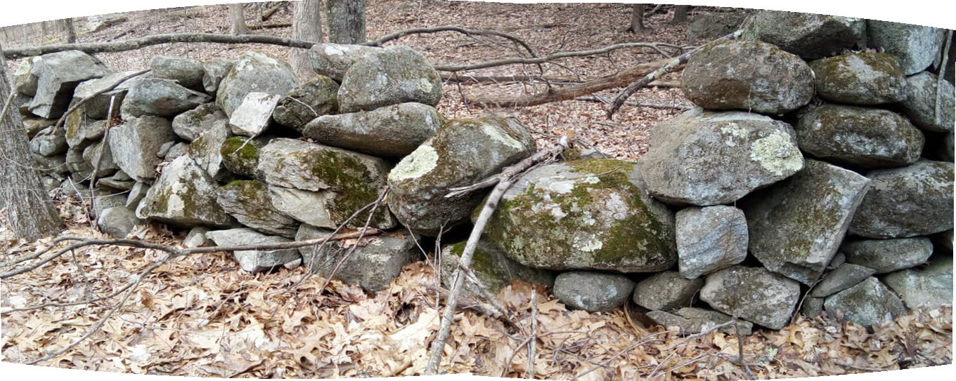
    The captioned illustration above reproduces their Figure 1, a photo of Big Stone Shelter, which located above tree line at an elevation of 3840 meters (12,600 feet), even higher than in Putre, Chile.  Its features –a glacially rounded boulder, a mix of angular and milled stones, the overall form, and the pattern of stacking– are identical to those of primitive fieldstone walls in New England.  And though this shelter is a small enclosure rather than a wall around a land parcel, New England has many such small enclosures in its formerly de-forested highlands, or as niches attached to walls.  Whether some or all of these were roofed with organic material that has since decomposed is unknown.

The similarities in expedient stone construction built by indigenous inhabitants in the high Andes, Basque herders in California Sierras, and farmers in New England demonstrate the adage that form follows function, regardless of historic or cultural setting. Such walls are ecofacts as much as they are artifacts.

Of course, the story of stone structures everywhere is much more complex than the simple connections made above. And these three connections are only a few among many.  But the conclusion is always the same. Beneath cultural overlays, the expedient architectural requirements of herding animals in rocky glaciated landscapes produces similar results."

Accessed from: https://stonewall.uconn.edu/2022/05/11/stone-shelters-in-the-sierras-and-new-england/

The Distinctively Basque Stone Shelters of California’s White Mountains 

Abstract

"Basque and French shepherds in California’s White Mountains built dry stone shelters that persist today. Despite French names carved on logs associated with a few of these structures, the typical pattern for these shelters is Basque: they closely resemble the cabañas pastoriles (shepherd’s huts) of Bizkaia. A square floor plan with walls about one meter high enclose a single chamber. The stone work is carefully laid to make one wall face. A narrow doorway, often in a corner, faces downhill in any direction except west and can be flanked by low stone “spurs”. A fireplace is usually built into the south wall. Boulders too large to move are usually in the western wall or northwest corner. Metal, glass, wood, bone or leather artifacts are present. Typically Basque arborglyphs (carvings in aspen trees) are found nearby at lower elevations. It is unclear whether the White Mountains shelters originally had roofs."

Recommended Citation

Wing, Michael R.; Wing, Elizabeth H.; and Al-Jamal, Amin M. (2022) "The Distinctively Basque Stone Shelters of California’s White Mountains," BOGA: Basque Studies Consortium Journal: Vol. 9 : Iss. 1 , Article 4.

https://doi.org/10.18122/boga.9.1.4.boisestate

Available at: https://scholarworks.boisestate.edu/boga/vol9/iss1/4


     Apparently, "nothing happened before 1620" in these peoples' view of the human history of what is now referred to as "North America."  

         Apparently, none of these people are familiar with the word "Tsektsel" or any Indigenous term for a "prayer seat" in languages other than Yurok. 

Tsektsel (Yurok), a "prayer seat"

Aboriginal Alpine Ceremonialism in the White Mountains, California

Abstract: “At 3,609 m. (11,840 ft.) elevation in the White Mountains of Eastern California is a site containing 216 rock features consisting of cairns, pits, and other stacked-rock constructions but very few artifacts. Two obsidian bifaces, two milling tools, and lichenometric dating point towards site occupation between 440 and 190 cal B.P., contemporaneous with the White Mountains Village Pattern, which was marked by intensive seasonal occupations of multi-family groups in the alpine ecozone of the range. Though the site’s features are similar to facilities associated with artiodactyl hunting across the American West, their diversity, abundance, and distribution are more consistent with ceremonially-oriented sites on the Plains, in the Mojave Desert, and especially on the Plateau. This, in conjunction with the site’s setting, suggests that there were ritual functions associated with the site, and that the ceremonial use of high-altitudes has been overlooked in the region’s research history.”

https://escholarship.org/content/qt71d2g30s/qt71d2g30s_noSplash_0005b610d8eb3ffac3aaad128f8c8aff.pdf

"When the novice had recovered she was taken into the high mountains in the summertime by her mentor and her male relatives (as many as ten of them). They went to a prayer seat, cekce>l, a semicircular enclosure of rock – sometimes river rock brought from below ... . ... the novice and her teacher swept the seat carefully [http://texts.00.gs/Standing_Ground,_5.htm]." ~ Thomas Buckley : Standing Ground : Yurok Indian Spirituality. U of CA Pr, Berkeley, 2002.

A Rock Feature Complex from Northwestern California

Joseph L. Chartkoff: "Tsektsel is derived from Yurok and means roughly "a place" (Wylie 1976)..."


American Antiquity

Vol. 48, No. 4 (Oct., 1983), pp. 745-760 (16 pages)

Published By: Cambridge University Press

 https://doi.org/10.2307/279774

https://www.jstor.org/stable/279774


 Here in "New England," as it has been known for a tiny percent of its human history, Nohham writes:

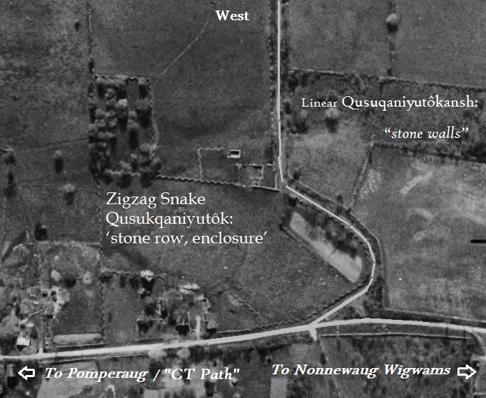
níswonki - an enclosure, "three bends" (Nipmeuw, shwihwakuwi, Narragansett). https://www.academia.edu/40876479/Assessing_Stone_Relics_in_Western_Massachusetts_Part_II_Patterns_of_Site_Distribution

Here in the Northeast, an other Algonquian language term:

świhwákuwi (viz. świk+wāgawi, ‘it grows around,’ Unami Lenapeuw, Zeisberger 1995:151, 173; świ, ‘three’ for 3-sided - Mohegan Nation 2004:98) form open ellipses that the author considers roughly equivalent to the “nave” of a Christian church…”

 https://www.academia.edu/40876478/Quantitative_Assessment_of_Stone_Relics_in_a_Western_Massachusetts_Town

Sunday, May 22, 2022

LiDar and Aerial Stone Snake Gateways (Bethlehem/Washington CT)


Above: Interesting Stonework, one of many places I'd love to "groundcheck the stone walls."  

  Now and then, I drive that presently paved Wood Creek Road that cuts across the bottom left of the LiDar image. I drive it slowly, looking at the way the stones are stacked along (often both sides of) the roadside, and sometimes I stop to capture a photo of those "cart path gateways," Serpent Gateways hidden in plain sight on the edge of two present day towns in Western CT:
Above: Looking to the East, or really, "a little south of east."
   
  "Farmers' Fences," some might say, "Leading into Farmers' Fields:"
Above: 1934 Aerial Image (Apple Orchards, Cow Pastures and Hay Fields)
Below: Same place, in the early 21st century.


An used (un-blogged) photo in that batch of photos causes me to pause, first trying to use the row of stones in the distance to place it in perspective on the aerial images, and then suddenly I find myself looking at a certain shadow:
I'll use that "Uktena" description, the "knows your intentions" description, because the head is at an angle and not "straight on," like quite a few others at certain "gateways," including the one on the other side of the "barway" opening into the enclosure:
The Overlay:

The other "gateways" along this little stretch, I've blogged them before - one of these days I'll go back when I'm feeling better, I keep telling myself...


The very wide opening:
A "cow run?" An Indigenous Game Drive?


Guarded by a Stone Serpent:
A small "bowl" just might be a place to offer some tobacco:

Friday, May 13, 2022

The Zigzag "Stone Wall" Dissenter (Nonnewaug CT)


    Here in Nonnewaug (extending throughout Pootatuck, and even into Mattatuck and Paugussett), it is my observation that many zigzag rows of stone falsify Eric Sloane’s statement that “One of the minor mysteries of old fences is the zigzag stone fence. Why would anyone place stones in such a fashion? The answer is simple: the stones were thrown there during a clearing, piled against an existing snake-rail fence. The rails rotted and disappeared, but the stones remained, winding across the land in the same crazy manner.”


      Here in Nonnewaug, field checking includes observations of triangular flat topped rattlesnake head-like boulders, similar to those of linear snake effigies, occurring at certain points of the zigzag rows of stones. 

Here in Nonnewaug many zigzag row of stones turn to linear rows, in some cases still retaining a boulder or stacked stone snake head.


     Here in Nonnewaug, the statement and the image used by the Gages in “How to Identify and Distinguish Native American Ceremonial Stone Structures from Historic Farm Structures”  that “If you find a zigzag wall that has even in/outs then you have a farm wall” are also falsified by observations of a large number of consistently  “even” ten foot/three meter long segments of stones creating these zigzags. The 1934 aerial photograph that includes the site of the Nonnewaug Wigwams  is a striking image of these often carefully constructed “even” zigzag stone constructions. It’s possible that some of these zigzags have wooden fence rails placed on top of them in the 1934 photograph, making some of them very visible. Field checking also reveals evidence of a number of decomposing chestnut rails on top of these zigzag rows of stones.
          If a zigzag stone fence is composed of random stones plucked from a plowed field that have been tossed against wooden rails, then would this indeed have the more “regular” and “even” appearance as opposed to stones intentionally “serpent stacked,” recalling these powerful and protective Spirit Beings?


  Here in Nonnewaug, I interpret the majority of these zigzag stone constructions to be Indigenous Great Snakes rather than the later “messy” field clearing debris of the post-contact period. I would suggest that the addition of wooden rails was to meet legal property ownership requirements under colonial law, “improvements” to otherwise “vacant land.”


  And yes, of course, here at Nonnewaug, a few other statements are drawn into question:

Gages “Farm Wall Criteria”

‘A sketch map or aerial photo shows an organized layout of fields.’

(Implies Indigenous Peoples were “unorganized,” implies enclosures were unrelated to Indigenous Landscape usage rather than later cultural appropriations.)


   ‘There are openings in the wall to allow access to the fields.’


   (Serpent Gateways at openings, guardian spirits of whatever was inside the enclosure – sometimes wide, sometimes narrow. Sometimes a “step/stone turtle shell” in an otherwise continuous fuelbreak.


 May have a stone wall lined "road" leading to the fields called a cow lane or cow path.

(Remnants of zigzag and linear rows of stones, exhibiting Indigenous Iconography,  still line both sides of many roads, including Nonnewaug Road, evidenced as well in the aerial photography of 1934 before many of the roads were paved and widened.)


May have a wall with multiple notched stones evenly spaced out (about 6 ft apart).

(Many may be Horns possibly placed behind/above snakeheads in the uppermost course of stones, “serpent stacked” smaller effigies that are part of a larger Horned Serpent or Great Snake effigy. These stones may also be horned medicine people or spirit effigies, some of which may also be "about to sing." )


Curtiss Hoffman

I strongly disagree with my friend Curtiss Hoffman when he writes (in part, in "Stone Prayers," page 61): "As Allport and Thorson have shown, New England colonial farmers built thousands of miles of stone walls to separate fields, either to control movements of livestock, or as property boundaries. However these walls are generally made of well-laid stones and are higher than one course of stones, and they also run straight in one direction, and meet at right angles, and tend to be continuous for considerable distances, wherever they are not dilapidated or punctured for cart paths. What I am calling "stone rows" lack some or all of these features: they tend to be made of smaller stones which are more haphazardly laid; they may be only one or two courses high, so they would not be able to function to keep animals in or out...they meet other walls at non-right angles..."

   (Allport and Thorson (et al) are repeating a colonial myth related to “Yankee Exceptionalism” that completely ignores the idea that Indigenous Peoples of the Northeast built with stone. Many “walls” featuring Indigenous Iconography, both zigzag and linear, are “well laid” and “higher than one course of stone,” and in my experience do extend for “great distances” and do meet at “right angles.”

“Haphazardly” is hardly the term for some of the more massive and exceptionally well built stacked stone constructions that have managed to survive unmaintained over hundreds of years of time.  


    Before 1990, I might have told you the same old story about the mystery of zigzag stone walls that almost everyone still repeats, derived from the writer and artist Eric Sloane. Since 1990, when I began “ground checking” what should be “Yankee Farmer built stone walls,” I became more inclined to suspect that the oldest of the stonework was made by Indigenous Peoples over an undetermined number of years. And I can’t find one yet, a zigzag stone wall that fits the Eric Sloane conjecture turned fact method of construction, although in a small number of places, the angle segments are filled with what appear to be dumped field stones from later field clearing of plowed enclosures for a short span of distance. I have also come across one example of old chestnut rails placed on top of a series of single stones.


    My little Case Study of “Zigzag Stone Walls” mostly comes from around where I live, an English Watch House overlooking the former floodplain fields associated with a late Woodland/Contact Era Pootatuck village known as The Nonnewaug Wigwams, occupied in 1672 when colonists fron Stratford CT arrived, and “abandoned” sometime around 1740. The Indigenous place name probably refers to the stonewall-like diagonal fish weir in the river of the same name. And yes it’s the “Nonewaug” Cluster in “Stone Prayers” by Curtiss Hoffman, a place where I do vaguely give out locations by saying “in plain sight most everywhere one goes.” My experience and observations are that the oldest and most numerous of “stone walls” are probable snake effigies that served in part as fuel breaks and water control on a Sacred Landscape that was in part a garden and in part similar to a great and vast cathedral.


An incredibly beautiful example:

https://wakinguponturtleisland.blogspot.com/2017/04/grey-fox-serpent.html

 Way too many more examples:

 https://wakinguponturtleisland.blogspot.com/search?q=zigzag

At Rock Piles over the years: 

https://rockpiles.blogspot.com/search?q=zigzag

Saturday, May 07, 2022

Markum Starr Presentation (Southbury CT)

"Big Snake" Effigy
Save the Date: Annual Meeting - May 15th 2022 - Open to the public


The Southbury Land Trust Annual Meeting is Sunday, May 15th 2022 at 1:30 p.m. at the Southbury CT Public Library. 

Guest speaker Markham Starr is our guest speaker presenting on ceremonial stone walls created in New England by Native Americans. 

("Ceremonial Stone Walls" is actually Ceremonial Stone Landscapes?)

Markham Starr has been documenting these structures for the past seven years.

This program is free to the public.


Ceremonial Stonework: The Enduring Native American Presence on the Land


While archaeological evidence shows the first people in New England inhabited the landscape for more than 12,000 years, newly landed colonists from Europe immediately dismissed Native American spiritual practices as pagan rituals to be destroyed or silenced through Christianization. Although disease, war, and other troubles brought to the continent nearly annihilated the indigenous population, the physical manifestations of Native beliefs, wrought in stone, were often ignored. Still standing witness to the strength of their spiritual lives, the stone objects they created remain scattered across the New England landscape. This book takes the reader deep into woods now long abandoned to rediscover the structures they left behind.


After walking hundreds of miles to photograph 8,000 constructions, the author chose 270 color images, separating the work into 25 categories in an attempt to understand their significance. While the exact meaning behind them remains obscure, there can be little doubt of the overall importance of this stonework to its creators or their descendants. Endangered by modern development, Ceremonial Stonework sheds additional light on what has been overlooked and ignored for so long, seeking to help preserve them for generations to come.

 Note: Color book sold out. A kindle/tablet version in color is available on Amazon for $9.99

https://www.markhamstarrphotography.com/ceremonial-stonework--the-enduring-native-american-presence-on-the-land