Showing posts sorted by relevance for query orenaug. Sort by date Show all posts

Saturday, March 25, 2023

Orenaug Striking Serpents

       -and Sachem Pomperaug’s Castle

Both sides of a raised or Striking Serpent Effigy Row of Stacked Stones or Qusukqaniyutôk

   Sometimes, but not all the time to say the least, one may find an old painting that includes some Indigenous Ceremonial Landscape features. Here’s one:

   With some informed imagination as well as familiarity of the landscape, sometimes one can detect many details and slap some labels on these old paintings:


    Seen from a distance, of course you can't see the details of those features but ground checking some of those “stone walls/fences,” one sometimes finds the Indigenous Iconography is present, “snakes and turtles mostly” but other effigies as well, effigies one won’t find if one isn’t looking for them, because of that old myth that these rows of stacked are all settler colonist constructions made after (in this town) 1673 rather than older Indigenous constructions that may in fact far older than that, built by Indigenous Peoples sometime in the past…


    At the time I took some of these Orenaug photos, I wasn’t “seeing” the large boulders (and tors?) below the cliff side of Bethel Rock as Raised Head or Striking Serpents, my term for these sorts of snake head variations, apparently after voting at the Senior Center in 2014: 


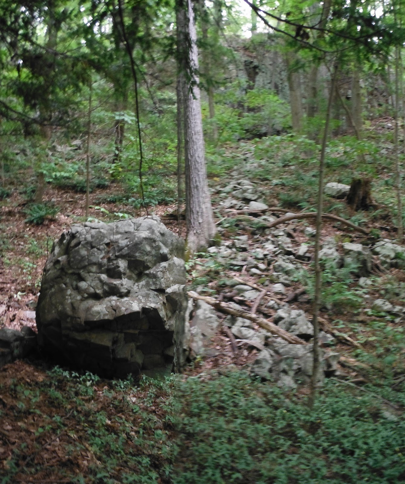
There's even a Serpent with raised head built up on a rocky talus slope: 


  I had to ponder some smaller examples and finally puzzle out this one, over on a local land trust property before I ever figured out that this is a (sometimes) repeated Snake Head variation:

   
Pootatuck Stone Effigy and a Pictograph in Alabama, two Uktena-like Serpents, head to head:

There's all sorts of interesting stone features up there, Hidden in Plain Sight, that practically no one has any interest in in my town, just above the center of town: 
   In the mid-1800’s, Woodbury CT historian William Cothren wrote: “Orenaug is the name of the beautiful trap-rock cliffs, which bound the village on the east. The front cliff has been recently purchased and improved by the writer, as a mountain park. Oak, maple, hickory, chestnut, and cedar trees are scattered over the mountain-top, and in the beautiful ravine beyond, while the crest is covered by a beautiful grove of pine trees, in the midst of which a tower, thirty feet in height, has been erected, from which views of six surrounding towns may be obtained. It has been named the Orenaug Park. Here one can always catch a delightful breeze, and enjoy a beautiful panoramic view of the village, valley and meandering river below, while the whispering pines above his head sooth the perturbed, wearied and overworked mind. The beautiful evergreens suggest thoughts of peace, and the beatitude of the eternal rest on high:
   "As the softened land-breeze marches,
    Through the pine's cathedral arches."
     A few moments walk to the south-east, through a pleasant grove, over the second cliff, brings the visitor to the celebrated 'Bethel Rock," in the bosom of these cliffs, of which more will be said hereafter. A more lovely and romantic spot, even without its sacred associations, cannot easily be found.”
     (The "sacred" Cothren is talking about is best explained here: https://youtu.be/-DY-V7T0KSI)


    Back in 1673, Capt. John Minor and a group of people walked from present day Stratford CT to present day Woodbury, ending up at some abandoned Indian fields and village site, near the grave of the Sachem Pomperaug, according to local Historian William Cothren. There’s a big rock formation called Pomperaug’s Castle, reportedly an Indian Fort, but having climbed up there, I’m not entirely certain that’s true. I’m more inclined to believe that there was a palisaded wooden structure on a rise above that floodplain called the Hollow where John Minor had a timber framed house built making use of the old abandoned Indian Fort. It was the easiest thing to do after all, just as planting in those already cleared fields was… 


Related Posts:
and a few "Newer Posts" after that one.


Monday, September 10, 2018

An "Unlikely Place" for a Ceremonial Stone Landscape Part 01

Stone Walls or Uktena Qusukqaniyutôk at Orenaug Park?
    “This is a serpent effigy - and the serpent effigies are quite often in dispute because the presumption is that they are stone walls. Most often, they are too low to pen anything in, but we identify them by other means. Usually they do have a head, such as the one you see here. This particular one, just behind the head, also has a space and an orange stone, because we believe that they are related to the serpent effigy that is in the area of Scorpius that the Cherokee referred to as the Uktena, that is, a serpent with an orange stone. In its terra form, it’s (it has) a jewel and it is horned, but this is, as below, so above...” Doug Harris
   Note: DH is likening the Orange stone (as below/in the stone "wall") to the orange colored bright star Antares that is the Jewel on the head of the Great Serpent constellation (as above in the sky), part of what Europeans came to call Scorpius.


The complete text and video can be seen here at the National Park Service website:
This presentation was part of the Proceedings of the Maritime Cultural Landscape Symposium, October 14-15, 2015, University of Wisconsin-Madison.

    I agree with Doug Harris that this is a Ceremonial Stone Landscape Feature that, diagnostically speaking, represents a Spirit Being from the Underworld, related to water and weather, particularly in its aspect as a protective spirit against the Upperworld (Sky) “Thunder Beings” or “Thunderbirds” who could shoot lightening from their eyes and cause wild fires:
Beenaysee eshkotay – Thunderbird fire, comes from the thunderbirds’ eyes and strikes whatever it is looking at. Renewal begins with the roots that remain underground. (Figure 5.2 from: Living with Boreal Forest Fires; Anishinaabe Perspectives on Disturbance and Collaborative Forestry Planning, Pikangikum First Nation, Northwestern Ontario. Accessed from http://umanitoba.ca/institutes/natural_resources/pdf/theses/PhD%20Thesis%20Miller%202010.pdf)

     I’m unsure about the orange stone mentioned (having only the still capture from the video as reference) – and I would offer a guess that the “jewel” (on the head of the Uktena) may be the stone I have labelled as “The Jewel” or Ulstitli (and also "Ulun’suti" when in possession of a human, as well as "crystal" or "carbuncle"). I’ve taken the liberty to add horns, observing another repeated feature that in my experience suggests a “horn or antler rest” that I imaginatively conjecture may have been used to further “decorate” or enhance the stone feature to convey that this is a Horned or Antlered Snake, with the power or abilities of a Great Snake to control both a wildfire or a humanly set fire (of Renewal). This presumed stone wall may be better described as a snake petroform and a fuel break as well on a landscape once tended by low ground fires.

    The Uktena is the “Stronger Looker:" 
     "According to (James) Mooney (1900:458-459), the name Uktena is derived from akta, or eye, and implies being a “strong looker,” as everything is visible to it (i.e., it can see thoughts). From the same root is derived akta’tĭ, “to see into closely” which is also the Cherokee word for a magnifying lens and telescope. So the name Uktena implies that it sees thoughts and it does so in an accurate way; knowledge that comes in useful to predict enemy tactics (Jannie Loubser - E-mail communication July 21, 2015). "
   I would further qualify the “stone wall” as an Uktena Qusukqaniyutôk because the head is bent at an angle from the “body” of the “wall” or Qusukqaniyutôk ~ ‘stone row, enclosure’ (Harris and Robinson, 2015:140)
    This tilted head motif can be observed in many other “stone walls” that I suspect to be Uktena Qusukqaniyutôk:
An enhanced drawing with embarrassing horns or antlers:
I once came upon an unauthorized photo of Jannie Loubser at a suspected malicious website and learned in a personal communication with him that this was a photograph of an unidentified “squiggle” at the Painted Bluff site in Alabama, at the time Jannie was writing up his report that was not classified as a Snake/Uktena because of a lack of a head on one end or the other: 
     I suggested that the squiggle may be two Uktena, head to head, guarding the circular shape that may be a sort of "gateway" or "doorway" to the Underworld. I sent along a better photo overlay:
  There's an outcrop at Orenaug, surrounded by "stone walls" that also might bear some similarity to the Petroglyph, but perhaps it's more related to the Upper or Sky World and the Thunder Beings/Birds (maybe). It's just as possible that it's a place where a Great Horned Snake lives - or emerges from the Underworld.
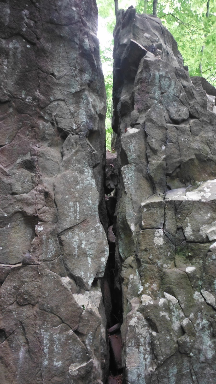
     I've overlaid some of that stolen image above onto a photograph of that Orenaug outcrop, illustrating the similarity to the petroglyph at Painted Bluff in these two different forms of Indigenous Rock Art. Both can be seen as a person about to enter a Sacred Space, guarded by two Uktena or Great Serpents/Snakes, one in paint, the other in solid stone...
The "Gateway" is very narrow and a person would perhaps brush up against the Uktena, head turned slightly toward the person entering this space:
Overlay (including a surveyors pin at orange arrow):
As the person leaves that (probable) Sacred Space, another Uktena watches on, "knowing the person's intentions," as he or she leaves the site of suspected Ceremony:

Perhaps a person might be seeking the protection of the Great Snake before climbing to a higher point, it suddenly occurs to me. The survey pins (and some inaccurate yellow lines) tell us exactly where this feature of the Ceremonial Stone Landscape is located:
(To be continued...)


Sunday, September 09, 2018

An "Unlikely Place" for a Ceremonial Stone Landscape (Intro)

   Between Main Street and the massive scar of an earth products quarry, in a town park associated with some names very familiar to local historians, is hardly the remote location deep in some untended second growth woods usually associated with a Ceremonial Stone Landscape. 
   Over the past 30 years, I've come to realize that Orenaug Park contains many features that are elements of an Indigenous Ceremonial Stone Landscape: 

"Ceremonial Stone Landscapes is the term used by USET, United Southern and Eastern Tribes, Inc.[1], a non-profit, intertribal organization of American Indians, for certain stone work sites in eastern North America. Elements often found at these sites include dry stone walls, rock piles (sometimes referred to as cairns), stone chambers, unusually-shaped boulders, split boulders with stones inserted in the split, and boulders propped up off the ground with smaller rocks. While neither the age of these sites nor the idea of their creation by indigenous peoples has been accepted generally, interest in the sites is increasing. This interest is generated in part by USET's Resolution #2007:037 [2], entitled Sacred Ceremonial Stone Landscapes Found in the Ancestral Territories of United Southern and Eastern Tribes, Inc. Member Tribes.
Sections of the USET resolution describing these sites read as follows:
"within the ancestral territories of the USET Tribes there exist sacred ceremonial stone landscapes and their stone structures which are of particular cultural value to certain member Tribes;"
"for thousands of years before the immigration of Europeans, the medicine people of the USET Tribal ancestors used these sacred landscapes to sustain the people's reliance on Mother Earth and the spirit energies of balance and harmony"
"whether these stone structures are massive or small structures, stacked, stone rows, or effigies, these prayers in stone are often mistaken by archaeologists and State Historic Preservation Officers (SHPOs) as the efforts of farmers clearing stones for agricultural or wall building purposes"
The resolution goes on to request that the federal government work to understand and preserve the stone landscapes."
   My  friend Diane Dix writes:
  "In 2008, members of the Nolumbeka Project were instrumental in proving the eligibility of the Turners Falls (MA) Sacred Hill Ceremonial Site for the National Register of Historic Places. Without this intervention, the site would have been destroyed by the extension of the airport’s runway. Nolumbeka Project members assisted by providing records from our Archives;  giving first person accounts verifying the sacred nature of the area; clearing brush;  monitoring  the site; and participating in important meetings.  [Visit http://www.nps.gov/nr/publications/guidance/TurnerFallsDOEDecision-Redacted.pdf  for details about this important preservation success]
   ...the lithic remains of the Native Americans of New England remained hidden in plain view for centuries.  Many of these features are constructed with stone and blend quietly and reverently into the natural surroundings. Yet, once one awakens to their presence they seem to be everywhere. Most were constructed hundreds, even thousands of years ago, when the Indians burned much of the land to control the vegetation and foliage did not obstruct the sightlines. Often these monuments lead the eyes to the place where the earth meets the sky..."

Ceremonial Stone Landscapes are also being recognized and preserved by some towns, through "Memoranda of Understanding" with Indigenous Peoples, such as Wendell MA:
   "A group of collaborating Native American tribes has offered to work with Massachusetts towns to identify landscapes of ceremonial or religious significance to their heritage, and Wendell is taking them up on that.
The history of indigenous ceremonial stone landscapes and the importance of maintaining their integrity and tranquility was explained to the Selectboard by Doug Harris, deputy tribal historic preservation officer for the Narragansett Indian Tribal Historic Preservation Office in Charlestown, R.I.
   The Wampanoag Tribe of Gay Head (Aquinnah) and the Pequot, Mohegan and Narragansett tribes are collaborating on this and have signed a memorandum of understanding with Wendell to share authority of sites of an indigenous nature..."
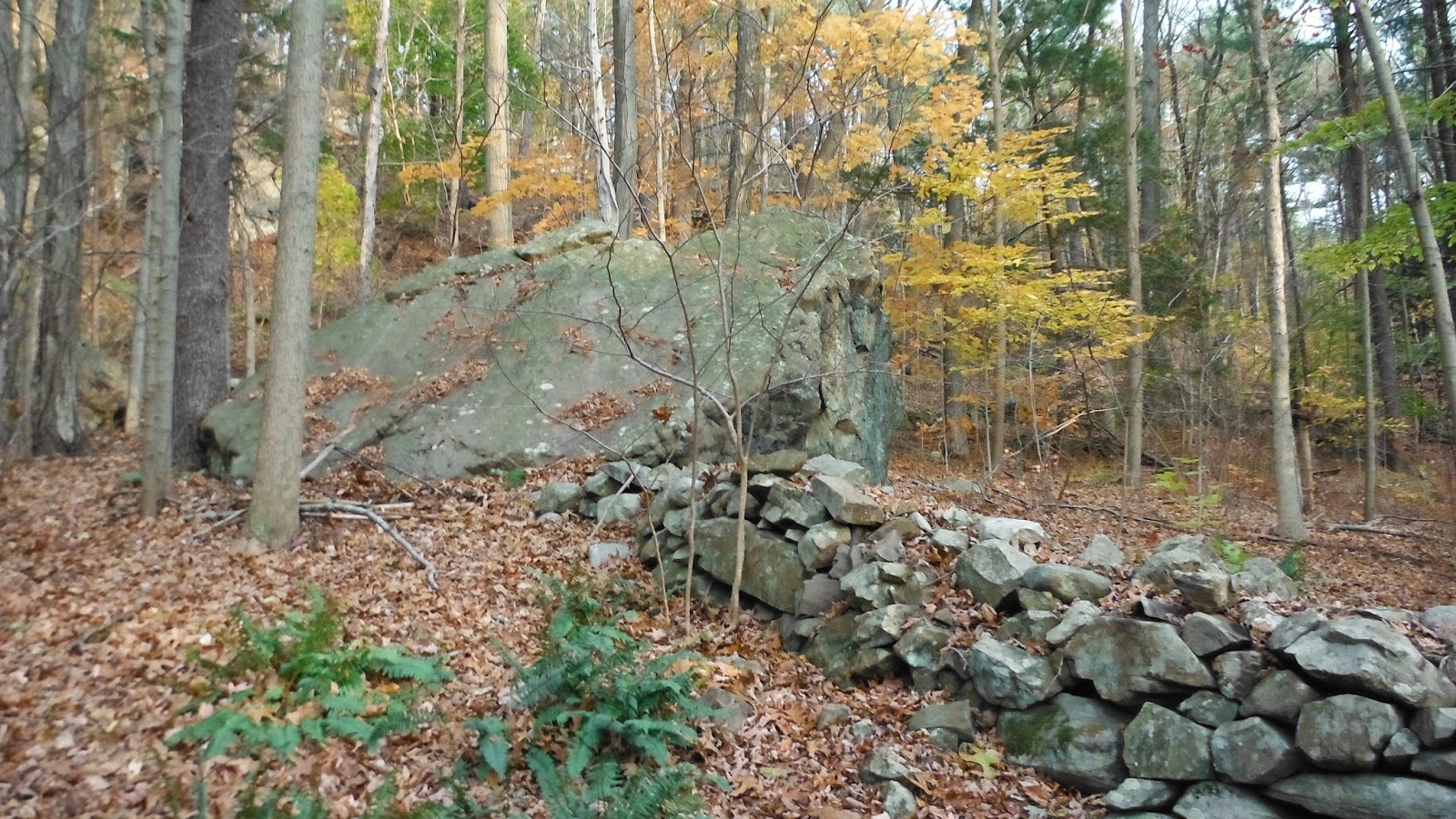
Below: Snake Qusukqaniyutôk (‘stone row, enclosure) around outcrop at Orenaug.
An overlay illustration:
To be continued...


Thursday, September 08, 2016

A Boulder Split into Four Quarters (Woodbury CT)

(Rows of Stones on a Talus or Scree covered Slope, sometimes connected to boulders or tors)
     In the mid-1800’s, Woodbury CT historian William Cothren wrote: “Orenaug is the name of the beautiful trap-rock cliffs, which bound the village on the east. The front cliff has been recently purchased and improved by the writer, as a mountain park. Oak, maple, hickory, chestnut, and cedar trees are scattered over the mountain-top, and in the beautiful ravine beyond, while the crest is covered by a beautiful grove of pine trees, in the midst of which a tower, thirty feet in height, has been erected, from which views of six surrounding towns may be obtained. It has been named the Orenaug Park. Here one can always catch a delightful breeze, and enjoy a beautiful panoramic view of the village, valley and meandering river below, while the whispering pines above his head sooth the perturbed, wearied and overworked mind. The beautiful evergreens suggest thoughts of peace, and the beatitude of the eternal rest on high:
   "As the softened land-breeze marches,
    Through the pine's cathedral arches."
     A few moments walk to the south-east, through a pleasant grove, over the second cliff, brings the visitor to the celebrated 'Bethel Rock," in the bosom of these cliffs, of which more will be said hereafter. A more lovely and romantic spot, even without its sacred associations, cannot easily be found.”
     (The "sacred" Cothren is talking about is best explained here: https://youtu.be/-DY-V7T0KSI)
     I had a few moments after a visit to the Town Offices, to walk up from Main Street (originally a game trail for mastodons that became a major Indian Trail aka the Connecticut Path) toward the “mountain” mentioned. I crossed some old stone walls that have been mangled, maybe rebuilt, maybe robbed, and now serving as a convenient place to dump brush, old chunks of concrete and asphalt. I was looking for “sacred associations” - features of the Ceremonial Stone Landscape in this section I hadn’t walked before.
     I came to a row of stones, probably modified sometime after 1672 with a wooden cross and rail (stake and riders) fence to make it somebody’s “improved” and legally owned property, probably a pasture for horses or cows but who knows, maybe it was a hay field meadow or perhaps it was plowed and planted with something, corn or maybe tobacco.
The "simple" explanation that this is an example of "stones tossed under a cross and rail fence" (possibly re-stacked later to "pretty up" the long piles of refuse at a later date) sounds complicated, while the idea that a pre-existing Indigenous was appropriated by the later addition of wooden rails may be argued using the Law of Parsimony. 

     I hoped to find a “gateway” in the row of stones and in the distance I could see an opening:

     So, yes, that is a larger triangular boulder, with that other sort of long stone I often observe and don’t have a name for. “Collar” comes to mind but snakes don’t wear collars although it could be a fold in the skin of a snake just behind the head, and you could use it to hold up some antlers or pieces of branches that might represent horns.


 The other side is no longer intact – and if I were making some simple deductions about it, I’d say the gate opened toward the uphill side and those piled stones came out of the cart path into the hayfield (sorry about the blurred image) and probably were tossed aside because they were impeding the movement of the gate. Probably the gate rested on it:

Nearby I came to a junction of an intersecting row of stones:

     This row leads east toward the trap rock cliffs that are popular rock climbing destinations – if you don’t hurt yourself (break your talus bone?) climbing over the talus slope (“a slope formed by an accumulation of broken rock debris, as at the base of a cliff or other high place, also called scree,” as Wikipedia believes) to get to them.
       I was observing the stacking pattern, looking for the suggestion of eyes for effigies as well as the “making a snake pattern” – a stone or combination of stones suggesting a snake head and smaller stones stacked to make a tapering in size body and snake tail.
"Combination of Stones" sometimes includes an artistic variation that shows the jaws of a snake:
"Jaws" may even include the suggestion of rattles...


      This row also had a sort of gate at its high point, but it looked messy and messed with, a metal stone drill mark suggesting a boulder had been split. I have to admit to being distracted by the view down into the ravine:
Above: western face of split boulder.
Below: northern face of the same split "filled" boulder. 
   Yes, that is a heap of stones at the base of the boulder. And yes, there seems to be a row of stones purposely piled at the edge of the talus, sometimes just cobbles, sometimes just boulders and sometimes both. Most of my captured images are too blurry to post. 
    Except for these:


Above: Wedged stones??
Below: peeking north from the east side of the split boulder, cliffs in the distance. 

Above & below: Noticable "linking or connecting stone rows between boulders/tors... 
Here and there, sometimes rows of stones are built on the talus, connecting to the cliff face.
I doubt that these are related to farming practices. They may have been property lines that were appropriated into the historic record after 1672 when the English showed up and sold to Cothren toward the end of the Golden Era of Stonewall Building. 


Had I just followed that first intersecting row of stones, I would have landed at this spot:
Another "over the talus" row that begins with a possible snake head:
The Snake Overlay: