Continuing on from http://wakinguponturtleisland.blogspot.com/2014/02/dc-and-google-images.html, I guess you could call this "Jumping Off of (Google) Earth and Into Other Sources I Often Use."

The first of the images dc sent was the one above: "Here is a capture of
the rows near my brother's pad in Redding Ridge. I have outlined one of the
rows, hope it shows up on your screen. My brother's crib is in top part of the
capture. The row runs from right next to a stream in the upper left hand side
of the screen, up a steep hill to that copse of trees, and then turns to the
right and runs along a ridge that overlooks his place."
The rows weren't easy to spot, but I could see some faint grey stones in there, especially in this crop:

I tried a little highlighting:

Just because I can, I often seek out images from old aerial photos.
From 1934:

There's the bend in the road, but I don't know what the dark areas are - could be trees, but could even be water. In 1965 it's still a little unclear, but the possible post contact stone walls or the possibly pre-contact rows of stone do show up:

{I looked up 1965 here by street name: http://magic.lib.uconn.edu/mash_up/1965_aerial_index.html
and accessed the image here: http://cslib.cdmhost.com/cdm/singleitem/collection/p4005coll10/id/9164}
dc's image is tilted so that west is almost at the top, so I'll include a west at top version of the above image:

And then there's the bing bird's eye images where I eventually got these funky images:

{If you go to http://binged.it/1g6CWFU you should be able to see this better - and roam around too, switching angles and all' - like this (horrible capture of) the view that is very close to dc's first image above:}

When you add in the photos from dc (and add in the obvious new constructions around the houses) you begin to suspect these rows of stones and the little "details" that could be mounds and/or boulders could possibly be Indigenous Pre-Contact stonework, as dc writes:
"The section running up the hill to the trees is shown in the photos with (the) time stamps (on the photos):

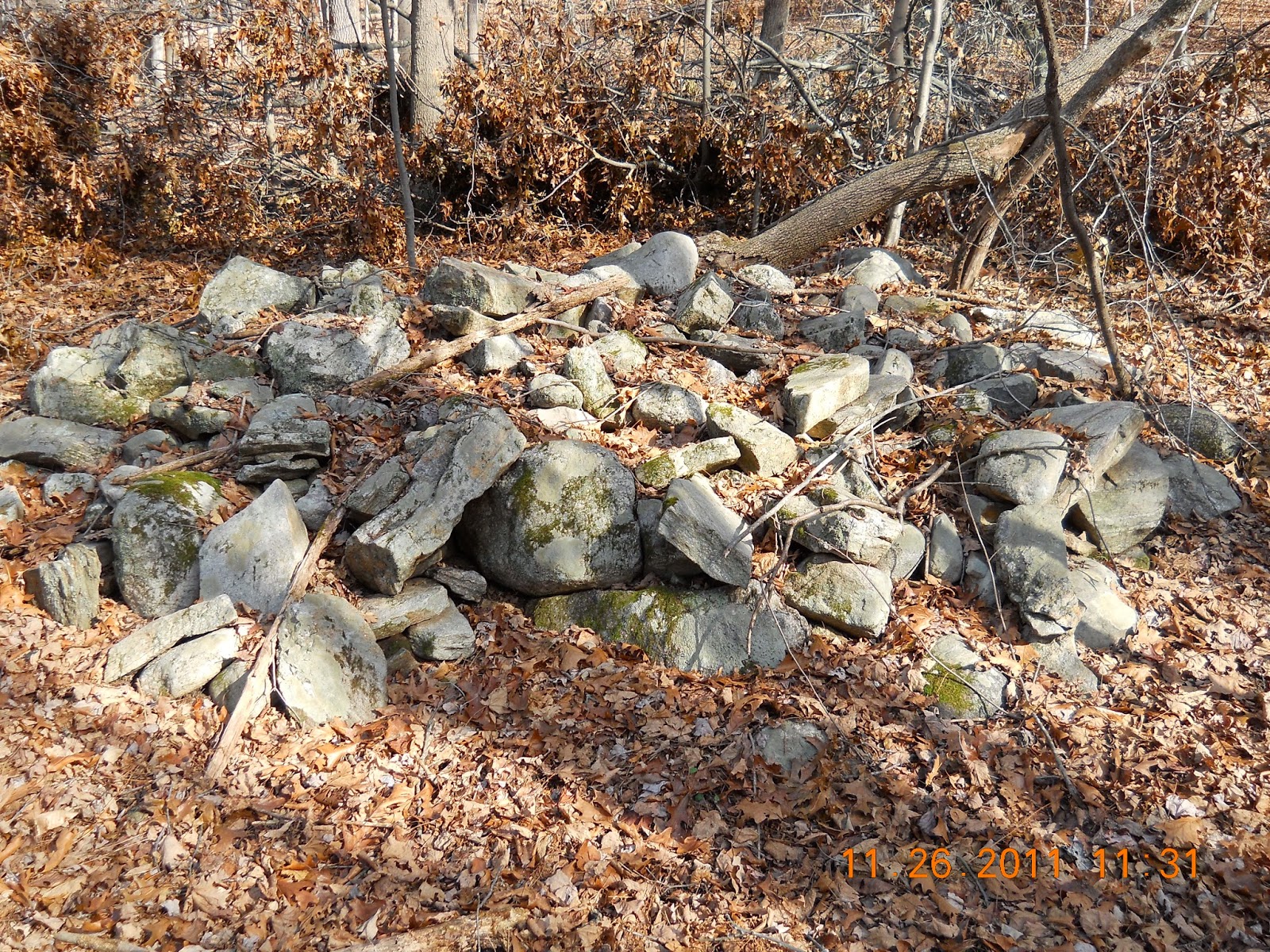


"11:37 (is in the trees):"

"11:41 is the part that runs along the ridge after making that turn to the
right in the capture:"

And it's an iffy business, identifying rows of stones from these images, as dc writes:
"This row that runs over the outcrop here is probably where photo 11:22 was
taken, but I am not 100% certain:"


And the mandatory Turtle Petroform crop (add painted in eyes) from the photo above:

No comments:
Post a Comment