Thursday, October 06, 2022

The Fathers' Monument (Part One)

 Or: Searching for an “impressive structure of native boulders, 44 feet high,” according to William Cothren.

   Over thirty years ago, Woodbury CT's favorite historian William Cothren got me curious about Indigenous made stone constructions when he included absolutely no information about our family home (that I was looking for) but did include a woodcut of a stacked stone monument over what he claimed was the Grave of the Sachem Nonnewaug (that I wasn't looking for). 

Sachems' Stones illustrations from Cothren, by Curtiss

   Just a few weeks ago, in the last of the summer of 2022, while looking for something else, I came across a reference to a "boulder monument" that I thought I had somehow missed, even though Mr. Cothren relates that it was quite tall, almost fifty feet tall and composed of "native boulders."

   I'm very disappointed with Mr. Cothren who chose to describe these quarried rectangular blocks of stone as "native boulders." I didn't measure the structure and thus can neither confirm nor deny the "44 feet" part of the description. It is the tallest monument in the old Puritan burial grounds:


   "The Old Burial Ground lies on a 3.8 acre shelf to the West of Main Street, sloping to the Hollow. This location was considered ideal for burials as the area was not good for farmland, and the original section, on the southern end, was near the site of the first Congregational meetinghouse. Stones date back to 1678 with many gravestones, monuments and sarcophagi from the 17th, 18th & early 19th century. Early graves in New England were customarily marked with uncut boulders and many have become a piece of the stone wall that lines the east side of the land. In 1785, construction of St. Paul’s Episcopal Church was begun on the northerly section of this parcel and a burial ground was developed in the church’s shadow. In time the two grounds expanded to merge, with no division line.

   The thin soil on this parcel has been kind to seedling pines and hemlocks, some of which have reached majestic proportions. In this cemetery each small plot holds its own story, all part of the warp and woof of the tapestry that is Woodbury.

   The Fathers’ Monument stands proudly at this site. It was dedicated during the Bicentennial Celebration of the organization of the First Church as the Second Church of Stratford, held May 5, 1870. This impressive structure of native boulders, 44 feet high, was erected in memory of the first three Congregational ministers in Woodbury: Zechariah Walker, Anthony Stoddard and Noah Benedict , whose united ministry covered a period of one hundred forty three years. The benefactors of this monument include William Tecumseh Sherman of Civil War fame. One third of the more than $1,500 cost was donated by an anonymous contributor.

   At the base of the monument is an old mill wheel that was brought from Stratford by Woodbury’s earliest settlers. It was carried between two horses on their journey and was used to grind the grain and corn for the whole settlement at the rate of one bushel per day..."

   "A flat, irregular slab of pasture granite lies at the foot of the monument. This original grave marker of Rev. Zachariah Walker, who passed away in 1699, is one of the oldest burial markers in the region..."


   Whether one is a Woodbury native, or a New England enthusiast, a slow walk through this ancient burial ground will evoke a strong sense of Woodbury’s heritage…” 


http://www.woodburycemetery.com/history/

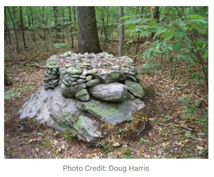
  I pondered a bit about a similarity in shape to some Manitou Stones while standing there, as well as some that resemble single stones that might be "two horns" on certain Stone Snake Effigies...


Town Mowing Crew 


Sunday, September 25, 2022

LiDar Swiping

 Students of the "stone wall" like this feature on this CT LiDar Viewer, the "Swipe" option that allows the viewer to quickly switch from a Hillshade view to some autumn aerial imagery that sometimes shows distinct rows of stones sometimes - or sometimes not, as above. Toggling the swiper, one suspects that there may be rows of stones up on that scenic hilltop in my old hometown:


The "longer" LiDar view:
    "Various Algonquian bands, often included in the Wappinger tribe, originally inhabited the Naugatuck River Valley. In fact, the name "Naugatuck" is derived from an Algonquian term meaning "lone tree by the fishing place". One early 19th century author explained that this name originally referred to a specific tree along the river in the area of modern-day Beacon Falls, but came to be applied broadly to the entire river over time. The valley was later settled in the 17th century by English colonists. Given its rocky soil, which was not good for farming, and the high potential for water power, the Naugatuck Valley became an industrialized area in the 19th century. It has been associated with the brass and copper industries…the Naugatuck River has been followed by early paths and roadways and is now followed by Connecticut Route 8. The river enters a forested, hilly area between Connecticut Route 118 and Thomaston..." - Wikipedia


Of course the image immediately reminded me of this map
 whereupon Thomaston is still called Northbury,
 at the Edge of the "Wilderness:"

Is that an already cleared little hill (as was Scott's Mountain) with older Indigenous Stonework (as is/was Scott's Mountain) or is it one of those "Hilltop Farms" where Yankee Exceptionalism transformed the (nearby) Wilderness at sometime or other?? Ceremonial Stone Landscape features or remnants of Merino SHEEP Farmers in the brief period before barbed wire was invented or something??
Why didn't I ask Charlie Crowell if it's known who was the "first farmer" at this particular spot??

Old Aerial:

Some more images, which is about all I have until I find opportunity to ground check
 these probable rows of stones:
1934: Pasture? Hayfields?? Woodlots???


Saturday, September 24, 2022

Walking Slowly to Medicine Rock


John Patrick MacSweeney Jr. at Medicine Rock (2022)

   We really didn’t go all that far, my brother and I, but we saw some interesting things. We saw the “nearest” Medicine Rock (one of two on the trail map), a milky white quartzite outcrop, but we also saw a great number of dead ash trees as well as two peculiar rows of stones that seemed sort of related to the one of the multi-trunked trees (maybe, possibly):

  We had been noting an absence of “stone walls” and finally found two. There was one that was composed of larger stones, pointed at about true north while the other is composed of smaller stones which appeared to continue in into the brushy distance to the west, sort of a bunch of stone circles rather than a linear or zigzag construction, although it appears somewhat serpentine on the LiDar image I pulled up from the world-wide computer-net:


   So here’s a “Why go back?” answer: There are some interesting things to be seen on that tiny piece of the world and only the curious have something to find. I've got a snapshot of 1934 to look at, as well as other perhaps traces of older cultural stone landscape features to observe…  

A circle of stones to the west of the trail, 


A Row of Káhtôquwukansh or “Stone Prayers?”


Monday, September 05, 2022

Drought and the Great Serpent


     I’ve been watching those old stone snakes transform and disappear for years now, some rebuilt to make them “pretty” or, even worse, far too many just bulldozed out of existence - neither of which can ever be undone. When I drive by and see some brush clearing going on along a row of stones, I will often cross my fingers and hope that they just leave that “stone wall” untouched, thinking I’ll be back sometime soon to catch a good photo of some Indigenous diagnostic feature but more often than not, the next time I drive by, I’ll find that the machines got there first and that artwork I saw is forever gone.


    The Great Serpent is an Indigenous spirit being who, among other things, can bring rainfall. The thought passed through my mind that perhaps this destruction of the “snake rows of stones” and the drought just might be related…

 "To the Tanoan language speakers along the Rio Grande, this mythical horned and plumed serpent Awanyu appears as a flash flood, winding its way down an arroyo after a heavy rain. It is a water serpent both feared and respected. He lives in springs, ponds and rivers and when angered can cause heavy rains destroying crop fields..."  

https://wakinguponturtleisland.blogspot.com/2018/08/avanyu-water-serpent.html

https://wakinguponturtleisland.blogspot.com/2016/08/look-little-closer-at-stone-wall.html

https://wakinguponturtleisland.blogspot.com/2007/06/im-listening-to-sound-of-thunder-in.html

Sunday, August 07, 2022

Monday, August 01, 2022

Re-Reading a Forested Landscape


  Reading a Landscape sometimes involves going back to before the times of appropriation and colonization, before the introduction of the rat and the pig, and everything that followed. Reading a Landscape sometimes involves as much unlearning as it does learning, as myths and misconceptions fall away like autumn leaves that reveal a big stone snake along an ancient Indian road…


Unlearning a Zig Zag Row of Stones:


The carefully constructed pre-contact zigzag stone row at the bottom of layers and layers of the post-contact field clearing stones tossed from the former field above...

Monday, July 11, 2022

Larry Harrop (RI)


Norman Muller photo

Lawrence A. Harrop, 73, of Newport, passed away at home Monday, June 6, 2022. He was the husband of Katherine (Virion) Harrop.

https://whatsupnewp.com/2022/06/obituary-lawrence-a-harrop/


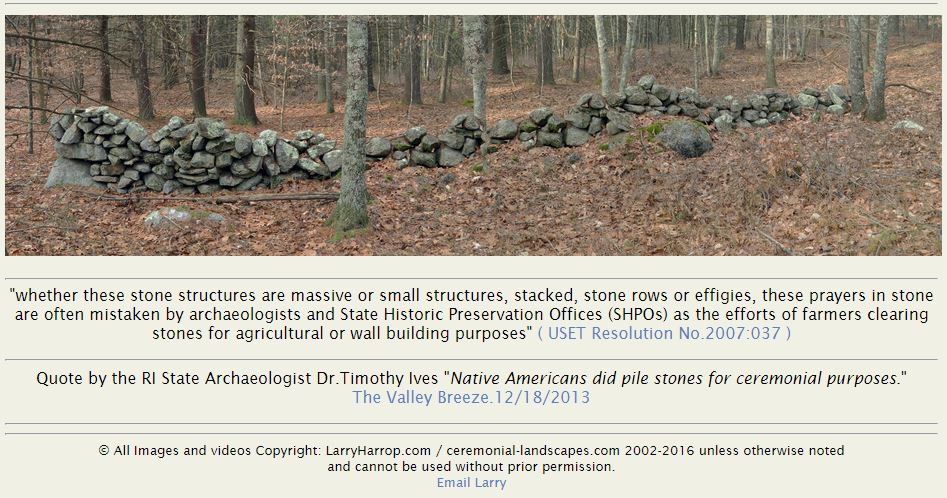
"There’s that beautiful Serpent Wall, right there on Larry Harrop’s Home Page for “Ceremonial Stone Landscapes; A sampling of Native American stone constructions found in the State of Rhode Island.” That “Strong Looker” follows you along as you view all the other photos, keeping an eye on you, knowing your thoughts and intentions as you see and hopefully observe some of the best photos I know of that document all the stacking patterns and variations that all but the most unimaginative might imagine are the results of field clearing or stone fences made to impress herds of cows or sheep, as the Euro-American Myth goes..."


Ceremonial Stone Landscapes, by Larry Harrop

Katherine Harrop has graciously granted permission to NEARA to host the contents of his web site, restyled for easier viewing.

Click below on a category name to see thumbnail images for that category. For now, we only have thumbnail images, but we hope to get all of the full photographs soon. See also his videos on YouTube.

All of these photos are Copyright by Larry Harrop. 


Friday, July 08, 2022

The Rain Maker

    “Once upon a time on the shores of the Big Water Where Daylight Appears, certain heroes cap­tured the great horned serpent that lives in the depths of the sea and, while they held him captive, scraped some of the scales from his back and placed them in a little pouch woven from Indian hemp, with symbolical designs representing the lightning (Fig. 33). There is enmity between the Thunders and the great horned serpent who cannot show his head above the waters without provoking the wrath of the Thunders who immediately gather to attack him with their bolts of lightning. Therefore, when the scales taken from the back of the serpent, were exposed on a rock, beside the sea, or on the shore of a lake or stream, thunder clouds would immediately gather and the cornfields would presently be refreshed by rain. The owner of the charm must re­move it before the first rain drops fell or he was in danger of being struck by lightning...”

Fig. 33 - Old Medicine Pouch of Woven Indian hemp containing flakes of mica,
said to be scales of horned water serpent and used for rain making. – Heye Collection


Thursday, June 16, 2022

Nonnewaug is an Indigenous Place Name (CT)


The Nonnewaug Diagonal Stone Fish Weir (1996)


     “Nonnewaug” is a much misunderstood word, despite how often it is used in and around Woodbury CT. Modernly, Nonnewaug is the name of the local high school, the regional school system, a river, a road, and a waterfall. Nonnewaug is said to be the name of “an Indian chief” but that may not be quite accurate. There was a person was known as the Sachem Nonnewaug. His paper trail is limited to signatures to be found on treaties with the earliest settler colonists, made after the Pequot or First Puritan War, in the Housatonic River valley, in what is now known as Western Connecticut. Nonnewaug is an Indigenous place name, in the Quiripi or “R” dialect of the Algonquian Language group. The word most likely literally refers to a stone fish weir of undetermined age, damaged in the 1990s by a tree washing down stream, remnants of a diagonal row of boulders now barely recognizable a a fish weir.

   I often see social media posts about Nonnewaug Falls, a favorite place of mine, in Woodbury CT.


    I appreciate that people enjoy the beauty of the place – I’ve been doing the same for well over fifty years. I’ve sought out and read many stories about the Falls in local histories and newspaper clippings, had people hand deliver or mail me copies of Nonnewaug Falls related material in the past, and that continues to this day when I’m more likely to get an email or enter a discussion about the place on Face Book.

   There are many versions of the “History of Nonnewaug Falls” as well as the “Legends of Nonnewaug Falls.” Just about all of them could be considered “firsting and lasting” stories that erase and then memorialize Indian peoples, as Jean O’Brien writes about in “Firsting and Lasting: Writing Indians Out of Existence in New England.” The exception to that thought is the first bit of writing I ever came across on my first visit to Nonnewaug Falls in the early 1970s. There’s a brass plaque above the Upper Falls that implies that a “Nonnewaug tribe” still existed in Seymour CT about a hundred years ago. Here are two 21st century blog posts about Nonnewaug Falls for example:

     “The falls are named after one of the last chiefs of the Nonnewaug tribe who was buried nearby. A plaque on the southern side of the upper falls keeps the chief’s memory alive. The plaque was placed there in 1916 by members of the Nonnewaug tribe of Seymour. It reads: “To the memory of Nonnewaug last chief of his tribe, friend of his white neighbors, who sleeps with his fathers near these falls which bear his name.”   https://www.ctmq.org/nonnewaug-falls/

  “Nonnewaug Falls was formed by glacial melt streaming over bedrock, carving a path into the landscape during the Last Glacial Period (LGP aka last ice age). So named for Chief Nonnewaug, the final leader of the territory’s long-vanished aboriginal inhabitants, Nonnewaug Falls has been a familiar and locally-celebrated landmark for nearly two centuries. Woodcuts published in the 1800’s portray Nonnewaug Falls with much the same rugged and secluded character that it possesses today.

On the opposite bank near the top of the falls, is a bronze tablet mounted on the face of a rock outcrop. It was placed there in 1916 by members of the Nonnewaug tribe of Seymour to memorialize the chief. It reads: “To the memory of Nonnewaug last chief of his tribe, friend of his white neighbors, who sleeps with his fathers near these falls which bear his name.” Nonnewaug is Mohican for “dry land.”

https://scenesfromthetrail.com/2022/05/09/nonnewaug-falls

    The Nonnawauk Tribe #9 of The Improved Order of Red Men is actually “a fraternal organization established in North America in 1834. Their rituals and regalia are modeled after those assumed by men of the era to be used by Native Americans. Despite the name, the order was formed solely by, and for, white men,” according to Wikipedia, although by 1974 people of Indigenous descent were finally allowed to be “improved” by the group.

 https://en.wikipedia.org/wiki/Improved_Order_of_Red_Men

    “Chief Nonnewaug” refers to the Sachem Nonnewaug, the Indigenous leader’s title rather than the person’s personal name. One little reference from one slim volume of Woodbury History (the name of which momentarily escapes me) implies the man’s name may have been Wonowax, suspiciously similar to Womoqui whose name appears on an early treaty with a pictograph signature that looks like a reverse image of a later image of what John Minor records as “Nunawauk – his marke.”


  William Cothren, in the second volume of his Woodbury History, offers a translation of the word Nonnewaug, as “the fresh pond or fresh water fishing place,” as implied by the “(am)aug” ending of the word, a variation of “Paug,” denoting “water at rest.”  In a 1962 publication, Indian Place Names of New England, Charles C. Huden translates the word Nonnewaug to “dry land,” also noting that it may be a sort of Yankee farmer humorous translation alluding to the “stream drying up in summer.” Huden has many tips on translating these badly recorded place names and below is a map cobbled together on an old map that I’m probably in trouble with someone about making “corrections” to the original:


     John Hammond Trumbull, in Indian Geographical Names (1870) writes, “Every name described the locality to which it was affixed. The description was sometimes topographical; sometimes historical, preserving the memory of a battle, a feast, the dwelling-place of a great sachem, or the like; sometimes it indicated one of the natural products of the place, or the animals which resorted to it; occasionally, its position or direction from a place previously known, or from the territory of the nation by which the name was given,—as for example, 'the land on the other side of the river,' 'behind the mountain,' 'the east land,' 'the half-way place,' &c. The same name might be, in fact it very often was, given to more places than one; but these must not be so near together that mistakes or doubts could be occasioned by the repetition. With this precaution, there was no reason why there might not be as many 'Great Rivers,' 'Bends,' 'Forks,' and 'Water-fall places' as there are Washingtons, Franklins, Unions, and Fairplays in the list of American post-offices.”

     Trumbull cites quite a few names that resemble Nonnewaug, when he relates that “Names of fishes supply the adjectival components of many place-names on the sea-coast of New England, on the lakes, and along river-courses. The difficulty of analyzing such names is the greater because the same species of fish was known by different names to different tribes. The more common substantivals are -amaug, 'fishing place; -tuk or sipu, 'river;' ohke, 'place;' Abn. -kantti, 'place of abundance;' and -keag, -keke, Abn. -khigé, which appears to denote a peculiar mode of fishing,—perhaps, by a weir; possibly, a spearing-place.

From the generic namaus (namohs, El.; Abn. namés; Del. namees;) 'a fish'—but probably, one of the smaller sort, for the form is a diminutive,—come such names as Nameoke or Nameaug (New London), for namau-ohke, 'fish country;' Namasket or Namasseket (on Taunton River, in Middleborough, Mass.) 'at the fish place,' a favorite resort of the Indians of that region; Namaskeak, now Amoskeag, on the Merrimack, and Nam'skeket or Skeekeet, in Wellfleet, Mass.

Nahanm[oo], the Abnaki name of the 'eel,' is found in "Nehumkeag, the English of which is Eel Land, ... a stream or brook that empties itself into Kennebec River," not far from Cobbissecontee. This brook was sometimes called by the English, Nehumkee. The Indian name of Salem, Mass., was Nehumkeke or Naümkeag, and a place on the Merrimac, near the mouth of Concord River (now in Lowell, I believe,) had the same name,—written, Naamkeak.

J. Hammond Trumbull

https://www.gutenberg.org/files/18279/18279-h/18279-h.htm

  Margaret Bruhac cites Trumbull for a possible translation of Nonotuck as "far away land" (Nauwut-ucke) in the Massachusetts dialect as the Indigenous name for modern Northampton Ma.”


    Nonnewaug is just such a place name, a fishing place, perhaps specifically an eeling place, that in 1673 was occupied by a group of Indigenous People, often referred to as the “Nonnewaug tribe of the Pootatuck.” Pootatuck is another place name that’s also a known contact era village referred to as the Pootatuck Wigwams also a fishing place at the Falls near the mouth of the Pomperaug River on the Housatonic River. “Nonnewaug” could be a fish weir “far away” up the Housatonic River from the Pootatuck Wigwams.


     Sachem Nonnewaug also no longer "sleeps with his fathers near these falls." William Cothren lamented the mid-1800s destruction and probable looting of his grave in his History of Ancient Woodbury: 


Monday, June 13, 2022