Saturday, January 24, 2015

Possible "Ophiomorphic Petroform?” (Edited in 2022)

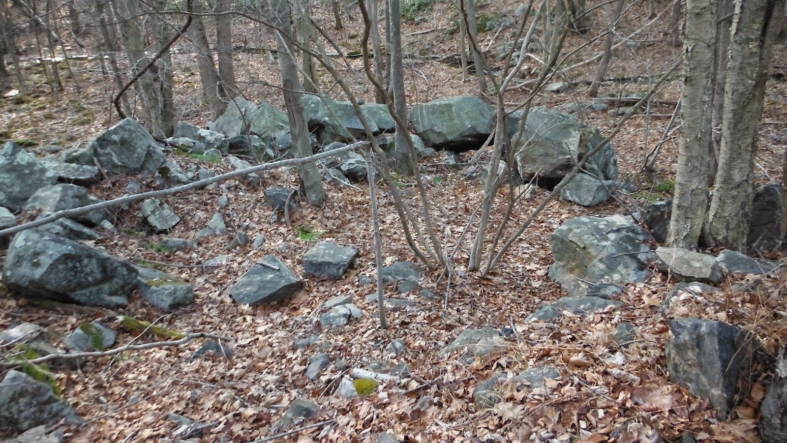
An Ancient Road and an Ancient Snake Effigy
by an Old Turnpike
by the side of a newer State Highway...


Along Rte. 109 Washington CT
Or the Old Indian Trail that became the Old Litchfield Turnpike
The boulder, at a gateway perhaps, just below that "O" in "Old."
This is not the link to a "Bird's Eye View" anymore:

2022 edit: 


Monday, January 19, 2015

Elder Brother's Warning


"The Heart of The World: Elder Brother's Warning” was filmed by Alan Ereira for the BBC in 1991: In a desperate attempt to prevent further ecological catastrophe and destruction, the Kogi Mamas broke their silence and allowed a small BBC film crew into their isolated mountaintop civilization to hear their message and warning to Younger Brother (those (un)conscious people who mashing up our environment). The subsequent messages and warnings were voiced in this documentary. After the documentary was filmed, the Kogi Mamas returned to their work in isolation and asked outsiders to not come to their land. ~ http://vimeo.com/103812927
The Kogi soon realized that their message and warning had not been heeded by Younger Brother, and instead, as they had predicted, many catastrophes occurred and the natural world continued to be devastated at an even more rapid pace.
In turn they contacted the same filmmaker twenty years later to give one final message. This became Aluna, a documentary made by the Kogi Mamas themselves in which they give a second warning and say that they have chosen to share their secret sciences with Younger Brother so that Younger Brother can help change the world for the better."
Aluna trailer
vimeo.com/36960419
Kogi Indian Mama Shibulata and Oxford Scientist Professor Alex Rogers takes questions after the world premier of Aluna the Movie at Sheffield Doc Fest 2012

"Ciudad Perdida (Spanish for "Lost City") is the archaeological site of an ancient city in Colombia's Sierra Nevada. It is believed to have been founded about 800 AD, some 650 years earlier than Machu Picchu. This location is also known as Buritaca and Teyuna.
Ciudad Perdida was "found" in 1972, when a group of local treasure looters found a series of stone steps rising up the mountainside and followed them to an abandoned city which they named "Green Hell" or "Wide Set". When gold figurines and ceramic urns from this city began to appear in the local black market, archaeologists headed by the director of the Instituto Colombiano de Antropologia reached the site in 1976 and completed reconstruction between 1976-1982." 
Ciudad Perdida consists of a series of 169 terraces carved into the mountainside, a net of tiled roads and several small circular plazas. The entrance can only be accessed by a climb up some 1,200 stone steps through dense jungle.[1]    http://en.wikipedia.org/wiki/Ciudad_Perdida

Sunday, January 18, 2015

Former Stone Mounds

I referred to these former stone mounds at the Rock Piles:Stone Pile in the middle of Old CT Path.
What I remember as perhaps 3 or 4 foot tall substantial stacks of stones on boulders with a mixture of cobbles of all sizes, including some pretty hefty ones, are now barely recognizable as Stone Mounds:
Between a remarkable reproduction Colonial Home and the present roadway, a small remnant of a double row of stones that suggest perhaps the original Indian Trail - called the old "Mansfield Highway" by one guy I talked to a few years back. The new road is built up to the "stone wall" in some places, using the construction as a kind of retaining wall... 
Remnants of the Stones: 


That linear row becomes zigzag: 
But just for  100 feet maybe, until it becomes a linear row along the edge of a bedrock outcrop:
If you walk that edge of the outcrop, you eventually come to the end of it.
A single stone at one point may suggest that there were possibly once more stones - it would be easy to load stones down into a cart or something, but that's kind of negative evidence and conjecture: 
The photo below, bad as it is, does show some quartz inclusions that might be, perhaps, the eye of a serpent, maybe a tooth, but I'm unsure. 
A head on view that doesn't really recall a serpent:
But there extending southward from a possible standing stone is a serpentine stone row, possibly separating the riparian zone of the low area from the higher drier ground: 

1934 above, 1965 below.
Zooming in and labels added:

Tuesday, January 13, 2015

Old Connecticut Path -- Ashford/Eastford, Connecticut

    I may have mentioned that I've observed that some possible Indian trails, including those that have become modern roads, are bordered on both sides with "stone walls,"allowing a more frequent controlled burn inside those rows of stones than the land around them.  
     Note that in this video both sides of the Path are bordered in rows of stones:


Published on Jul 13, 2013
"Charles Chism described the route of the Old Connecticut Path across the family homestead on Axe Factory Road in Westford, CT. His description, recorded by Harral Ayres in his book The Great Trail of New England, notes that there was a strip of land across the farm that had never been plowed. This was the place where the Path crossed the Chism farm. A remnant of the Path fitting Charles Chism's description may be found today on Pine Hill. The video brings you on a short walk within a stone wall lined corridor along the edge of Pine Hill just west of the Chism homestead. The placement of the ancient road follows the line drawn by David Chism in his map of the Old Connecticut Path. The route across the Chism farm connects with the segments headed east towards Bigelow Brook and headed west across that Natchaug State Forest towards Grass Hill.

Local legend and traditions recorded by Ellen Larned in her History of Windham County indicate that the Hooker party camped on Pine Hill on their journey to Hartford in 1636. The fields bordering the ancient pathway and the nearby North Chism Brook would have provided a suitable space for parties traveling along the Path. Based on the route from Cambridge and estimates of the rate of daily travel, Pine Hill would have been near the end of the seventh day of walking.

The Old Connecticut Path is one of the earliest trails followed as part of America's westward migration. As early as 1635-36, the migration from Massachusetts Bay at Boston/Cambridge west to Connecticut began following the Old Connecticut Path. Reverend John Wareham lead his congregation from Dorchester, MA to establish Windsor, CT in 1635. John Oldham traveled the Path that others followed from Watertown, MA to establish Wethersfield, CT. Reverend Thomas Hooker and his entire congregation walked along the Old Connecticut Path for two weeks across the wilderness in 1636 from Cambridge, MA to establish Hartford, CT. Join me for a walk and use your imagination to experience the landscape traveled by the pioneers of the 1600s."

For more information, visit the Old Connecticut Path website at https://sites.google.com/site/oldconn...

Send comments to oldconnecticutpath@gmail.com
Great Wall of Westford:


"The Old Connecticut Path was the Native American trail that led westward from the area of Massachusetts Bay to the Connecticut River Valley, the very first of the North American trails that led west from the settlements close to the Atlantic seacoast, towards the interior. The earliest colonists of Massachusetts Bay Colony used it, and rendered it wider by driving cattle along it. The old route is still followed, for part of its length, by Massachusetts Route 9 and Massachusetts Route 126.

In lean years of the early 1630s, when the Massachusetts Bay Colony ran short of grain, Nipmuck farmers in the valley of the Connecticut River loaded some of their abundant surplus maize into birch-bark backpacks and trod a familiar route to the settlements at the mouth of the Charles River, where they traded food for European goods made of copper and iron and woollen cloth.[1] Fur traders and the exploratory party of John Oldham (1633) penetrated this first of the trails west into the continent's interior. In 1635, some settlers from Watertown took this route when they removed to Wethersfield, Connecticut."Old Connecticut Path

Bushcraft412 Video


In the comments someone says: "That is COOl, but it is a fence, hand made it has lasted well, No mortar and the round rocks in the middle are the giveaways that it is a fence. Where do you live?"
Bushcraft412 says: "I live in NY and I found this on public land in the Southern Tier. Not sure about it being a fence. It's a 30x30 foot square. The farm equipment being right next to it makes me think it was the foundation of a small barn or storage building. I'm going back to do some more exploring this weekend to see if I can find any more remnants or clues about what exactly it is. I know the land was abandoned farm that the state bought and reforested in the 1930s."

Sunday, January 04, 2015

Last Little Walk in 2014

or
A Big Boulder Bowl and Confusing Rows of Stones Connecting Stone Piles

   I drove past the entrance to the grocery store when I realized I hadn't walked that day, the last day of 2014. Just because it was the next road after that - and just because I never had stopped and walked around right there, I did. It's also within a larger area once known as the Deer Park, near what was once known as the Stone Path and I'd been on other parts of it's edges. 
Above: the Big View - south at the top.
Below: the Boulder "Bowl" circled, the bulldozer path approx. in orange. 

    There was a "No Dumping" sign right where I parked - and a whole bunch of stuff that had been dumped there. There was a ditch cut into the ground, leading into a swampy area and it led up to a bunch of Big Boulders where it looked like the machine had started to cut perhaps a road into the outcrops on the other side of the wetland but backed up, never following through...
Looking back west:
The cleared space inside is about 20 feet in diameter, I am estimating.
Looking south (maybe SSE), I noted another kind of circular structure sort of spot, around a larger boulder set up, perhaps purposely, that recalls that rhomboidal shape again:
Following that edge of the outcrops to the north, there seemed to be some evidence of a stacking of stones along it:
Farther along, after seeing signs of semi-modernish human activity, like fire wood cutting and metal gas cans from that era before they started making plastic ones, as well as those sort of piles that were probably stones around the roots of trees that fell, I finally came upon some definite carefully placed small rows of stones that connected numerous small piles of stones, covered by leaves and difficult to capture in a digital image:
(Enhanced image:)


(I was going to post this yesterday, but I got caught up in images of some beautiful and interesting rows of stones on Mt. Watatic:

And then early this morning, I saw this photo by Paul Thebeau:
"A ring of boulders at the base of Mt Watatic. I dont know enough to believe they were arranged this way but the ring is almost perfectly circular. I placed a glove in the center for scale."