Wednesday, March 05, 2008

No Mention of Stone Structures, but...


Are any Rock Piles people or NEARA members or enlightened Archeologists/Anthropologists aware of any possible Stone Structures in East Hampton CT? I heard this story last night, saw the map as the camera quickly passed over it, a large swamp in the center of it.

I will try to get further info (and I find this map sort of helpful), but wanted to get this out ASAP.


It's exactly the sort of place I'd expect to find something - as would Peter W. and others...


From the WFSB website:


East Hampton Residents Oppose Condos
Developer: Construction Will Not Affect Wetlands
POSTED: 3:44 pm EST March 4, 2008
UPDATED: 7:50 pm EST March 4, 2008


"EAST HAMPTON, Conn. -- East Hampton residents are taking a stand against the possible construction of new condos.
Many of the citizens in East Hampton told Eyewitness News they believe the construction of 127 condos will change the appeal of the town. They said they enjoy the town in its current form, which includes historic homes, stone walls and an abundance of trees.
"We don't want to change the character of the town," said Diana Marsh, of East Hampton.
Channel 3 Eyewitness News reporter Irene O'Connor reported that Pelletier, the group spearheading the construction of the condos said the development will allot affordable housing to area residents.
O'Connor reported that residents said they don not oppose affordable housing. However, they oppose the traffic that may go along with the increase of East Hampton residents. In addition, residents told O'Connor that they are concerned about the wetland and wildlife that would be affected with the building of the complex on what is currently undeveloped land.


"There's fisher cats, there's deer, there's all kind of stuff. I'm just afraid that it won't be there for my children to enjoy," said Paul Marsh, of East Hampton.
"When somebody puts something with this size and density there's going to be an impact," said Diana Marsh.
An attorney representing Pelletier said the wetland areas around the condos will not be affected and there will be a system of wells that will be run and managed by the town. Pelletier has made efforts to attempt to get the zoning codes changed so six units can be built in each acre instead of five. The issue of zoning will be addressed at a commission hearing Wednesday night."


There's a little bit of video at the Channel 3 website also.


Friday, February 29, 2008

"As Long as the Grass Shall Grow"

June Carter, Johnny Cash, and Pete Seeger sing "As Long as the Grass Shall Grow" which was written by Peter LaFarge...


Accessed from:
http://www.youtube.com/watch?v=aOVU0W1r4YQ

Monday, February 25, 2008

Stones on Boulders

I recently posted about this cave.
Maybe it's just me, but it resembles a turtle facing to the left...
It's probably the true Leatherman Cave, but the caves in the area were called "The Old Hunting Caves," according to some older local histories...


I once saw "Old John" dig up some shards of Indian pottery here at the fire pit...


I couldn't climb up this in the snow safely, but there's a boulder perched on an outcrop across the little stream:


Sort of lined up, north/south, on the hillside were some boulders with stone piles on them (I'm looking south as I took this one):


There's a stream in the little valley between the cave and the stones on the boulders. As the snow melts, I'll return to show some details of possible stone work at the head of the spring...


So there you have a few photos of Leatherman Cave and some boulders in the snow...

Monday, February 18, 2008

coterminous

So I’m sort of rereading Bragdon’s Native People of Southern New England, 1500-1650, and find that my use of “riverine” in describing the Wigwams is incorrect and the proper word is “Lacustrine.”
And then this morning I found three other words underlined in red (but in black here) on page 192:

“(George R.) Hamell’s research focused on those sacred places…metaphorical thresholds between this world and other worlds, the crossing of which entails physical, spiritual, and social transformation. Thresholds might, he argues, be coterminous for farming people with the village clearing…(A)nomalous watery places, springs, whirlpools, swamps, and marshes, many identified with…salamanders, lizards, turtles, frogs, and snakes, as well as…beavers and otters (from Man in the Northeast 1987:67-69, listed in her References as “Mythical Realities and European Contact in the Northeast during the Sixteenth and Seventeenth Centuries” 33: 63-87).

So, consulting an online dictionary, I look up:
co·ter·mi·nous (k -tûr m -n s) adj.
Variant of conterminous.
con·ter·mi·nous
(k n-tûr m -n s) also co·ter·mi·nous (k -)
adj.
1. Having a boundary in common; contiguous: The northern border of the United States is conterminous with the southern border of Canada.
2. Contained in the same boundaries; coextensive: the conterminous 48 states.
3. Having the same scope, range of meaning, or extent in time.
[From Latin conterminus : com-, com- + terminus, boundary.]

So a little later, I pick up my much underlined “Changes in the Land” by William Cronon, and I’m reading about Villages and find the quote I was sort of thinking about from Edward Winslow who once wrote “Every Sachem knoweth how far the bounds and limits of his Country extendeth,” followed a few sentences later with Cronan saying, “A sachem’s land was coterminous with the with the area within a village’s economic subsistence and political expressions were most immediately expressed.”

Both books speak of the humanly created cultural landscape of the same time, more or less,mostly by controlled burning.
I claim to see (and have been photographing and posting here) remnants of stone rows that sort of seem to outline these very things and could be a way to controll burning, mostly before the great depopulation of the Northeast by disease - and imitated, often unsuccessfully, by early European settlers.
Well, I think so anyway…

Friday, February 15, 2008

Lacustrine


There’s always that word that you meant to look up and then one day you finally do, and it surprises you. Today it’s “Lacustrine.” I was rereading Native People of Southern New England, 1500-1650 by Professor Kathleen J Bragdon, a “comprehensive study of American Indians of southern New England from 1500 to 1650, (In which) Kathleen J. Bragdon discusses common features and significant differences among the Pawtucket, Massachusett, Nipmuck, Pocumtuck, Narragansett, Pokanoket, Niantic, Mohegan, and Pequot Indians.”

The sentence I read on page 35 was “By A.D. 1000, three distinct ecological regions had emerged in southern New England: maritime/estuarine; riverine; and uplands/lacustrine.”
"Lacustrine plain"
From Wikipedia, the free encyclopedia
"A Lacustrine plain is a plain that originally formed in a lacustrine environment, that is, as the bed of a lake, but from which the water has disappeared, by natural drainage, evaporation or other geophysical processes.
The soil of the plain left behind may constitute fertile and productive farm land, due to the previous accumulation of lacustrine sediments. In other cases it may be a wetland or a desert.”

From: http://en.wikipedia.org/wiki/Lacustrine_plain

On page 38, she writes, “…there is very little archeological evidence for village based settlement systems during the Late Woodland period…”
I’ll go back to a statement from my first post (http://wakinguponturtleisland.blogspot.com/2006/06/first-post.html):
“It's been many years since I woke up to the fact that I live in a special place on Turtle Island.Not that I was actually asleep for a long period of time, but rather I gradually became aware that remnants of ancient stonework was all around me, dismissed as Colonial construction, but (are) really part of a managed cultural landscape that may be hundreds or thousands of years old.”
And I’ll add a little bit using my new word for the day, “On a Lacustrine plain still known by it’s Indian name.”

Wednesday, February 13, 2008

Stone row in a swamp covered with snow in a flood


It's flooding here today in Western CT. This is the corn field across from my driveway, the river in the distance, a stream (that begins at the rock shelter where it is still zigzag stone bordered) overflowing the ditch of today (or the last couple hundred years or so).

There's a swamp, on Swamp Road oddly enough, 3/4 miles away, to the south, where there's remnants of a Y-shaped stone row, interuppted by a state highway.

That swamp flooded today and it looks sort of interesting, snow covered and sticking up out of the water.

It would make a good panorama, but I can't get that function on the new version of my camera program aafter a crash a while back.


Peter you have my permission to copy and stitch them together for Rock Piles if you like - I might just steal them back in pano-form if you are moved to do so...


Another Park Road


With just under a half hour in which to walk ( required by the "Walk or Die Exercise Program" I've created), I parked over by the entrance to Leatherman Cave, another old favorite of a place of mine. Look up the Leatherman at: http://en.wikipedia.org/wiki/Leatherman_(vagabond) or Google it (on the web or in images) and it will tell you a little bit about him, as well as showing many pictures of "Crane's Look Out," a but not the LM's Cave. There's a little bit about the area atthis blog: http://wakinguponturtleisland.blogspot.com/search?q=leatherman, where I mention it's older name "The Old Hunting Caves." My intention was to photograph some rock piles and a stone worked spring below them, about 200 feet from the True Leatherman's Cave, but it was muddy and I wouldn't have enough time.


So I just walked up the road, which just happens to be called "Park Road."


It's near a State Park but I think the name predates the Park created in 1926: http://ct.gov/dep/cwp/view.asp?a=2716&q=325176.
"Leadmine" in Thomaston is the graphite place. Black Rock used to be covered in Black Lichens and that's where the name really came from.

I found my only quartz arrowhead on a trail here, and witnessed a nice guy named John dig up some Woodland Pottery Shards outof a fire pit right in front of the LM Cave, back tracking to the spot he "had a feeling about."


I didn't think about it until I was leaving and looked at the street sign, wondering if again here's another example of a Deer Park adopted by colonists using an ancient Indian land use scheme.


None of these photos are that great ( You can barely make out the zigzag row at the top center of the photo) but there below the road were stone rows and springs and rock piles I never noticed before...


Tuesday, February 12, 2008

(An) Archaeological Perspective

From:
Archaeological Perspectives , Edited by Harold D. Juli

The Institute for American Indian Studies: Preserving the Archaeology, History and Culture of Connecticut's First Settlers
by Lucianne Lavin, Director of Research & Collections, Institute for American Indian Studies (http://www.birdstone.org/)

“Formerly known as the American Indian Archaeological Institute, the Institute for American Indian Studies (IAIS) is a small museum and research center nestled in the beautiful Litchfield Hills of Washington, Connecticut. IAIS is dedicated to preserving and promoting an appreciation of the archaeology, history and living traditions of the indigenous peoples of the Americas, especially in New England…
…From its beginnings, the Institute's main objective was archaeological research. During its formative years in the 1970s and 1980s, directors of research manned large field crews to investigate and dig numerous prehistoric sites in the northwestern highlands of Litchfield County. One of its most famous discoveries was the Templeton site in Washington, a 10,190 year-old Paleo-Indian camp excavated by Dr. Roger Moeller-the oldest archaeological site in southern New England. The site's cultural remains lay three to five feet below the surface of a terrace overlooking the Shepaug River. They included rare fluted spear points and other stone tools used to collect and prepare foodstuffs, slice hides for clothing, and process bone, wood, and plant parts for the manufacture of other non-food items such as bone needles and punches, wooden spear shafts and tool handles, and mats for bedding, sitting, and covering shelters.”

In the late 1980s the Institute began to focus on late prehistoric and early historic Native American sites. Hoping to understand more clearly patterns of settlement and land use among the Weantinock and Pootatuck tribes whose homelands once encompassed much of present Litchfield County, Dr. Russell Handsman instituted an extensive survey of the Housatonic River drainage. Dr. Handsman's research indicates that the landscape contains a long and continuous archaeological record of Native American presence in northwestern Connecticut for thousands of years up to and including the historical period. His findings are in direct contrast to some historical sources, which claim that this region of the state was uninhabited prior to European settlement.
Dr. Handsman believes that this disparity arose because inland Native American settlements and land use patterns were so different from those of contemporary Europeans and coastal Native American societies, that colonists misread the landscapes they encountered, believing them to be uninhabited. In northwestern Connecticut they did not find nucleated, year-round villages, enclosed lands, or extensive agricultural fields. Instead, evidence uncovered by the Institute suggests a different kind of pattern. Following a seasonal round of ripening fruits/plants/nuts, anadromous fish runs, and other animal life-cycles (such as seasonal migratory habits of waterfowl, winter yarding habits of deer, etc), northwestern Connecticut Native Americans practiced a settlement system of semi-sedentary base camps, smaller seasonal camps, and even smaller temporary camps that contained all or portions of the group's population at various times of the year, depending on the tasks at hand…”

Taken from:
http://cttrust.org/7496?highlight=harold


To this I add a little story of my own.
I know someone whose Indian name is “Iron Otter.” We both have daughters named Kate who are the same age, went to the same schools, from Kindergarden to high school. Ever since he was old enough, Iron Otter would go to a fishing spot that his grandfather knew about, where they’d meet up with other Native People, from all over New England who also knew about it. Iron Otter’s grandfather was Moeller’s informant who first showed him what became known as the Templeton site, that very same fishing site. Driving on the back roads, taking various short cuts, I could drive there in 20 or 30 minutes from my house.
My house was very possibly begun to be built around 1700, the time of the “Land Deed” for this “purchase,” by the Indian Interpreter for the “Plantation” that became the town I now live in. Differing concepts of land ownership in mind, it’s very possible that this “Deed” was more of a treaty that implied not an actual sale but more of an agreement to share the resources of the area peacefully. I once read a New Milford history that described a similar sort of deal happening in that town, a house being at least begun to be built on the opposite side of the river from the Indian wigwams, just as my house was. I think the idea was that the English would wait until the Indians moved on and sort of just take over the land, perhaps making a “Confirmatory Deed” to make it a legal deal, from the English Law perspective (the second “purchase” of the same land here I think occurred about 1710 or so).
New Milford became a city – just as New London, Derby and many, many other cities did, built on the sites of many other former Indian cleared fields and what we call Villages from our Euro-centric point of view.
But where I live stayed rural – no factories, no train spur.
The sunrises everyday over the opposite hillside from my house where a Village stood for many years since at least 1659, illuminating the ancient stone fish weir that gives the area it’s Indian Place Name, by the agricultural fields on the other side of the river from my front door, the last floodplain of a chain of floodplains put into cultivation the first year that a group of English people found already cleared by Native American People, where mile after mile of remnants of stone rows remain that perhaps were used to control intentionally set fires as those people maintained the cultural landscape that those people walked and lived upon for at least the accepted 10,190 years, evolving into a culture that remains little understood today…

Monday, February 11, 2008

New England Indian–related topic in two books


Carl Masthay writes to me in an email: “Here are two books of interest, one a bit of the fringe, the other a dissertation (this latter one I might want to buy for myself).”
1. Rediscovering Vinland: Evidence of ancient Viking presence in America by Fred N. Brown III (2007, 296 pp., photos, index, bibliography, references, paperback; iUniverse, Lincoln, Nebr. ISBN: 978-0-595-43680-4; also available as an eBook). I may have mentioned that, having grown up around possible Viking sites such as America’s Stonehenge in New Hampshire, I’ve been avidly interested in the whole subject of pre-Columbus visitors to our land. Based on 15 years of research and the culturally rich Vinland Sagas, this book uses such evidence as DNA, language, customs, and immunity to tuberculosis to show that the Narragansett and Wampanoag tribes of the regions visited who the early English settlers were, in fact, genetically similar to Europeans and were descendants of mixed Indian-Viking populations!
Tom Elliott, Book Review Editor, Mensa Bulletin, 14R Russell St., Waltham, MA 02453-8505
Reviewed in Mensa Bulletin, January 2008, p. 39.

2. [To buy for later? C.M.] [Note in Algonquian and Iroquoian Linguistics 32(4):25-26, 2007]
White, Kevin J., 2007: Haudenosaunee Worldviews through Iroquoian Cosmologies: The Published Narratives in Historical Context. Ph.D. dissertation. State University of New York at Buffalo. 670 pp. AAT 3262030 [AAT is some kind of catalog number for dissertations. The on-line source is called Digital Dissertations I think, Then you can order and download, billing it to a credit card or hard copy like the old University Microfilms used to do. John Nichols]

“Returning to the original published Iroquois (or Haudenosaunee) cosmologies, I shed new light on the development of interpretation and revelation as it pertains to the Haudenosaunee. I analyze and edit J.N.B. Hewitt’s “Iroquois Cosmology Part I” to reveal the scholar, the informant, and a unique clash of their worldviews. Hewitt was a baseline for comparison to other published narratives that I have assembled here in contrast to William N. Fenton’s analysis in his 1962 article “This Island, the World on Turtle’s Back.” I examine in detail translations of the cosmologies, including some by modern Native scholars presented on the World Wide Web. My examination of these works reveals transitions in both Native and non-Native thinking over the centuries of contact. Patterns of change show an indigenous culture struggling to balance ancient traditions, sacred beliefs, and obligations to generations yet unborn against the assimilationist tide of the larger Western culturre. I attempt to excite a discussion about the theology, philosophy, and cosmology grounded in more subtle understandings of Haudenosaunee cultures. Finally, I use the examination of outside/inside views of cosmologies to suggest further fertile study of the other major ethnographic works conventionally used to construct and interpret worldview, theology, and understandings of indigenous groups.
The complex history associated with the Haudenosaunee is steeped in problematic thinking. Though Haudenosaunee voices are present as informants, the knowledge, wisdom, and worldview are hidden in condensed and filtered formats of academic literature. The preferred voices are those like William N. Fenton and David Cusick while the designated Holders of Tradition within the culture are muted. Modern Haudenosaunee scholars contribute interpretations of this ancient worldview grounded in their own theological and philosophical contexts as practitioners of these ancient conceptual frames of reference. Also revealing in this dismissal is a tendency to treat Iroquois [different] from any of the founding Six Nations (Mohawk, Oneida, Onondaga, Cayuga, Tuscarora, and Seneca) as members of one homogeneous group. By placing all these published works side by side, I allow the reader to draw individual conclusions, as though they were part of an audience hearing this among a group.”

Email communication (2/10/08) from Carl Masthay, mentioned on an earlier blog:
http://wakinguponturtleisland.blogspot.com/2006/12/christmas-and-new-years-greetings.html

Sunday, February 10, 2008

What In The World Is A Gungywamp?

By MARLENE CLARK
The Hartford Courant February 6, 2008

"Gungywamp is a 100-acre area in Groton that archaeologists consider a treasure. Its exact origins remain a mystery, but its unusual stonework and artifacts span centuries, if not eons…
Some say ancient Native Americans used the area and built the structures for religious ceremonies prior to the Colonial era.
Researchers have associated the name, "Gungywamp," with ancient Gaelic, Mohegan, Pequot, and Algonquin terms meaning "church of the people"; "place of ledges"; "swampy place"; or "all powerful" and "white," respectively. Or it could be a corruption of the phrase, "spongy swamp." Gungywamp is all on private property.
Researchers include members of the Gungywamp Society, an education and research group dedicated to preserving Gungywamp and other archaeological sites in Connecticut.Information also is available at www.gungywamp.com and at www.stonestructures.org/html/gun gywamp.html."

http://www.courant.com/news/local/hc-asked0206.artfeb06%2C0%2C3034208.story

Wednesday, February 06, 2008

Heap of Stones


Another old engraving of another "Heap of Stones" from another old history...


A History of Connecticut
By Elias Benjamin Sanford


"The common tradition has been, that, having taken the captive chief back to the spot where he had been seized as a prisoner, the brother of Uucas, who was marching behind Miantonomo, with a single blow of his hatchet killed him. In the same spot, still known as " Sachem's Plain," he was buried. An immense heap of stones long marked the grave, placed there by the hands of his tribe, who visited it at each anniversary of the death of their chief, and with loud lamentations expressed their grief.
Some years ago a block of granite, inscribed with his name and the year of his death, was placed over the grave of the brave and gifted Narragaiisett chief..."

Page 46/47 HISTORY OF CONNECTICUT. [1643.
http://books.google.com/books?id=VhUCAAAAYAAJ&pg=PA11&dq=history+of+indians+in+connecticut#PPA47,M1

Perspective (Again)

As happens more often than I can keep up with in writing, when I get my daily fix at Rock Piles, that Peter is looking at or thinking about something very similar to what I'm looking at or thinking about too.


I tend to look at things from different perspectives from time to time in many aspects of my life and especially when revisiting sites that I've come across - or neglected to look at very closely sometimes, this spot for example. The photo is taken standing under the older power lines of the 1930's. That day I just happened to notice the big stone on the left:


I got a little closer:


I remember spotting more stones and eventually saw in the snowy perspective how evenly spaced they were from each other, placed on an angle to the contour of the land, perhaps you could say like diagonal lines on the hillside. I took this picture looking back toward a linear row...


And I found I didn't have a wide enough field of view with my camera to capture the "grid-like" stones, but now that I see Peter's photo, I'll try again when more snow falls and conditions are similar (I hope).


Did I just say "I hope it snows"??


(This is the linear row:)


From the air and the topographic map of 1955, the older power lines only...


Friday, February 01, 2008

"crappy useless bit of land"

I think I understand my friend Peter's use of the phrase "crappy useless bit(s) of land" -


here's another bit in the corner of Industrial Zoned land for sale...

to be continued....

Wednesday, January 30, 2008

I'm still wondering...

... I'm still wondering at the bounds of the Nichol's Deer Park.
Did it extend that far, as the swamp with the zigzag rows and stone worked springs, the turtles and that really big stone wall etc.????

It was in here somewhere:

1892:

1944 (revised by field check 1952 and again in 1955):

It even says "Nichols Hill" on hill probably less than a mile away from the "Lost Lake", and in the lower right corner is West Side Hill...

So from that Prichard Waterbury history mentioned in the last post:

"We find mention, in Waterbury, in 1750, of The Park, also of "The Park fence" and "The Park gate "—leaving no doubt regarding the fact that at that date the region familiarly known as the Park was used as a deer park. It contained more than three hundred acres, and remains to this day a wild, rugged region, almost untouched by the hand of man. It has had an interesting history. Much of it remains in the realm of tradition, but numerous facts may be gleaned from the records.

There was an ancient highway laid out through it in 1716, known as the Stone path. It merits its name, and can still be found without difficulty. It began at the road west of Westwood" (which in 1729 formed a part of the Litchfield road (now Route 63 or "Straits Turnpike"), and before that period the course of the Common fence) and ran to the Nichols' Farm road, now the Bunker Hill road…”

The Park road, surveyed in 1763, runs through a section of it. There was also a "way" from the Stone path to the point where the Park road enters the enclosure near Matthew Lilley's house.

Here also was the Park gate (the early Woodbury road passing twenty rods distant from the gate). The Crank of the Park was the bend or angle at its more southern point, between the Stone path and the east fence. Tradition tells of a club house. The building stood on the "way" or path between the Stone path and the Park gate...

...In 1742 he made his first purchase within the territory which he later owned.
In 1749 he laid out, bought, exchanged, and bargained for lands all about that region, and became the virtual owner or controller of all the land in and surrounding his future park—so that the string of his purchases extended all the way from the summit of West Side hill to the extreme northern part of Gaylord's hill, including some of the Hopkins land—and this, notwithstanding the title still held by others to lands within the enclosure, probably provided for by "bargains" not on record.

It would be interesting to learn why James Nichols forsook his deer park. We only know that on January 2, 1756, he sold to his " brother" Ebcnezer Wakelee, all the land in the Park that he then owned, and that he was, at that date, living in Salisbury. In 1756 he sold also to Wakelee "sundry pieces outside of the Park fence.

The same year Eben- ezer Wakelee sold to his brother James Wakelee, for ,£135, " one half of that Land called ye park," and said that it was the land he bought of James Nichols. Fifty of the above acres (which ran up to the top of Welton's mountain) Wakelee sold to David Shelton of Ripton. This land remained in the Shelton family for more than fifty years, and the name adhered to the locality as late as 1865. John Clark (who removed to New Milford) bought most of the Shelton tract about 1812; he sold fifteen acres of uniform width, off the south end, to William K. Lampson, who conveyed it to James Scovill, who sold it to Edward Scovill. When his estate was settled this land was " distributed" to James C. Scovill. So far as the records reveal, or their estates make it to appear, William Morgan and Miles Morris are still the owners of five acres of this original layout of fifty acres.
The Park field lay in the southeastern portion of it.
About 1760, George Nichols began to cultivate the land there, giving it that name. The Nichols family owned lands in that region and all about it, long after James sold out. Tradition indicates at a later period perhaps, and probably in the time of John Nichols (the author of a most remarkable conveyance of land) that a club of Waterbury's young men, built a club house in the Park and filled the region with the echoes of their festivities—but nothing more substantial has reached us than the possible site of this club house, elsewere referred to. George Nichols had an hundred-acre farm, said to be located at Scovill's meadow. It extended from the old Woodbury road northward, probably to the southern limit of the Park, and along on the outside of the western side of it. "

THE EARLY WOODBURY ROADS. “There were three early roads to Woodbtiry.

The first one is mentioned in 1687 and at that date ran over Break Neck hill.
A lower road is mentioned in 1718 and earlier.

An upper road is found about the same time.

It is not until 1720 that a lay-out of the road of 1687 appears upon record.

At that time, it comes duly labelled as: "A road towards Woodbury so far as our bounds went." Isaac Bronson, Timothy Standly and Thomas Judd laid it out. They began on West Side hill, where Highland avenue is. They called the place "our west bars." The bars were in the common fence. The first course of the road ran to the west side of the old Bunker Hill road and was twenty rods wide to that point. From thence the road was to be ten rods wide. It took the course of the present Middlebury road to the Park road, up the Park road to the foot of the first hill (Richards, so named from the first Obadiah Rich- ards's 2 acre lot), where it entered the "lower way."

It then turned (page 553) southward and ran along the east side of the hill crossing its southern point, and came out into the present road opposite the Oronoke road which it followed to Oronoke hill, where it diverged from the lower way and ran over the northern extremity of the Oronoke range. The old road is still used, and there is a house on it which was long occupied by the Umberfields. It unites with the present Middlebury road near Pine rock—a well known point in the Water- bury and Middlebury line. It followed the present road by the south end of Mount Fair, then went northwestward down its west side in the course of the present road to the ancient Richardson place at Bronson's meadow, where Ebenezer Bronson lived in 1729, and Ebenezer Richardson in 1750, and his son Nathaniel kept tavern in Revolutionary days..."

"...Reuben Nichols lived very near the Park, where the watering place now is. He also built a house on its western edge —a part of it set into the ledge—and along which the Park fence ran. Bethlehem pippins grew there. A somewhat celebrated apple tree of the above variety still stands not far from the house. The rail fence, in an angle of which this tree stands, it is said was frequently moved, so as to include the tree—the owner, on either side, contending for its possession. Orra Nichols, Gideon's daughter, was, perhaps, the last descendant of the Nichols family who clung to the Park...

...We are indebted to Dr. Timothy Hosmer of Farmington, for the following picture of life in Waterbury at this time. It is contained in a letter written by him to his friend Ensign Amos Wadsworth, on July 30, 1775,* and relates to an old red house that is still standing about two miles from Waterbury centre, on the north side of the Middlebury road, and on the lower end of Gaylord's hill. I think, but do not know, that this house was built about 1750, by James Nichols, the founder of The Park. It is generally accredited, however, to Capt. George Nichols, and the tradition still lives that two days were spent in i-aising the large frame, that an ox was roasted, and that unusual festivities attended the occasion... "

From place names chapter:

"BUNKER HILL ROAD—Before 1720 it was known as the "Upper Road to Woodbury." Later, after Joseph Nichols settled near where John Atwood lives, it was called "the Road to Nichols' farm and Woodbury bounds."

"What more conclusive proof than the above do we need of the correctness of the statements of the earliest historians and letter writers, when they tell us that the so called wilderness of New England was, to a considerable extent, an open forest, "kept so, by being burned over twice a year by the Indians" as well as by the large trees which shaded out the undergrowth..."

OLD HIGHWAYS AND STREETS. Page 549


Tuesday, January 29, 2008

Nearby the Lake


There's lots of interesting names and stone references here in the place names section of "The Town and City of Waterbury, Connecticut," by Sarah Johnson Prichard.
Very near to the place in the last post is Nichol's Park or The Deer Park begining at page 703 at:
http://books.google.com/books?id=sD0OAAAAIAAJ
Were they perhaps rebuilt Indian stone rows, neglected during the epidemics and abandoning of land, regrouping of survivors?


By the Chimney

That's the chimney alright; I said I'd meet you here...
The eastern end of the swamp was dammed at some point and made this a pond by the road, uphill to the south of the chimney...
...and this is the notch of this arrow head shaped pond (or swamp).

I mean this is a pretty poor picture of the outcrop that juts into the pond. A picture taken with morning light would be better, so you could see the big stone that slopes down into the water, the place I first saw a Great Blue Heron take flight.

And I just now remember that where I'm standing was the first place I saw a large snapping turtle emerge from under the mud on the low side of the dam...


There's a little sort of cave that's part of that out crop and also many boulders that look various parts of turtles.


But walk up there that day didn't start there. My walk looked more like this, moving in a clockwise circle:

And the most interesting part was the part circled in red above....

I thought that following the really tall stone row would be interesting. The area was divided up into sections by all sorts of stone rows that sometimes traveled across outcrops. It met up with a zigzag row that outlined the swamp below...

Springs appeared to be stoneworked long ago, but now kinda falling apart, but sometimes I thought I saw a turtle or two...


I turned around when it looked like machines became involved in the present day picture. The lower edge of a field shows a srping and signs of the ancient stone work buried, mostly...


But heading back the combination of snow and stones visible made a couple good illustrations of changes over time. Somebody dumped a bike just over the zigzag but on the field side you see mounds of stones cleared from the field...Some turtles on a row...
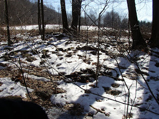


And just above the row, three very large stones that greatly resemble a snapping turtle emerging from the ground, it's head and forelegs (8 feet long perhaps), down on the edge of that stone-bordered swamp...