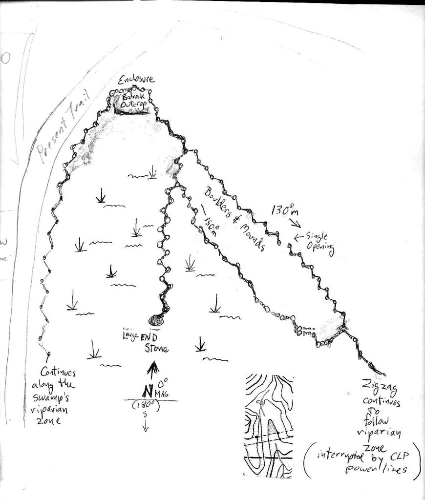
Three views...


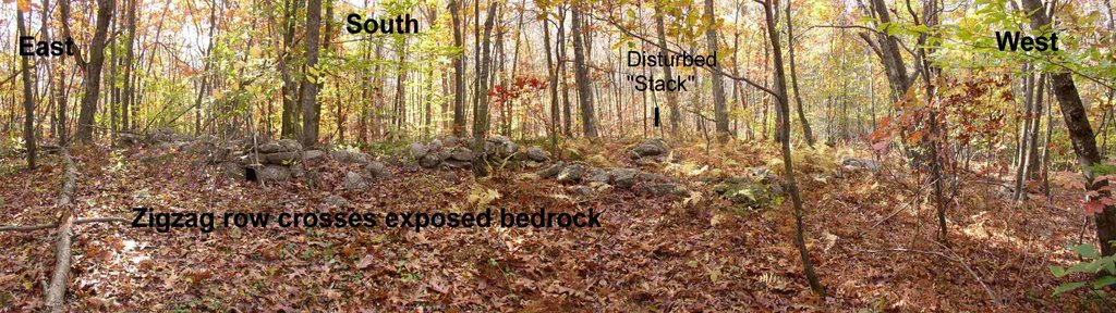
Headed south, I'm up on more exposed bedrock that's covered in leaves right now...It's marked "boulder" in one drawing and "bedrock outcrop in the other...This is a blurry picture of the stone row labelled "130 degrees magnetic" in the drawing, between the outcrop and where the three rows meet.
Here's the notebook scan and a drawing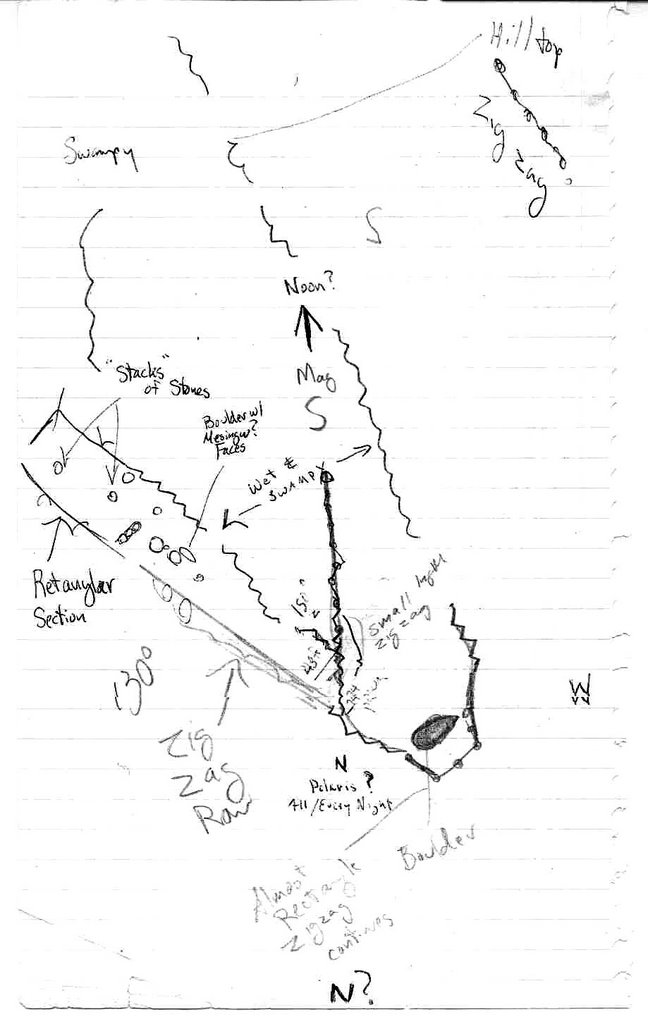 :
:
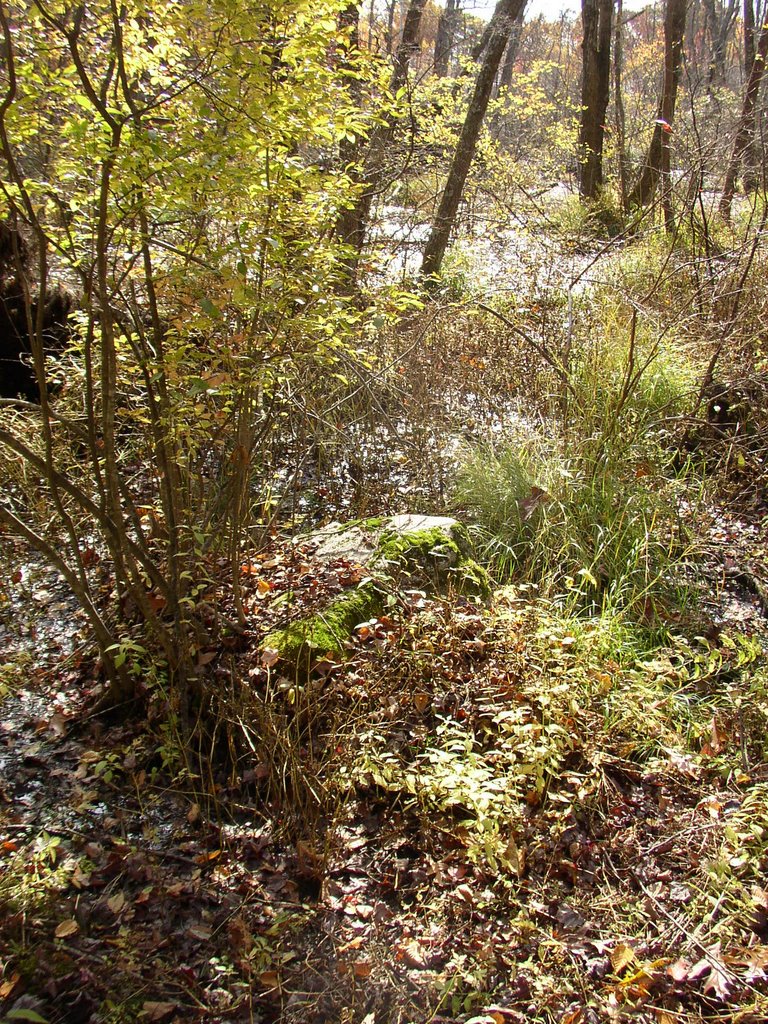
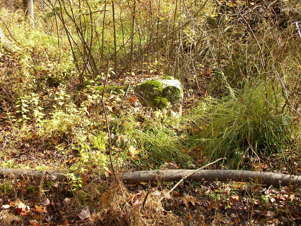
Facing south (180mag), this row ends with a single large stone:

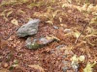
Here's the "End Stone."
Moun ds:
ds:


 Where was I?
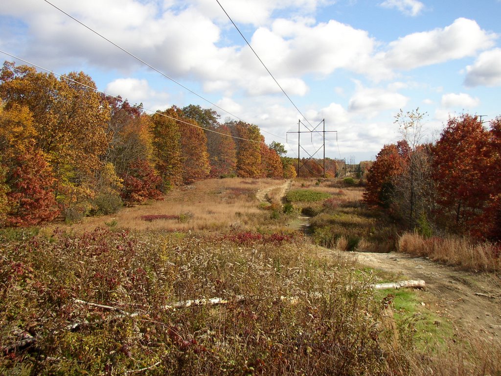
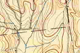
I was at the entrance to the "mound swamp," right at the big red dot on the map here.
Or was I?
Was it a swamp a long time ago?
Did it become a swamp only when those big black dots that are power lines appeared in the 1930's?
I can answer that question without hesitation:
I don't know...
I do know that yesterday I was standing where the big red dot is, looking easterly, when I took the photo above...
Where was I?
I was at the entrance to the "mound swamp," right at the big red dot on the map here.
Or was I?
Was it a swamp a long time ago?
Did it become a swamp only when those big black dots that are power lines appeared in the 1930's?
I can answer that question without hesitation:
I don't know...
I do know that yesterday I was standing where the big red dot is, looking easterly, when I took the photo above...
 This detail of the oldest map (1892, I think) is no help at all; it doesn't really look like the same place at all...
No map shows the swamp as a swamp, so it's up to me I guess.
This detail of the oldest map (1892, I think) is no help at all; it doesn't really look like the same place at all...
No map shows the swamp as a swamp, so it's up to me I guess.
 This sort of V-shaped swamp is outlined by zigzag stone rows. It is swampy now because of the dirt road that is marked by pencil lines.
The zigzag rows are disturbed by the road but they continue to the south, concealed by brush. And if I did follow them in the past, I don't remember well enough to tell you where they lead.
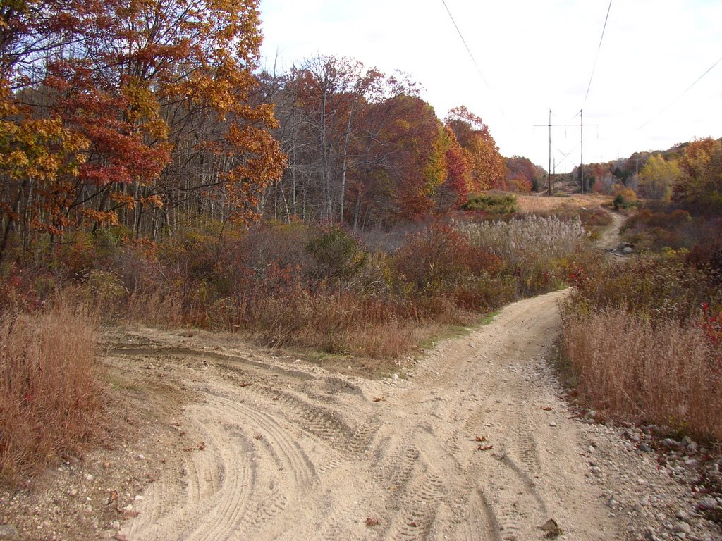
I turned left (north) on the present day trail...
This sort of V-shaped swamp is outlined by zigzag stone rows. It is swampy now because of the dirt road that is marked by pencil lines.
The zigzag rows are disturbed by the road but they continue to the south, concealed by brush. And if I did follow them in the past, I don't remember well enough to tell you where they lead.
I turned left (north) on the present day trail...

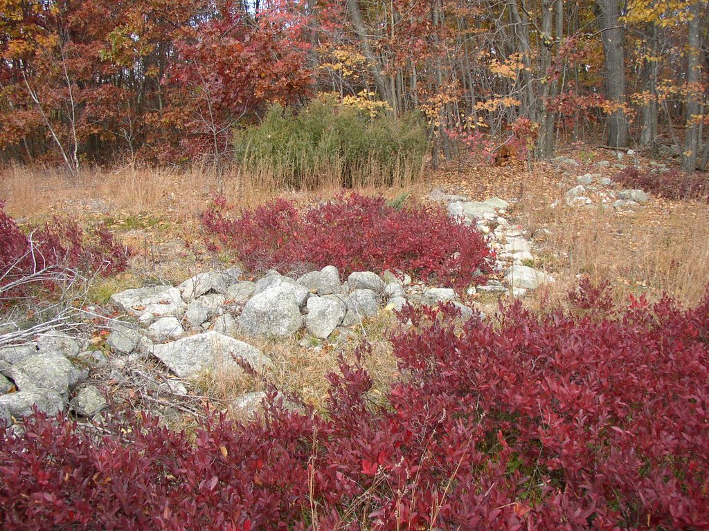
 Zigzag rows along the western border...
  ...that meet up with that black c-shaped line I've so skillfully added to the black and white copies of the topo-map. Disturbed by the trail, I think they intersected.
Wouldn't you?
It's an approximation; here's the row that leads to what is now an exposed piece of bedrock (covered in leaves, right now).
(I'm "off the trail" now, like Gary Snyder says...)
...that meet up with that black c-shaped line I've so skillfully added to the black and white copies of the topo-map. Disturbed by the trail, I think they intersected.
Wouldn't you?
It's an approximation; here's the row that leads to what is now an exposed piece of bedrock (covered in leaves, right now).
(I'm "off the trail" now, like Gary Snyder says...)
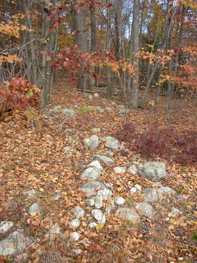
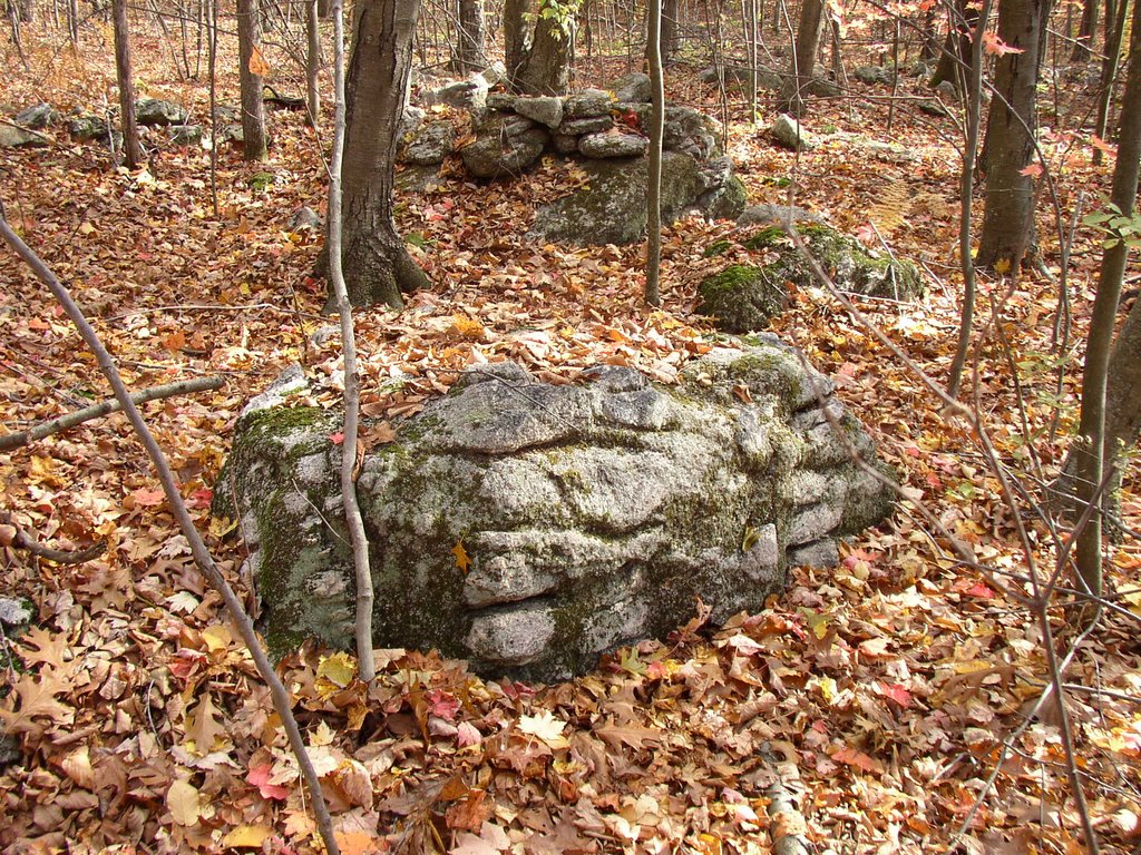
 See the biggest tree in the photo?
Below it is a disturbed mound along the side of the row, a small red dot on the map copy/drawing.
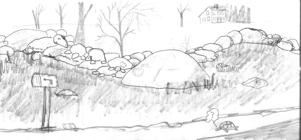
The big stone in the foreground is a point stone of the zigzag that thought at the time was a turtle but editing this in November 2021, I can tell you it's a snake's head...
The disturbed pile or stack or something...
See the biggest tree in the photo?
Below it is a disturbed mound along the side of the row, a small red dot on the map copy/drawing.
The big stone in the foreground is a point stone of the zigzag that thought at the time was a turtle but editing this in November 2021, I can tell you it's a snake's head...
The disturbed pile or stack or something...
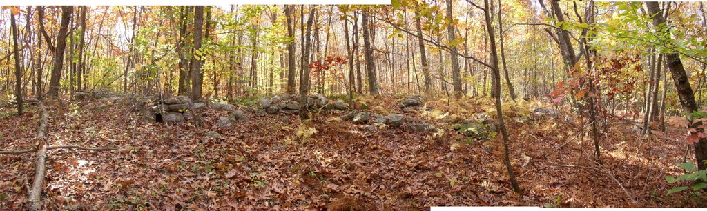
 Everybody loves a panorama...except Blogger perhaps; I've tried to upload it 4x now...maybe a separate post will work?????


Many of the old stone rows are missing now. Here's a zigzag remnant that shows nicely, wild low bush blueberries wearing their autumn colors...
 My new hat for perspective by some of the stonework. More to follow...


 For All: