Friday, August 19, 2011

Westbrook CT July 2011


Stewart B. McKinney National Wildlife Refuge Westbrook CT

(Above 1934 Aerial Photo showing of these stone rows)

A link to:
where a sea turtle effigy is an artistic cultural element in a stone row:

(Barnacles?)

Thursday, August 18, 2011

New England Cross & Rail Fence

The natives are very exact and punctual in the bounds of their lands, belonging to this or that prince or people, even to a river, brook, &c.” - Roger Williams, in his Key (CHAP. XVI. Of the Earth and the Fruits thereof).
       Roger Williams defended Indian Land Rights in a further exchange with Puritan leaders by saying, “they hunted all the Countrey over, and for the expedition of their hunting voyages they burnt up all the underwoods in the Countrey, once or twice a year, and therefore as Noble men in England possessed great Parks, and the King, great Forrests in England onely for their game, and no man might lawfully invade their Propriety: So might the Natives challenge the like Propriety of the Countrey here.”
The Puritans replied: “We did not conceive that it is a just Title to so vast a Continent, to make no other improvement of millions of Acres in it, but onely to burne it up for pastime,” as if survival was a kind of recreation.
      If Williams did see stone rows as the “bounds” of hunting grounds, or the resource zones of all the “fruits” he lists in his “Key,” as the firebreaks used by Indians as they safely and selectively burned their cultural landscape, he never wrote it down. At about the same time Fence Laws suddenly sprung up – as did those early wooden fences, so easily and quickly built, in fashion said to have possibly originated with Native American Snake Fences, their hunting fences and in one case around their cornfields, as Claude C. Coffin wrote in a 1947 CT Archeological Society Bulletin article about wooden and stone fish weirs along the Housatonic River.
Page 30 of "Our Vanishing Landscape"
A chicken/egg situation: what really came first, the stones or the wood?

      What could have been easier that to add the rails or "rayles" over low snake-like zigzag Indian fuel breaks and claim the “voyd places of the Countrey by the Law of Nature, (for Vacuum Domicilium cedit occupanti:),” and claim the land for your very own? The same goes for some "linear' stone "walls," that were turned into "proper" four and a half feet tall fences by adding the "cross and rails" pictured above in an illustration by Eric Sloane in Our Vanishing Landscape (page 30 - 1955), an adapted view pictured below...


Wednesday, August 17, 2011

Evidence of Native American Brush (and stone) Fish Weirs

Above: Fishing weir near Eastport, Maine. A weir is a traditional American Indian fishing device, consisting of a trap made of sticks or brush with a large basket in the middle. Weir designs vary according to the location and waters being fished. Typically, setting up a weir involved creating a fence-like structure of reeds, stretching it across a stream, and anchoring it to the bottom by sticking poles into the ground below the water. The reeds were tied together tightly so that fish could swim in, but couldn’t swim out ( http://www.learnnc.org/lp/multimedia/5963).


Evidence of Native American Brush Fish Weirs
In South Cove, Old Saybrook, CT
Archaeological Society of Connecticut
Research Summary and PowerPoint Presentation
Timothy C. Visel
Abigail C. Visel
PowerPoint Presentation by Abigail C. Visel

This paper was presented at the fall meeting of the Archaeological Society of Connecticut, October 18, 2008.
What is left today?
Unfortunately, little remains of these weirs today. The netting would quickly rot and marine worms could destroy a four-inch hickory pole in one summer. What remain are the stones, walls and enclosures that survived in protected areas along Connecticut’s coast. According to Mr. Clark of Old Saybrook, the brush weirs (he mentioned at least two connected to each other resembling a “double hook”) were “recycled” to build the long haul seine piers along the east edge of the Connecticut River. These rock piles still exist today; these “piers” have claimed more than one unfortunate boater. They are not piers at all, but a built up point from which to set long haul seines. They basically were large enough to hold an anchor capstan and boat tie offs. Mr. Clark states that to construct them, stones from the brush weirs were thrown to barges
at low water. Adjacent to the headland, clumps of rocks are still present according to local fishermen. This June, Mr. Jim Hoffman of Cove Road was talking about the cove. I mentioned the Indian brush weir, and Mr. Hoffman led me down with my son Will to show me the same headland and long stonewall that Mr. Clark showed me some three decades earlier. Mr. Hoffman knew about it; it was an oral story of the Old Saybrook small boat shad fishermen. He cautioned me that clumps of rocks were still present and make crossing under power dangerous. He also described what was on the Indian fish camp on the property. He said the trap was built to eat shad. Indians, he claimed, roasted them on the shore and artifacts over time have been washed from the edge. [Old Saybrook still has a number of shad gillnet fisheries that gillnet shad for roe and fillet (boned) for use in planking roasts each spring. These local roasts, to my knowledge, are the last remaining traditional fish planking roasts on the East Coast.]

One may ask how much of the 18th, 19th and 20th century fisheries fishing practices were learned from Native Americans. I contend quite a bit. In almost every fishery, I see evidence of earlier technology. Not that European settlers were not familiar with them, it is just style and design often reflected what preceded. I have that great print in my office of a 17th century Quinnipiac dug out oyster canoe next to a 18th century New Haven sharpie. The similar size and shape of these vessels are uncanny. The modern bull rake is almost identical to the ash/hickory push pull rake of Niantic Bay. The flounder and eel spears of Stonington, CT, are exactly the same as fishing depicted on Chesapeake Bay in 1587 by sketches of John White, Governor of Raleigh Colony (along North Carolina)...

Stones to Hold The Trap
Almost every feature of brush fykes and even the larger full tide traps used stones to help anchor the trap or its leader. They could be dragged to the shore and raft deployed to set them in place. I do not feel they were carried into place; having built fish pools for trout walking on soft mucky bottom, carrying rocks is less than rewarding under such conditions. Considering the amount of stones often used, it could represent decades of building or re-building. The leader would be placed first and rocks dumped on either side. If this were the case, leaders would need to move as driving stakes through last year’s stone piles would not work that well. At low tide, these submersed stonewalls would function more as a fence or barrier, assisting the final capture of fish on the ebbing tide. Several references shed information on the type of materials used to construct these weirs. The primary materials were stone and wood, secondary vines and rocks and twines mesh.

Therefore, only stones remain today as evidence of these early fisheries. Chaffinch Island, a public park in Guilford, CT, shares a similar feature – a stonefish weir from a headland. Here a similar bowl coastal feature directed fish much in the same way. In South Cove, in Old Saybrook, at the northeast corner of this bowl, a pronounced stonewall protrudes to create a Vtrap.
The amount of stones used was tremendous, and some assemblage is clearly visible on satellite imaging in the areas of the headland. Marine worms feasted (and continue to do so) on wood, especially in the warm months. Little of the wood or natural fibrous twine would survive to the following season...

One feature of our coastal traps in shallow areas is the use of small stones to support what is termed the leader. Here, stones would be piled into a crude wall, both to support the brush weir and to trap fish as the tide receded. In northern areas, where brush traps were set upon mud flats, no stones were used; currents were too strong. However, in coastal coves, I feel the stones at low tide formed a reef, which tended to keep fish concentrated against an “artificial shore.”
Tim Visel
The Sound School
October, 2008
from: http://www.soundschool.com/fishweirpaper.pdf

Tuesday, August 16, 2011

Ahquedaukenash

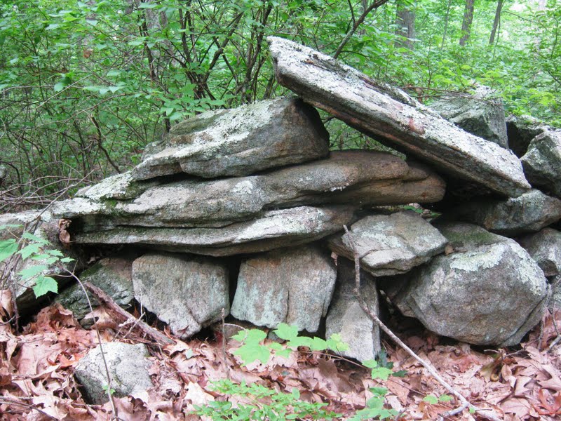
"The Ahquedaukenash then of the Indians, and the Aquedahcan and Aquedoctan of the English, were one and the same name, applied to the fishing place, of the Indians, at the outlet of Lake Winnepesaukee, now known as " The Weirs." This was called Ahquedaukee, or the Weirs, from the fact that the dams or weirs at this place were 'permanent ones. The Winnepesaukee is not a variable river, and at the outlet of the lake the water for some distance passed over a hard pebbly bottom, and did not average more than two feet in depth. This was an excellent place for ahquedaukenash or dams, and could not fail of being duly improved by the Indians. Accordingly as before suggested, they had here permanent weirs. Not being able to drive stakes or posts into the hard pebbly bottom of the river, they placed large rocks at convenient distances from each other, in a zig-zag line across the river. Against these they interwove their brushwood weirs, or strung their hempen nets, according to their ability. Such weirs were used in the spring and fall, both when the fish went up and down the river. Such ahquedaukenash were frequent upon this and other rivers, and the rocks thus placed in the river by the Indians, remained in their position long after the settlement of the English in that neighborhood, and were used by them for a like purpose ; hence the name of weirs as continued at the present time.

In the fishing season, the whole Pennacook nation were at their home at Namaoskeag, and welcomed strangers from abroad with feasting and revelry. The first thing to be done was to make an " ahquedaukee "or weir. This was usually done after this wise: a line of stout sapling stakes was extended across the river, some ten or twelve feet apart, at a point where the bottom was soft, so that the stakes could be driven into the sand or mud. These stakes were inclined down stream, and were interwoven with birch tops and other brush wood, or nets were strung from stake to stake, so as to present an effectual barrier to the fish. On one side of the river, one or more stakes in distance were left clear of brush or nets, so that the fish might have a free passage up.

There can be little doubt of the fact, that at the outlet of the basin, at the foot of the main falls of Namaoskeag, and upon the west side of the Merrimack, a place now known as the eddy, as before suggested, that the Indians had a permanent weir, made by placing boulders of stone at convenient distances across the outlet of the basin, in like manner as at their ahquedaukenash at the outlet of the Winnepesaukee. The position was equally eligible, and had this superior ad vantage,, that when constructed, both salmon and shad were secured in the basin above.

A run or school of fish would pass up till they met the swift water from the falls, when they would retreat in myriads down the stream, till they came in contact with the wier—-here they would turn again to meet the rushing school from above. Thus in a little time the capacious basin above the weir would be filled, and black with fish,—the strong and athletic salmon throwing himself out of the water in his affright and rage. This was the favorable time for the Indian fishers. The watch would give the signal, and the birch canoes would speed their way to the scene, an Indian in the stern of each plying his light paddle., and another in each bow with a spear or dip-net, according to his ability or ingenuity. When fish were so penned up as it were, it required but little skill to catch them, and a thrust with the spear, or a dip of the net, was seldom unsuccessful. When the canoes were filled, or the fishers became tired of their labor or sport, the fish were taken to the shore and delivered over to the squaws, who stood ready with their knives, and dressirig the fish, split them and laid them in the sun to dry, or hung them upon the centre-pole of their wigwams to smoke. Each night was passed in dancing and feasting, a kind of Thanksgiving for the success of the day. At these fishing seasons, lover's vows were plighted, marriages were consummated, speeches made, and treaties formed. There can be little doubt that it was a fishing season at Namaoskeag, when in 1660 Passaconnaway made his dying speech, spoken of by Hubbard, and that here too both Passaconnaway, and Wannalancet his son, heard the apostle Eliot preach to their people, and set the example to their followers of publicly recommending the Christian religion.

the history of manchester, formerly derryfield in new- hampshire; including that of ancient amoskeag, or the middle merrimack valley

The History of Manchester, New Hampshire, written by Chandler Eastman Potter in 1851. Chapter IV is titled "Manners and Customs of the Pennacooks, Ahquedaukenash or Weirs", and can be read in its entirety here:

"Ahquedaukenash" signifies, literally, a dam, or stopping-place, and was constructed in thjs wise: Large granite boulders were placed in an irregular line across the river, the boulders representing the angles of a crooked rail-fence, and at a proper distance below the falls. Wherever it was practicable, strong sapling stakes were driven into the bed of the river, and used for the same purpose, or took the place of rocks; but at the outlet of the Winnipesaukee this was impracticable, owing to the solid character of the river-bed. Having thus prepared the foundation, the rocks being some ten or twelve feet apart, a netting was then woven of twigs and tough and pliable bark, with meshes sufficiently close to prevent the fish escaping. This was strung entirely across the river, above and against the rocks, excepting a space between one or two of the rocks or stakes, these being left open for the fish to pass through in their progress up the river; through these openings the whole force of the fish must and did pass.

As few of them scaled the falls until after repeated efforts, and the rapidly advancing "school" crowded steadily through the opening, it follows that the pen. or ahquedaukenash, was soon full. Now was the time for the Indian shad-catcher. Expert fishermen,'and such others as were selected and appointed for the purpose, manned the canoes and pushed boldly out among the pent-up prisoners, and with spear and dip-net lost no time in filling the canoe, in this regard illustrating the old maxim, "Make hay while the sun shines." Returning freighted heavily, they handed them to the squaws, who stood ready, knife in hand, to split the fish, and hang them up to smoke for winter on the centre-pole of the wigwam, or laid them out to dry in the sun on improvised flakes.
The Merrimac River, Its Source and Its Tributaries, by J.W. Meader, 1869. Chapter IV is titled "The Forks - Winnipeaukee Lake and River", and details about the Ahquedaukenash can be read here:
http://books.google.com/books?id=Jb8eJCboU2AC&lpg=PA106&ots=n623qn2644&dq=ahquedaukenash&pg=PA106#v=onepage&q=ahquedaukenash&f=false

Monday, August 15, 2011

SOUTHINGTON ROCKSHELTERS


by FRED W.GUDRIAN of the ALBERT MORGAAN ARCHAEOLOGICAOL SOCIETY

THE BULLETIN OF ARCHAEOLOGICAL SOCIETY OF CONNECTICUT


ABSTRACT: located in Southington. Connecticut are a large group of rock shelters that had a series of occupations from late Archaic to the Final Woodland period. The shelters have been dug by bottle and pot hunters over the last twenty years.

DISCOVERY

It was a warm and sunny November day in 1972when I first came upon a group of rock shelters while hiking in Southington, Connecticut (Map 1). The shelters are located along the side of a ridge that runs the length of Southington's western border. Some of the shelters are located on the foothills near the ridge, while others are on the ridge itself (Map 2)…

Walking north, next to the ridge, I approached a large terrace that rises up about 10 m (ca. 33 ft). On the top of the terrace I saw a large glacier-deposited boulder shaped like an inverted "L" which is called "WAVE". Beyond this boulder, among the trees, there appeared a giant boulder.

I walked the distance, about 30 m (ca. 100ft) quickly and saw that the stone boulder was nearly 19 m (ca. 63 ft) long. This stone, called the "WHALE", has a large niche on its northern edge and was an important pre-contact shelter site. Behind and slightly southwest is a smaller rock with another overhang shelter, called the "BOAT". Slightly to the north of the WHALE is another small shelter, the TURTLE…

After examining these shelters I continued northward about 115 m (ca. 380 ft), crossing a small dried river bed along the way. Off to the left, toward the ridge, I noticed two shallow canyons separated by a large rock wall. At the far end of each canyon the land rises up and contains a large cave with a smaller 21niche-like cave to the north. These shelters are called the "FOURSISTERS".

After climbing around that group of four caves, I then continued my hike to the north and came across another group of shelters called "TABLETOP" that contained three medium sized caves. Another 30 m (ca. 100 ft) north, I found another shelter overhang called the "CLAM".

Circling back through the woods by a different route, I re-examined the large boulders on the ridge that I had encountered when I first started my hike. At almost the very top of the ridge there is another large overhang that has a wonderful view across the valley to Meriden. The shelters in this area are called the "SOUTHERN GROUP..."


Sunday, August 14, 2011

Yellowstone Lake Weir

Winnipesaukee stone walls

"Weirs Beach has been habitated for thousands of years. A 1976 archeological excavation at the beach, led by Charles Bolian, a Professor of Anthropology at the University of New Hampshire, found that Native Americans used the area as a summer camp for hunting and fishing as long ago as 8000 B.C!


The campsite extended in a long arc along the lake and along the Western shoreline of the Weirs Channel, roughly from today's Winnipesaukee Pier to today's Channel Marine. Before the original Lakeport dam was built around 1766, the level of the Lake was roughly 5'-12' lower than it is today, so much of the original campsite is now under water!

...(t)he original fishing WEIRS had been made of stone walls in the form of a "W"and stretched across the entire width of the channel. The bottom two points of the "W" pointed towards Paugus Bay and were utilized during the late summer Shad down-river migration, while the middle point of the "W" pointed toward the Lake and was utilized during the spring up-river Shad migration. The points of the "W" were "...left open a few feet for the water and fish to pass through. A short distance below the opening another wall was built in a half-circle, and into the spaces was placed wicker-work, made of small saplings, through which the water could easily flow, but fine enough to entrap fish of any considerable size."


The stone walls, sturdy enough to last hundreds of years, were only partially destroyed by the several miller's dams that were built in the Weirs Channel from 1766-1829 and an 1833 dredging project. They were still in evidence until the dredging of the Weirs Channel in the early 1950's...)

Bashan Lake

Arrowheads and artifacts at The Milford Historical Society


Updated: Thursday, 11 Aug 2011, 7:53 AM EDT
Published : Thursday, 11 Aug 2011, 5:08 AM EDT
By: Gil Simmons

Milford, Conn. (WTNH) - The Milford Historical Society is a shoreline treasure that shows how life once was.
"I think this society is so lucky to get this," Bill Hoagland from the Historical Society explained. "There is so much you can talk about, show and explain."
The Claude C. Coffin Indian Artifacts Collection on display at the Milford Historical Society shows visitors bones, arrowheads and clay pots put together like puzzle pieces.
"The estimate I got about 4,000 pieces or a little more," Hoagland said.
Hoagland says some of those pieces date back to over ten thousand years ago. This is a unique collection and was handed over to the society back in 1967 from Mr. Coffin, a local award winning archaeologist, two years before he died.
"He had originally planned on sending it up to New Haven, but they had planned to sell part of it and he wanted it kept intact."
Many of the items were found in Milford. Others were unearthed at locations around Connecticut. He started back around 1900 when he was just 14 years old.
"He gave it to us with the understanding we would keep it intact, which we have done."
His original log books are on display and they show Claude's organization skills and artistic ability.
"Every cotton picking piece of goods we have here from him has an identification number on it," Hoagland said. "In those books somewhere you will find a descripter of where he found it and so forth."
From display case to display case, the presentation has a lot to offer when is comes to learning.
"I am always amazed at the kids," Hagland said. "... anywhere from second grade to third fourth and fifth grade sometimes, and even the little kids are amazed."
Something that would surely make Claude proud if he was here today; A historical treasure that will teach for many years in the future.
The Milford Historical Society is at 34 High Street. For more information on the collections visit milfordhistoricalsociety.angelfire.com
WTNH Video:

Bing Map Share

Cuttyhunk Island - bird's eye of stone rows in a pond

I'm just seeing how this works, the share option @ Bing maps...
http://www.bing.com/maps/?v=2&cp=qx1z5x92mv6q&lvl=17.8755715781384&dir=192.2019105352281&sty=b&form=LMLTCC
Kettle Holes from Rock Piles?


Thursday, August 04, 2011

Just off the Blue Trail

Following a stream crossed by the Blue (Mattatuck) Trail in Watertown CT, I found boulders with some unusual stuff happening on them. The first I thought might be so old that the sandstone had fallen apart, but now I wonder - and will probably never really know - just what was going on here...


So then I look to the west:

A Split Rock with bridges??? And other "placed" stones????
And there's that sand again, all surrounded by thick moss...


...except where the moss is peeled, way over to the right of me:
I don't know what to think about this one...