Saturday, February 27, 2010
Friday, February 26, 2010
Picture Glossary of New England Lithic Constructions
by Daniel V. Boudillion
"This page (http://www.boudillion.com/glossary/glossary.htm) is a glossary of stone structures that are often found in the woods of New England. These structures can be of many eras and origins, and its not always easy to determine what is what. There seem to be Native American structures, both pre-contact, historical, and modern, as well as Colonial and Neo-Pagan structures. Further, some of the structures seem to indicate a pre-contact Native American activity not recognized or allowed by modern archeologists...
There are thousands and thousands of small rock piles in the Massachusetts woodlands. Many of these are in rocky and swampy areas that would not have been worth the time and effort of a Colonial farmer to clear the stones into piles. Often, these piles are on the east side of hills overlooking water. It is considered by some that these piles have Native American significance. Indeed, I have seen a good few that appear to be made to represent a turtle, a creature whose spirit was sacred to the Native Americas of New England. The best resource on the native significance to rock piles is Peter Waksman's Indian Rock Piles website.

More on Dan's Turtle Shell: (http://www.neara.org/macsween/turtlevision.htm)
From: http://www.boudillion.com/glossary/glossary.htm
Graphic Intro to Archaeology
Archaeology: The ComicJohannes Henoch Neethling Loubser - 2003 - 190 pages books.google.com |
Wednesday, February 24, 2010
Manitou Api

Manitou Api
“The Place Where the Creator Sat"
David Courchene (Nii Gaani Aki Inini)
September 17, 2006
On this sacred site, you could not help but feel the presence of the ancestors joining us in our efforts to find ourselves as a unique and beautiful people. You could feel the dancing of the ancestors as songs were sung at the (Whiteshell) petroforms. As the teachings were being delivered by the elders, it felt so good to be hearing the truth being spoken…September 17, 2006


With the building of the Petroform of the Turtle, this experience literally took us back to the time when our ancestors left markings on the Earth. Today we have left ours, signifying our search for the Truth and our return to the sacred site of our people.
The most noticeable thing was the excitement that everyone was showing as they searched for rocks to form the petroform. As it was being built to its near completion, one of the grandmothers called me over and told me to look in the direction of the back of the Turtle. What I could see was an Eagle emerging from the back of the Turtle. The elder seemed to be so excited. One had to be there to witness and feel what was being done as an event that reached beyond our minds' comprehension.
During the four days, little baby turtles kept appearing…
More at:
Photo at the top of the page:
Muzzu-Kummik-Quae;
Earth Woman of the Anishinabe
Earth Woman of the Anishinabe
Composite of moon, forest and petroform, Whiteshell Provincial Park, Manitoba, 1993.
Muzzu-Kummik-Quae is the mother of all creation.
Monday, February 15, 2010
Standing on the Stone

It’s all connected
From where the water of life
Springs forth from the ground
To where the ocean encircles the world

It’s all connected
Stone by stone by stone


To the stones in the sky
To the stones that fall from the sky

To the stone you stand upon
Connected for a moment
To everything, to the mystery,
And happy to be
Thursday, February 11, 2010
Tuesday, February 02, 2010
Small Detail Part 2

at the center of the Universe:
rockpiles equinox sunset-2009
spring equinox (2009)
2007 equinox
2006 map-thing
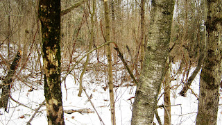
You might notice linear or zigzag stone rows that appear sometimes as light lines, as well as dark ones - and notice the sort of scallop shape of the small stream around this little sort of island on the first terrace above the floodplain; what you are seeing is the outline of serpentine and zigzag stone rows.


The Path begins on a floodplain corn field, walking to the south on ancient glacial lakeshores:

The zigzag rows visible on the 1934 aerial photo are obscured by the trees at the top of the little rise to the left. The zigzag rows turn into more linear row containing some very interesting stones, sometimes found as sort of circular heaps or mounds, many suggestive of animals, especially turtles all along its course.
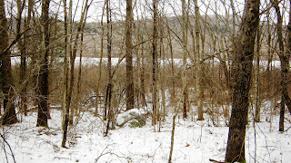
Also note the stone row on the left. In previous posts I've called it "the backbone." In the aerial photo, it is the northern (upper) edge of the light colored field. If you follow that row, you end up at a rockshelter...


As the row turns linear, descending to the floodplain, it abruptly stops.

(We pause to look back north rather than the southerly view we've had in all the above photos; note the large 'end stone' boulder with a rather testudinate stone sitting on top of it... )

Check the aerial photo; do you think the stone row points to those 4 Stones?
Today it seems, to me, as if the landscape was made into
a sort of Medicine Wheel, not at a remote location, but here at this habitation site...
As the crow flies, you end up near here:

There is apparently a parking problem
at the symbolic Center of the Universe.

If you'd been wondering about that other white dot a little NW of the 4 stones in the '34 photo, it is most likely this stone to the west of this (twisted) apple tree, perhaps all that is left of the stone burial mound... 

Approaching the northern most boulder/standing stone...

Standing at the North Stone, high noon on Ground Hog's Day, the sun behind clouds.
Walking south, I find the 4th boulder, the South Stone...
Walking south, I find the 4th boulder, the South Stone...

I went back and lined myself up with the 4 Stones, centered myself with the Great Mystery, and eventually took a photo looking in each of those four directions, in a sun-wise circle, East, South, West, and North...


Monday, February 01, 2010
A small detail from the big picture
The Center of the Universe in the Heart of the N_____ Wigwams (April 1934)

I just recently stopped thinking about and calling the four stones in the photo above a calendar site. It happened sometime after Norman sent me an article by Herman Bender entitled Medicine Wheel or “Calendar Sites”: Indian Time or the Space/Time Continuum. I remember that it took numerous readings to get everything to stick to my head – on the inside I mean.
Those four bright white spots clumped together in the center of the photo might or might not be boulders, three of which are still there in 2010 as I write this.
Then again, maybe they are SHEEP.
Big SHEEP...
The space within those boulders is something like the Center of the Universe or being centered in the Universe, if I understand what Herman is saying. I know that, no matter what the groundhog says about it tomorrow morning, on the Vernal Equinox the apparent sun set, viewed from the easternmost stone, will sink into the distant hillside directly above the westernmost stone. For a time the sun will set behind the northernmost stone, a standing stone, a few days before and a few days after the Summer Solstice. Whether the sun shines or not, I’ll know these things will happen, just as certainly as I know that when the sun is at it’s highest in the sky everyday, it will be, when viewed from the standing stone, will be directly over the southern-most stone.

I was paying too much attention to three large boulders but not enough to all four stones. I left the fourth stone, the southernmost stone, out of all the drawings I ever made and all the photos I ever took as well, but it may be just as well because it just doesn't" stand out" as a Standing Stone should - except in my imagination, unlike that other triangulation of Standing Stones...
This is, incidentally, where someone sketched a drawing of an Indian Sachem’s grave that became a wood cut illustration in a mid 1800’s history of the town, the author of the history relating “…the small remnant of his people buried him in the beautiful plain at the foot of the musical falls that are called by his name…An apple tree was planted at the head of his grave, which still stands there, the faithful guardian of the ashes that repose beneath its grateful shade. It is a venerable tree, some 150 years old, but does not bear the marks of so great an age, though there are several decayed places in it, so perfectly shown in the accompanying cut of the grave and tree, taken by the artist on the spot during the last summer. When the writer first visited it, twenty years ago, there was a large hillock, or mound, raised over the grave which remained, distinguishing the sachem's, by its size, from the other graves around him, till a few years ago, when the present owner of the field committed the sacrilege of plowing it down, saying lie was not going to have such an old " hummock in his field," much to the regret of every true antiquarian, and lover of ancient things. The mound thus destroyed was some ten feet long, six feet wide, and four feet high, having been gradually formed…”

I was paying too much attention to three large boulders but not enough to all four stones. I left the fourth stone, the southernmost stone, out of all the drawings I ever made and all the photos I ever took as well, but it may be just as well because it just doesn't" stand out" as a Standing Stone should - except in my imagination, unlike that other triangulation of Standing Stones...

This is, incidentally, where someone sketched a drawing of an Indian Sachem’s grave that became a wood cut illustration in a mid 1800’s history of the town, the author of the history relating “…the small remnant of his people buried him in the beautiful plain at the foot of the musical falls that are called by his name…An apple tree was planted at the head of his grave, which still stands there, the faithful guardian of the ashes that repose beneath its grateful shade. It is a venerable tree, some 150 years old, but does not bear the marks of so great an age, though there are several decayed places in it, so perfectly shown in the accompanying cut of the grave and tree, taken by the artist on the spot during the last summer. When the writer first visited it, twenty years ago, there was a large hillock, or mound, raised over the grave which remained, distinguishing the sachem's, by its size, from the other graves around him, till a few years ago, when the present owner of the field committed the sacrilege of plowing it down, saying lie was not going to have such an old " hummock in his field," much to the regret of every true antiquarian, and lover of ancient things. The mound thus destroyed was some ten feet long, six feet wide, and four feet high, having been gradually formed…”
Subscribe to:
Posts (Atom)