Or: Why is my eye drawn here?
Here's an article that keeps popping up around me:
"Old Stone Walls Record the Changing Location of Magnetic North" by John Delano - Distinguished Teaching Professor of Atmospheric and Environmental Sciences, University at Albany, State University of New York
March 12, 2019
"When I was a kid living in southern New Hampshire," Professor Delano tells us, "my family home was on the site of an abandoned farmstead consisting of massive stone foundations of quarried granite where dwellings once stood. Stone walls
snaked throughout the forest. As I explored the deep woods of tall oaks and maples, I wondered about who had built these walls, and why. What stories did these walls contain?"
As nature reclaimed farmland, stone walls continued to mark historical boundaries. John Delano, CC BY-ND
"What stories did these walls contain?" Delano asks.
And I ponder,
"What Turtles did these rows of stacked stones contain?"
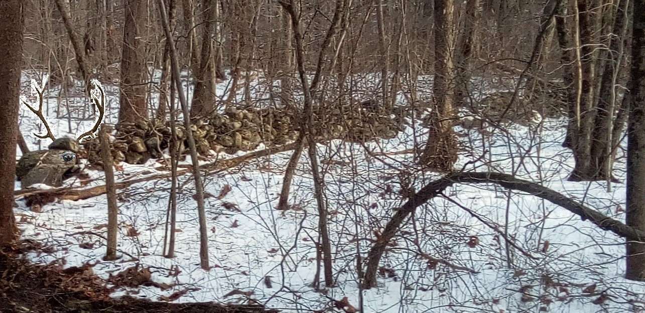
I often find myself wondering about, and wandering about, these iconic stone walls, rows of stones that do indeed seem to
snake across the landscape on this northeastern corner of the continent.
I wondered, "Who built this wall (that begins with a Big Snake's head)?" - but for just a little while:
So did my fictive associate, Sherlock Stones:
Delano continues, tells us that, "Decades later, while living in a rural setting in upstate New York and approaching retirement as a geologist, my long dormant interest was rekindled by treks through the neighboring woods. By now I knew that stone walls in New England and New York are iconic vestiges from a time when farmers ("What kind of Farmers? I asked aloud as I read this), in order to plant crops and graze livestock, needed to clear the land of stones. Tons and tons of granite had been deposited throughout the region during the last glaciation that ended about 10,000 years ago.
By the late 1800s, nearly 170,000 subsistence farming families had built an estimated 246,000 miles of stone walls across the Northeast. But by then, the Industrial Revolution had already started to contribute to the widespread abandonment of these farms in the northeastern United States. They were overgrown by forests within a few decades.
During my more recent walks through the woods, on a whim I used a hand-held GPS unit to map several miles of stone walls. And that was how I realized that in addition to being part of an American legacy, their locations record a centuries-long history of the Earth’s wandering magnetic field."
Well now, there are several things that bring the term Pretzel Logic to my mind when I read this, especially when further along into the article, Delano says: "Here’s the logic. When settlers were piling up those stones along the boundaries of their plots, they were using property lines that had been laid out according to the surveyors’ compass readings. Using LiDAR images, the bearings of those stone walls could be determined with respect to true north and compared with the surveyors’ magnetic bearings. The difference is the magnetic declination at the time of the original survey.
Historical maps and surveys underscore the orderly way plots were divvied up from the landscape in a grid.
For example, the original surveys divided New Hampshire’s Stoddard township into hundreds of lots with boundaries with magnetic compass-bearings of N80 degrees W and N14 degrees E in 1768. As the land was cleared for farming, owners built stone walls along and within those 1768 surveyed boundaries..."
Of course the differences in magnetic north declination shows up in those surveys from 1700 and records the magnetic changes up to the present every time a new survey is made but there seems to be a great number of assumptions affecting the conclusion that this has something to do with determining when a row of stones was actually built.
First off is the assumption that the premise is true that "stone walls in New England and New York are iconic vestiges from a time when (colonial and post colonial) farmers, in order to plant crops and graze livestock," began piling stones for the first time ever in this virgin wilderness populated with nomadic savages. In a mere 100 years or so a relatively small population of people of European descent (or their slaves, indentured servants, children, and employees), armed with compasses, built a vast number of miles of "stone fences," only to abandon it all - or a great percentage of all those farms.
Our old friend Mr. Wikipedia tells us that the proper term for Pretzel Logic is "Circular reasoning," (Latin: circulus in probando, "circle in proving" - also known as "circular logic") is a logical fallacy in which the reasoner begins with what they are trying to end with. The components of a circular argument are often logically valid because if the premises are true, the conclusion must be true. Circular reasoning is not a formal logical fallacy but a pragmatic defect in an argument whereby the premises are just as much in need of proof or evidence as the conclusion, and as a consequence the argument fails to persuade. Other ways to express this are that there is no reason to accept the premises unless one already believes the conclusion, or that the premises provide no independent ground or evidence for the conclusion. Begging the question is closely related to circular reasoning, and in modern usage the two generally refer to the same thing..."
If you start with the Colonialist assumption that only Post Contact people built stone walls and state a bunch of facts that may only be folklore and conclude that only Post Contact people built all those stone walls, then you've made a complete circle right back where you started, leaving out any evidence to the contrary.
Sounds like Pseudoscience if you ask me, leaving out the largest populations of suspects with the largest window of opportunity and attributing the "stone walls" to some supposedly advanced (white) civilization with supernatural abilities.
I may not live long enough to see someone pay for a scientific archaeological investigation to determine a possible age for these rows of stones in what's become known as New York and New England, but I do know a possible Cultural Clue may be showing if the row of stones begins with a Big Snake's Head, such as my friend Anna in New Hampshire captured in these photos:
There's more photos of suspected Indigenous Ceremonial Stone Landscape features from Anna here:
Variation in Woodbury CT:
And this is a search for more New Hampshire related possible Indigenous stonework: