It was in here somewhere:
1892:

It even says "Nichols Hill" on hill probably less than a mile away from the "Lost Lake", and in the lower right corner is West Side Hill...
So from that Prichard Waterbury history mentioned in the last post:
"We find mention, in Waterbury, in 1750, of The Park, also of "The Park fence" and "The Park gate "—leaving no doubt regarding the fact that at that date the region familiarly known as the Park was used as a deer park. It contained more than three hundred acres, and remains to this day a wild, rugged region, almost untouched by the hand of man. It has had an interesting history. Much of it remains in the realm of tradition, but numerous facts may be gleaned from the records.
There was an ancient highway laid out through it in 1716, known as the Stone path. It merits its name, and can still be found without difficulty. It began at the road west of Westwood" (which in 1729 formed a part of the Litchfield road (now Route 63 or "Straits Turnpike"), and before that period the course of the Common fence) and ran to the Nichols' Farm road, now the Bunker Hill road…”
The Park road, surveyed in 1763, runs through a section of it. There was also a "way" from the Stone path to the point where the Park road enters the enclosure near Matthew Lilley's house.
Here also was the Park gate (the early Woodbury road passing twenty rods distant from the gate). The Crank of the Park was the bend or angle at its more southern point, between the Stone path and the east fence. Tradition tells of a club house. The building stood on the "way" or path between the Stone path and the Park gate...
...In 1742 he made his first purchase within the territory which he later owned.
In 1749 he laid out, bought, exchanged, and bargained for lands all about that region, and became the virtual owner or controller of all the land in and surrounding his future park—so that the string of his purchases extended all the way from the summit of West Side hill to the extreme northern part of Gaylord's hill, including some of the Hopkins land—and this, notwithstanding the title still held by others to lands within the enclosure, probably provided for by "bargains" not on record.
It would be interesting to learn why James Nichols forsook his deer park. We only know that on January 2, 1756, he sold to his " brother" Ebcnezer Wakelee, all the land in the Park that he then owned, and that he was, at that date, living in Salisbury. In 1756 he sold also to Wakelee "sundry pieces outside of the Park fence.
The same year Eben- ezer Wakelee sold to his brother James Wakelee, for ,£135, " one half of that Land called ye park," and said that it was the land he bought of James Nichols. Fifty of the above acres (which ran up to the top of Welton's mountain) Wakelee sold to David Shelton of Ripton. This land remained in the Shelton family for more than fifty years, and the name adhered to the locality as late as 1865. John Clark (who removed to New Milford) bought most of the Shelton tract about 1812; he sold fifteen acres of uniform width, off the south end, to William K. Lampson, who conveyed it to James Scovill, who sold it to Edward Scovill. When his estate was settled this land was " distributed" to James C. Scovill. So far as the records reveal, or their estates make it to appear, William Morgan and Miles Morris are still the owners of five acres of this original layout of fifty acres.
The Park field lay in the southeastern portion of it.
About 1760, George Nichols began to cultivate the land there, giving it that name. The Nichols family owned lands in that region and all about it, long after James sold out. Tradition indicates at a later period perhaps, and probably in the time of John Nichols (the author of a most remarkable conveyance of land) that a club of Waterbury's young men, built a club house in the Park and filled the region with the echoes of their festivities—but nothing more substantial has reached us than the possible site of this club house, elsewere referred to. George Nichols had an hundred-acre farm, said to be located at Scovill's meadow. It extended from the old Woodbury road northward, probably to the southern limit of the Park, and along on the outside of the western side of it. "
THE EARLY WOODBURY ROADS. “There were three early roads to Woodbtiry.
The first one is mentioned in 1687 and at that date ran over Break Neck hill.
A lower road is mentioned in 1718 and earlier.
An upper road is found about the same time.
It is not until 1720 that a lay-out of the road of 1687 appears upon record.
At that time, it comes duly labelled as: "A road towards Woodbury so far as our bounds went." Isaac Bronson, Timothy Standly and Thomas Judd laid it out. They began on West Side hill, where Highland avenue is. They called the place "our west bars." The bars were in the common fence. The first course of the road ran to the west side of the old Bunker Hill road and was twenty rods wide to that point. From thence the road was to be ten rods wide. It took the course of the present Middlebury road to the Park road, up the Park road to the foot of the first hill (Richards, so named from the first Obadiah Rich- ards's 2 acre lot), where it entered the "lower way."
It then turned (page 553) southward and ran along the east side of the hill crossing its southern point, and came out into the present road opposite the Oronoke road which it followed to Oronoke hill, where it diverged from the lower way and ran over the northern extremity of the Oronoke range. The old road is still used, and there is a house on it which was long occupied by the Umberfields. It unites with the present Middlebury road near Pine rock—a well known point in the Water- bury and Middlebury line. It followed the present road by the south end of Mount Fair, then went northwestward down its west side in the course of the present road to the ancient Richardson place at Bronson's meadow, where Ebenezer Bronson lived in 1729, and Ebenezer Richardson in 1750, and his son Nathaniel kept tavern in Revolutionary days..."
"...Reuben Nichols lived very near the Park, where the watering place now is. He also built a house on its western edge —a part of it set into the ledge—and along which the Park fence ran. Bethlehem pippins grew there. A somewhat celebrated apple tree of the above variety still stands not far from the house. The rail fence, in an angle of which this tree stands, it is said was frequently moved, so as to include the tree—the owner, on either side, contending for its possession. Orra Nichols, Gideon's daughter, was, perhaps, the last descendant of the Nichols family who clung to the Park...
...We are indebted to Dr. Timothy Hosmer of Farmington, for the following picture of life in Waterbury at this time. It is contained in a letter written by him to his friend Ensign Amos Wadsworth, on July 30, 1775,* and relates to an old red house that is still standing about two miles from Waterbury centre, on the north side of the Middlebury road, and on the lower end of Gaylord's hill. I think, but do not know, that this house was built about 1750, by James Nichols, the founder of The Park. It is generally accredited, however, to Capt. George Nichols, and the tradition still lives that two days were spent in i-aising the large frame, that an ox was roasted, and that unusual festivities attended the occasion... "
From place names chapter:
"BUNKER HILL ROAD—Before 1720 it was known as the "Upper Road to Woodbury." Later, after Joseph Nichols settled near where John Atwood lives, it was called "the Road to Nichols' farm and Woodbury bounds."


"What more conclusive proof than the above do we need of the correctness of the statements of the earliest historians and letter writers, when they tell us that the so called wilderness of New England was, to a considerable extent, an open forest, "kept so, by being burned over twice a year by the Indians" as well as by the large trees which shaded out the undergrowth..."
OLD HIGHWAYS AND STREETS. Page 549


 The eastern end of the swamp was dammed at some point and made this a pond by the road, uphill to the south of the chimney...


 But heading back the combination of snow and stones visible made a couple good illustrations of changes over time. Somebody dumped a bike just over the zigzag but on the field side you see mounds of stones cleared from the field...
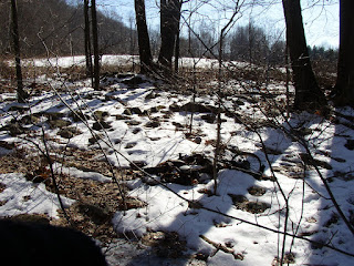 Some turtles on a row...


 The swamp that became Lost Lake must've been dammed when I was a baby, maybe - this recent map above shows it as a body of water.
 This is not the actual row below, but there are many up there that look just like this pattern.
 Eric Sloane in Our Disappearing Landscape offered this explaination, echoed by many other writers:

 In another place, at a right angle and to the west of a very long zigzag row, an immense linear wall meets up with another zigzag row, blocked sort of by the big fallen tree:


