Down on Main Street South in Woodbury Town, there is a sign by a piece of sidewalk, alongside some glacial remains still visible on the landscape, if you know how to look at what you are looking at.
In the center of the photo from bing is an ancient glacial kettle and moraine that over the years has become surrounded by development - like the empty building on Main Street just north of Sherman Hill Road. That water-feature is a kettle and that bridge over it is about where the sign is.
Go north on Route 6 and you'll pass by my cousin's house where what is known as "Pomperaug's Grave" is thought to be located.
Woodbury Historian William Cothren included this woodcut in an illustrated volume in the later 1800's:

"The present street, from the North Meeting-House in Woodbury to the Southbury Meeting-House, was laid out nearly upon the old Indian trail leading from the Nonnewaug wigwams to Pootatuck village, passing the grave of Pomperaug by the rock, near the carriage house of N. B. Smith, Esq. It was a custom of the Indians to have their trails pass the graves of their buried chieftains, and as each warrior passed the grave in his various expeditions, he dropped a pebble stone upon it in honor of his memory. A large pile of these pebbles had accumulated upon this consecrated spot previous to the settlement of the town, which remains till the present time...There was another village of the tribe in Nonnewaug, and a trail led from that village to Pootatuck village, by this grave, nearly on the line of the present street, as has been before stated. This trail had existed some twenty-five years before the settlement of Woodbury. In accordance with an Indian custom, each member of the tribe', as he passed that way, dropped a small stone upon the grave, in token of his respect for the fame of the departed. At the first settlement of the town, a large heap of stones had accumulated in this way, and a large quantity remain to this day. It is related that a brother of Pomperaug, who was a medicine-man, or Powwow, was also buried at first in this place, near his brother; but was afterward disinterred, and buried in the Pootatuck burying-ground...And Nonnewaug, too, at the appointed time, slept with his fathers, and the small remnant of his people buried him in the beautiful plain at the foot of the musical falls that are called by his name, where his fathers' people had been buried before him, true to their instinct of selecting the most beautiful places by the riverside, by the silvery cascade, or in the verdant plain. An appletree was planted at the head of his grave, which still stands there, the faithful guardian of the ashes that repose beneath its grateful shade. It is a venerable tree, some 150 years old, but docs not bear the marks of so great an age, though there are several decayed places in it, so perfectly shown in the accompanying cut of the grave and tree, taken by the artist on the spot during the last summer. When the writer first visited it, twenty years ago, there was a large hillock, .or mound, raised over the grave, ' which remained, distinguishing the sachem's, by its size, from the other graves around him, till a few years ago, when the present owner of the field committed the sacrilege of plowing it down, saying he was not going to have such an old "hummock in his field," much to the regret of every true antiquarian, and lover of ancient things. The mound thus destroyed was some ten feet long, six feet wide, and four feet high, having been gradually formed, in the same way, as in the case of Pomperaug's grave..."

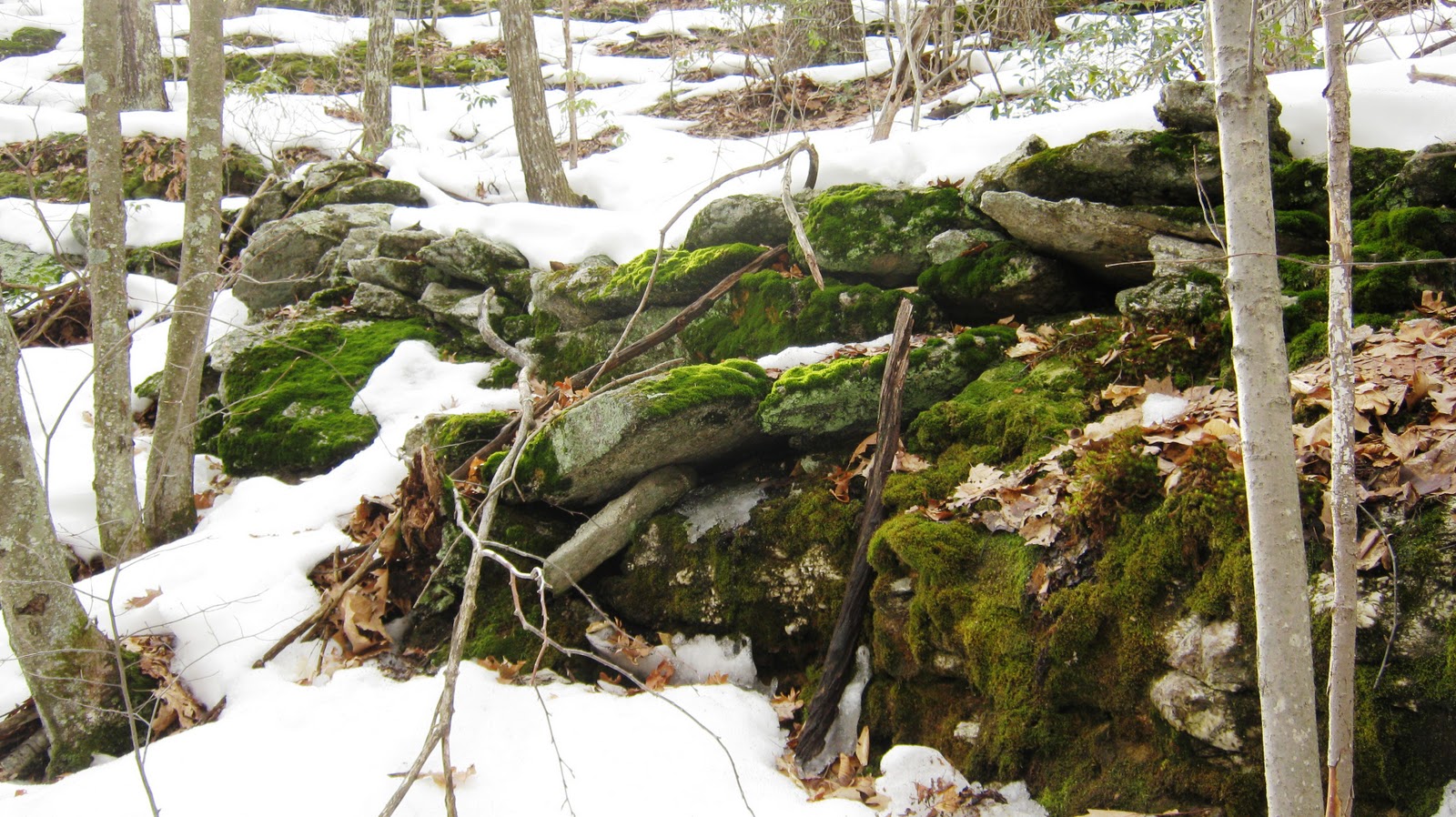
Those stones are all long gone now and most of the stone rows I suspect that lined the Indian Trail, separating it from other "zones" that Native People maintained by burning, kept from spreading out of control by these stone "fire breaks," also known a s "fuel breaks."
This idea comes from 19 years of observation at the Nonnewaug Wigwams section of the trail, puzzling first about the conventional wisdom that states that the stone rows or fences grew up alongside colonial roads, when they were removed from either the road itself or from the fields along the road, all in the last 350 years.
Up by the Nonnewaug Floodplain, I think a different truth is revealed as I refer to an early aerial photo from a survey of 1934 and then examine the stone rows that still remain for "cultural signs" of the Indian cultures that lived here for 10 or 20 thousand years. Those old trails have been modified from the times of the Grand Old Army of George Washington, but here and there the old trails and stone rows exist still. The link to this photo is:
http://cslib.cdmhost.com/cdm4/item_viewer.php?CISOROOT=/p4005coll10&CISOPTR=6508&CISOBOX=1&REC=1
Choosing the junction of Nonnewaug Road and Bethlehem Road, and zooming in on the spot to 100% magnification, I can find a stone row I'm very familiar with, having lived there for about 30 years:
The "trail" to the left is Bethlehem Road, now CT Route 61, and if you follow it long enough you will find yourself at Bantam Lake, an important place to Indigenous People for all the obvious reasons. The other trail that became a road is Nonnewaug Road.
 St. Patrick is said to be buried at Down Cathedral in Downpatrick, County Down, alongside St. Brigid and St. Columba, although this has never been proven. The Battle for the Body of St. Patrick demonstrates the importance of both him as a spiritual leader, and of his body as an object of veneration, in early Christian Ireland. Saint Patrick Visitor Centre is a modern exhibition complex located in Downpatrick and is a permanent interpretative exhibition centre featuring interactive displays on the life and story of Saint Patrick. It provides the only permanent exhibition centre in the world devoted to Saint Patrick.