
(Peter
was talking about it here: “Game on!” {http://rockpiles.blogspot.com/2014/02/woodbrige-ctgame-on.html}
and circumstance brought me by the preserve on Thursday (4/17/14), with some
time to stop and look around - and I had posted a couple photos of screen shots
here: http://rockpiles.blogspot.com/2014/03/waiting-on-woodbridge.html).

PDF Map,
showing the “stone wall” pictured above –and by the roadside below: http://woodbridgect.org/filestorage/8419/111/Bladens_Brook%2C_Russell_Swamp_%26_Round_Hill_Trails_-_color.pdf
And this
seems a handy place to hang this up: http://woodbridgelandtrust.org/WLT/our-properties/trail-maps/
I never
really got too far out of the Woodbridge part of the preserve that borders on
what really amounts to some easements between houses (as does the Naugatuck
Trail) in Bethany, spotted only one rather large Rock Pile and just one other
smaller one which was a little bit of a surprise, knowing that on the next hill
south, Peck Hill, you can’t swing a cat without hitting a Stone Pile - and it
doesn’t have to be a cat with a particularly long tail.
It was
the remnants of the mostly linear rows of artistically stacked rows of stones,
cobbles and boulders, most likely Indigenous in origin, that turned out to be
the most interesting features.
Here’s a couple bing map links that will show you
better some of the “stone walls” I encountered: http://binged.it/RrvorC, http://binged.it/Rtzbog and http://binged.it/RtyN9b.
And I know you are thinking, “Generally when I see walls meeting at right angles I
think colonial farmers,” but up on top of that steep southern slope of a hill
that’s just a little south and east of Skokorat or "Snake Hill," what
you see with boots on the ground might make you want to reconsider…
In fact,
I suspect a little linear remnant of stones along Sanford Road, under the word bridge on the map above, to be of Native
Origin:


This segment was made using a lot of interesting artistic stacking techniques, sometimes perhaps to resemble animal heads. It is not your typical tossed
stones or laid up “two on one” sort of imitation brick work that I think of as
the Yankee style of stone fence making:

Maybe there was some human enhancement or 'sculpting" of this one in the past, softened and less easy to see under all lichen
and weathering?

And
since we’ve got our boots on the ground of Turtle Island, does this remind you
of a certain animal that figures highly in Native American Culture?


There’s
a purple tint to that big chunk of quartz in this lacy segment:

The
other side:


The
construction mode changes further down the road, near the brook, with a bit of
European flavor to it. I'm guessing it was rebuilt and used some dressed, quarried stones along with the reused Native Stones. This is the other marked roadside segment marked on the map:


But
there on the other side of the road, some zigzag stonework shows still, and as
always I wonder which came first, the stones or the wooden rails… (27-28)(212)


And
up above, a row of stones finally shows, by a spring or “break out zone,” if
I’m using Peter’s term properly. Is there a sort of structure to it? Maybe…

Maybe…

Anyway, it gets more interesting in here, around that "T" shown on the trail map, incompletely shown.

2023 Edit:
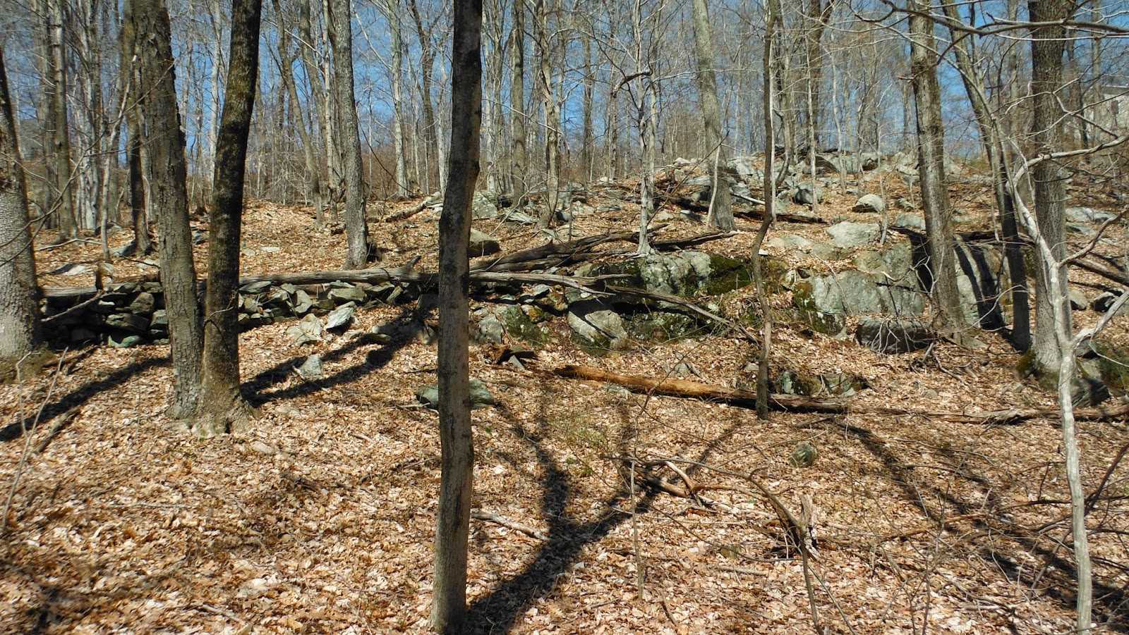
See the row of stones behind the row of stones in the foreground above?
Here it is closer:
and here's the overlay I missed back then:

These stacked rows of stones extend up and into - get incorporated into the outcrops above - and also "run over" another below:


…and
stones like these are stacked upon the row:


No comments:
Post a Comment