At the "other end," so to speak, farthest from the "village," is the Mast Forest, full of all sorts of resources. There are many series of stone rows that perhaps function as firebreaks for those "at least 70 reasons" that Lewis (and everybody else) hints at that I wrote about in my Thursday, June 08, 2006 post (that I didn't really give a title to I see).
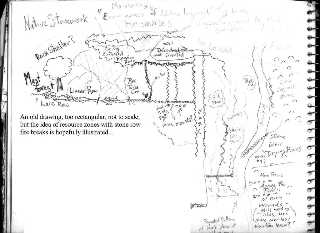
Here's an old drawing that looks better when you click on it:
And here's a series of maps that show the same place:
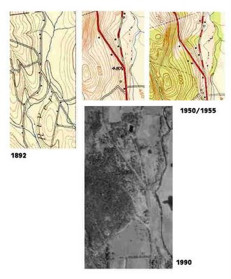 The 1892 map shows an old road that went from the first mill in the area, up into an oak and chestnut forest. The 1955 map shows it as a trail.
 The 1892 map shows the spring on the east side of what looks like a good rockshelter; it's the one shown in the upper part of the drawing that has a zigzag stone border around it. Pieces of it still exist, but it was diverted at one time.
I do have some decent photos of the sections of stone rows that meet near the "Key" I wrote about, the Box Turtle or "Turtle One" in the drawing.
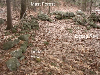
Looking south, the zigzag row is to the left (where the state highway is now), the linear row behind it:
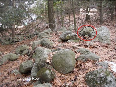
Remnants of the linear row on the downside of the highway are actually in my yard, disturbed when my house was built around 1700, when the Indian village was still occupied...
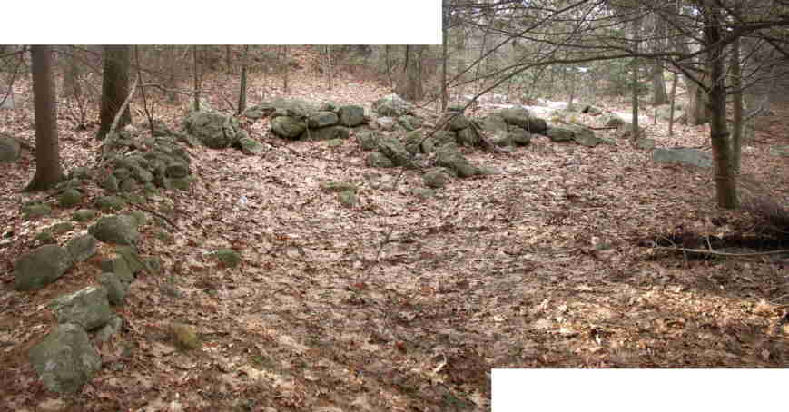
Here's looking west, up hill toward the Mast Forest:
Hi Tim -- Great work here. I tried e-mailing you at the address given on the NEARA website, but that doesn't work anymore. If you wouldn't mind please send me an e-mail at jimporter@NOSPAMmenotomyjournal.com
ReplyDeleteObviously, remove the NOSPAM before sending.
Jim
ReplyDeleteI would send you an email but it's chopped off of the screen.
timmacs@yahoo.com is my working email
Tim