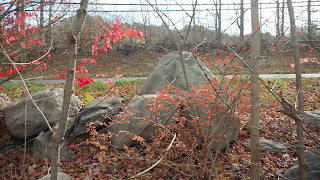
Above: looking East at a section of road still "bounded" by rows of stacked stones.
Below: looking west at ("Where the Bowling Alley Used to Be" on) CT Rte. 6 or The Old Connecticut Path, a major Indian Trail in the Contact Period, a trail originally made by mastodon and other Ice Age mammals further back in time, from the other side of a type of Manitou Stone...
Above: a sign nearby along Main Street/CT Rte. 6
Below: Terrace at low side (west) of the road:
Back across to the higher side, in some places a terrace/retaining wall, a free standing structure elsewhere, a wall of unknown age, full of probable Indigenous Iconography.
Above: Snake-like boulder.
Below: Rhomboidal or Healing Diamond (Mohegan)...
I suggest that this is a long maintained stone structure. I suggest the road was an Indian Trail, burned over every spring and fall. I suggest the stones functioned as a fuel break. I suggest the "pinning stones" are not typical European style additions but are more "effigy-like" than purely functional.
The spot is located under the Late Woodland Village known as Pomperaug, misspelled on this map:
The second photo I took that day:
The second look I took yesterday:
Another Stone Serpent Waking Up on Turtle Island:


No comments:
Post a Comment