In the Screen Capture above, there's what might be a Serpent Stone Row at the left, by where the road and state highway meet. At the lower center, is the stone fish weir that gives this area of land - and the road and everything else - it's Native American Place Name.
The photo below was used in a letter, where I wrote about: "A Wall of No Great Importance."
"I attended a town meeting on July 7, 2005 regarding the realignment of Nonnewaug Road in Woodbury CT. Part of the proposed work involves the removal of a portion of a “stone wall.” A letter from the CT State Historic Preservation Office was read that stated that the wall is considered to be of no great importance, but I strongly disagree with that. The possibility exists that this row of stones may not be of Colonial or Historic origin but could rather be prehistoric in origin, built by Native Americans as part of a land management scheme that depicts a higher degree of civilization than is accepted by most archaeologists and anthropologists.
There are actually two adjoining stone rows in question. One is a linear row that joins a zigzag stone row, a row atypical of the incidental construction of zigzag row that results from stones being thrown up against a wooden “snake fence” that has long since deteriorated, as in described in books about stone walls by Eric Sloane and others.
Another straight-line row connects to this zigzag row along the road, the first terrace above the floodplain, the shores of a glacial lake…"

Earlier this year, I posted something called: End Stones and also: More End Stones. Possibly I was going to continue some more about them because I found a folder labelled "End Stone" in 'my pictures,' yet another called 'endstone02.'
Imagine my surprise; I'd forgotten all about them.
I was going to start doing that all over again, only to find I'd already done so.
So please excuse me, "show and telling" the same old story, especially since I ranted and raved about its (partial) destruction ( A Wall of No Great Importance , July 2005, Linear row views, The Road Realignment, Wishing and Wondering, and probably more), but here and now I'm begining to think that this row that might just be a serpent row, once connected to zigzag rows, parts of which are buried or bulldozed away today. The end that connects to an ancient glacial lakeshore still remains down at the 100 year floodplain limit...


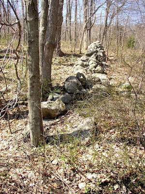
 Above and Below: Looking north along the ancient lakeshore...


Bing maps still show how the road looked before the re-alignment:
 (my address included in case you want to send me a Christmas Card or locate the spot yourself)
In this 1934 aerial photo, the zigzags show well...
 This drawing perhaps puts into focus the above aerial photos:
You also get to see the locations of some other stuff I wrote about, like the turtles in the chicken yard and the big box turtle by the stone row borders of the mast forest circa 1700...


