The Pines in 1965.
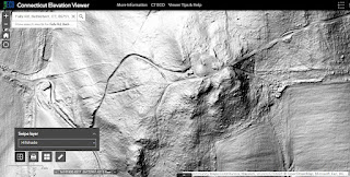
Both the northern and southern stone rows are visible as dark lines.
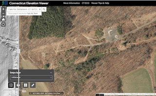
A bedrock outcrop to the southeast of the pines is visible as a bright light colored spot.
Below is aerial photography from 1934, with north at the top:
"Last LiDar" added on 11/07/2022:
The Improved Outcrop
see also:
Another set of power lines was added in the 1970's, but here are a few photos just out of range of that construction's disruption of the landscape, presented as if you were walking up hill toward the power lines and the outcrop, in a northeasterly direction...
Looking South West:
Looking north west more or less:
A Split Boulder Once Part of the Bedrock sits on bedrock at the bulldozer edge of the powerlines:
Head stone, 3 marginal scutes, and a larger scute between two huge legs???


No comments:
Post a Comment