I haven't been walking much in the last couple years, but in the last few weeks I've finally felt well enough to walk just a little too much, hunting for Easter Egg Hunt posters with my wife Roberta and my granddaughter Clover. The last four posters just happened to be at the town park closest to home.
If you have followed this blog, you have seen many photos from this place that became a town park, a place I have wandered about in for, I just realized, fifty years. Often referred to as a place where Native Americans were known to "camp," it is actually the site of a Late Woodland/Contact Period Village known to be occupied by Indigenous People from the town's founding as the Pomperaug Plantation in 1673, up to about 1740 when settler colonists began dividing the land into private properties, fencing in "homelotts" with wooden rail fences, often on top of existing "stone walls" of many sizes, types and shapes to establish legal ownership.
Over those fifty years, I've seen many "stone fences" and other stone constructions disappear after intense thunder storms that caused flooding - including stone work that zigzagged along the river and tributary brooks, but nothing as intense and destructive as the most recent activity by the electric power company in the last few years, in a place noted to be "Archaeologically Sensitive."
Have there been an Archaeological investigations into the path of this powerline path?
I can answer that very quickly: "I don't know."
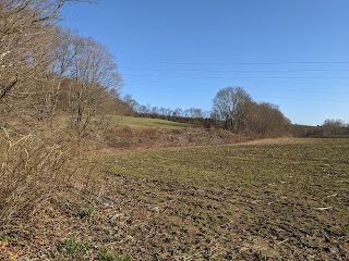
Here's the latest photos of the most recent of "changes," brush clearing under the powerlines that has recently occurred, sometime between my last visit and yesterday. Once the remnants of a Serpent or Great Snake Effigy's bifurcated tail, in "pretty good condition," I'll have to return when I'm feeling up to it and see just how badly this effigy of undetermined age has been disturbed...
(Powerlines:) https://wakinguponturtleisland.blogspot.com/search?q=powerlines


No comments:
Post a Comment