Saturday, October 31, 2015

Second Look at Stones on a Boulder

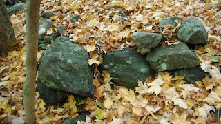
     As I returned to the spot and took a second look, I was surprised how close the boulders are to the Fish Camp Trail, a couple hundred feet perhaps. The stone row in the photo above is perpendicular to the Path and to the line of outcrop ridges that border the White Deer Rocks Woods, stones at the bases and “decorated” up to and including the ridge tops as well.

     Closer:
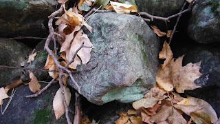
      Taking a second look, I wondered, “Is it a split boulder?” It’s filled with stones at the “split end.” There’s another small circle of stones, possibly a hearth, and then the possible Quartz Quarry Boulder too, off the path so that the debitage doesn't cut the children's feet, but close enough to those stone  boundaries of interestingly made rows of stones, the trail to the east or the gateway into those White Deer Rocks Woods...  
      So, thinking about the White Deer and the White Projectile Points made of White Quartz, Ceremony and Tobacco Sacrifice before a hunt and all, I should have been looking for a “Deer Head Stone,” right?
   Well actually, I only thought of it afterwards as I downloaded the images from the camera. My attention at the time was captured by the “scooped out” sort of depression on a certain stone, “scooped out” being a phrase that comes to me from the Yurok and neighboring Indigenous Peoples when talking about someone making a variety of different mortar boulders or “medicine baskets.”
(I should have been reminded of the Deer Stones that I pasted below this image above, the second from the left located on an outcrop along White Deer Rocks Road http://wakinguponturtleisland.blogspot.com/2013/12/rhombus-stone-on-white-deer-rocks-road.html )
    The first “Stones on a Boulder” feature that I ever felt reasonably certain was an Indigenous Ceremonial Stone Feature was a Bear’s Head and an associated Fire Starting Base Stone, both with a feature maybe natural, maybe purposefully modified to accommodate a shell full of tobacco or “Kinnikinnick.” - http://www.naranorthwest.org/trad.%20tobacco%20FINAL.pdf


     So, I just happened to have a clam shell in my pocket:
 
It fit nicely in the depression when turned like this. Perhaps some tinder was placed above it, intended to be brushed into the shell, perhaps just roll down into it…
(Above: Small pecked eyes of a deer?)
Interesting stone nestled into the split beside the possible deer head stone:

Bird-like, perhaps? 
Another interesting stone above it:
 And then there's this:
And this:

Friday, October 30, 2015

Two Species Specific Stateline Turtles (CT)

    When looking for these possible Stone Features of the Indigenous Ceremonial Stone Landscape of Turtle Island, I at least imagine that it always helps support my case when I find a possible “effigy” feature that greatly resembles a “species specific” representation of a culturally significant animal especially if it is near a culturally important place.
     And living somewhere that was called Turtle Island for much longer than it was called any other name, if that animal is a turtle I would imagine that helps build the case a little more
     And the only thing better than one turtle is two different species specific turtles not too far from each other (and good images of the actual kind of turtle who was kind enough to pose in in a kind of similar position that I can steal an image of from a Google image search).
     Yesterday I had found two images online (while looking for images of New England stone walls that resemble petroform snakes found in other parts of the world) that I immediately recognized as very realistic representations of a snapping turtle head (above) and a box turtle head (below), both most likely associated with a boulder large enough to inspire a rock climbing enthusiast to include on a website and presumably climb around on.

   So this morning I had to navigate around and find those images again, find out just where these two very "anatomically correct" in their very skillful artistic representation testudinate boulders might be.    Imagine my surprise when I read the description and directions below.
   I guess the next step is to find out if there are any Indigenous connections to this “Schaghticoke Road” in Kent CT.
   If you know of any, please let me know...


From the CT Bouldering Page:
 "Description: This area is amazing. Large boulders litter the mountain side... The rock is either a nice schist or a conglomerate/dolomite and is of fairly good quality. Most of the boulders are located directly off an old logging road that intersects the AT, however some of the gems require some serious hiking/bushwhacking. This area is mind blowing, and would make a great stop on the way to the Gunks, as its only 40 miles away by car. There is simply too much rock out here for one person to get a handle on, so come on out here and put up some problems!
Things left to be desired... long drive, not too many easy problems, boulders could be a bit bigger, but as of now I hardly know whats out there. Sorry for the lame photos, and vague directions, this area and page is a work in progress, and as I only found these boulders on mothersday, I have a lot of work to do.
Getting There: The trailhead is the AT trailhead on Schaghticoke Rd near Bulls Bridge in Kent, CT. Head up the AT north and up the mountain. After you cross the creek and pass a couple head high boulders on your left (4 minutes in), there is a small cairn. Here you can go off trail north towards the anvil boulder which leads you to the logging road which uncovers the majority of boulders in this area. If you choose to stay on the AT, at about 7 minutes the trail takes you through the twin boulders, which are large, slabby and featured.
To get to the Trapps area, this is where you leave the trail behind. From the uphill side of the twin boulders, at the other small cairn, head southwest along the side hill cross country for about 20 minutes, you can vaguely follow a game trail most the way, crossing a large slab/cliffband/headwall. You will find amazing roofs and overhangs in this area.
Third option, If you stay on the AT instead... a few minutes further up the hill brings you to the tooth, a highball boulder with at least 3 super classic lines on it, all unsent. There are no good boulders further up the trail from this boulder that I have found so far..."


Tuesday, October 27, 2015

A Stone Zig Zag

(Added 01/12/2023)

 
A Zig Zag Stone Fence or (Inter-writhing? Intertwined?) Snakes? 

Originally a remnant of Post Contact Wooden Rail Fences 
as illustrated by Eric Sloane... 
or is it Indigenous Stone Great Serpents?

Haphazard Field Clearing or an Intentional Prayer for Renewal (and Resource Protection) on a Fire Ceremonially Maintained Indigenous Sacred Landscape?


I have to argue with an old hero, Eric Sloane:


Monday, October 26, 2015

Serpents at the Edge of White Deer Rocks

(Is it "Twined Serpents" or "Inter-twined Serpents?")
(Above and below: Possible "Under Water Panther"
- one with inset from another elsewhere.) 


(There are turtles incorporated into the serpents too;)

Thursday, October 22, 2015

Bing and all ("America’s Stonehenge" NH)

(Formerly Mystery Hill, NH)
Plug the fanciful name into Google Earth and see what you get:
Lines of sight cut into the present day wounded forest.
(And please note I'm fooling with the various views you can get but messing with the buttons indicated by the red arrows:)
Look at all those nice rows of stones. Check out the various views: http://binged.it/1RoEaPE
In fact, someone has made a scale model:
    The scale model makes me wonder what it looked like, back before all the owners started messing around with it, re-building what was there way back before 1620 and especially before 1492, way back to the Late Archaic Period when Indigenous People were "hunting and gathering" - or actively shaping and maintaining a Cultural Landscape by using fire, depending on what source you might be reading. 
      So I’m looking for a close up of those stone rows, but everybody is more concerned about Phoenicians and Celts, sacrificial stones and moonshine...
     The Hiking Meditators have this one, but I'm looking for some untouched segments:

      Durned if I don’t find a few here:


    "The Folklore of Alternative Archaeology" (presented to the Archaeological Society of Connecticut, October 13, 2012) by Dr. Wade Tarzia, Associate Professor, Naugatuck Valley Community College
     I found them among the arguments against the “folklore” alternatives (excepting of course the “Yankee Farmer Folklore” that New England’s Stone Wall Myths are based on) that ignored completely the possibility that Indigenous People might have built anything larger than a hearth out of stone. I had to dig into some other website and excavate some documents to find out why.
   I’ll save you the trouble and slap these quotes up:
The Aboriginal School -- A small but growing group of people rejects the diffusionist theories and favors the idea that Native Americans built Mystery Hill (MH – the former name of the tourist attraction). There certainly is some precedent for such behavior, since Indian sites in the south west include some that are astronomically aligned (Cornell: 1981:168).  The school must assume that the site was constructed after 1200 BC, when cultivated plants are introduced into New England (Dincauze: 1974:53) -- that is, when at least partial sedentism and the rise of tribal life (thus increased opportunity for corporate architectural projects) may begin to occur..."
  {Corporate? Does he mean cooperative? As in “The cooperative effort to build the stone fish weir or the clam garden?" or "The cooperative effort to build the stone hunting drive?" Maybe…}
     "Band Society (pre-1000 A.D. Indians in New England): Bands of hunter-gatherer consist of small groups of 10 to 25 individuals who usually stay no longer than a week at any base camp before local depletion of edible wild plants and animals forces them to move to new territories -- they grow little or no food and are not able to remain sedentary for the long periods required for architectural pursuits. In addition, the low population density of band society generates lower levels of social stress relative to more complex societies, with the result that hunter-gatherers need fewer, less complex rituals of stress reduction. That is, ritual architecture may not have been requirements for such people.”
      In addition, the low population density of band society generates lower levels of social stress relative to more complex societies, with the result that hunter-gatherers need fewer, less complex rituals of stress reduction.  That is, ritual architecture may not have been requirements for such people. 
                The high degree of nomadism inherent in hunter gatherer life would not allow them to remain in any one location long enough for extended architectural endeavors.  And if we acknowledge the recent work of archaeologists like Renfrew (1984, 1984b), which suggests that megalithic monuments functioned to support land-holding groups, then we must reject a hunter gatherer basis for MH once again -- for hunter gatherers are little concerned with land rights or ownership.
                If we are to believe the oldest held date for MH, then Indians would not have built the site.  Once Indian populations grew large enough for them to require sedentism and agriculture -- and evolve into a tribal social-system -- the date is around 1000 AD.  If AmerIndians built MH, it must have origins after this date; yet, this goes against the popularly acknowledged dates of the site..." From: http://www.wtarzia.com/files/Mystery_Hill_ms.rtf

   Well, I'm just going to back up to that first photo of Dr. Wade's. I don't know where it is on that scale model of the site that reminds me so much of the rows of stones I see around me, not too far from Naugatuck Valley Community College - or in what was once known as the Old Deer Park that borders the College property. I think I see some suggestion of a possible petroform (or geoglyph) that is distinguished by a triangular shape that makes me think of a snake (and I'll overlay a couple Serpentine details):
2018 Update Overlay:


What might a "real archaeologist" say about this?
What might an "open minded real archaeologist" say about this?
Take a look here: 
Follow the links found here: 
I think I illustrate a few good examples of what might interest a "real archaeologist" of some possible places to conduct a test or two in order to test a theory that not every one of the quarter million miles of stone fences or walls are what we've been taught they are:


      And I don't mean to leave out Mary and James Gage! They have actually been there, unlike myself, and have written quite a bit about the place. There's many a photograph here:  http://www.mysteryhillnh.info/index.html and much more about their research and theories into Stone Structures here: http://www.stonestructures.org/
      They even dug up this old map - wouldn't it be interesting to look at the "gateways" that appear to have some boulders incorporated into them?