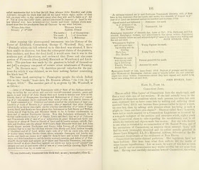
"The Pootatucks, a small tribe at Woodbury excepted,
no Indians lived permanently in any part of
what is now Litchfield county..."
Cultural Landscape Reading Glasses
Sometimes you have
to put on your Cultural Landscape Reading Glasses when reading those old
histories. My friend Bob DeFosses mentioned that he was reading a hard copy
reprint of an old one about the town he lives in as well as letting me know it
was available on-line. A convenient blizzard showed up and I started reading it
a little bit at a time, clipping some pieces of it in a page view format,
copying it in the rather rough plain text format that required me to do some
serious “clawing it back into a civilized language,” as Mark Twain once said of
the translation process (I’m sort of paraphrasing, I guess).
Early on in the
history, published in 1860, the idea is presented that Connecticut lands were
neither inherited nor stolen but properly acquired by purchase, sometimes even repeated
purchases, from Indigenous People, all fair and square. Many people suggest
that these land deeds show these seeming real estate transactions while others
contend that Indigenous People were actually continuing a tradition of what we
call Treaties – an agreement to live in certain Indigenous Homelands and share the
resources found there. Cronon in Changes in the Land writes about this and is a
good source to help understand the two concepts of “ownership” in early New
England.
Speaking of early, I
was surprised to find how early Harwinton was “settled” by people of English descent (as opposed to what Indigenous Peoples had been doing there for thousands of years):
“In 1657, some of
the Farmington settlers procured of the same Tunxis tribe coparcenary rights
and title to Mattatuc (Mattatuck was an Indian Town or Village, the “seat” of
which was located in present day Waterbury CT). In 1714 (, or 1718), the heirs
of those grantees received from the successors of those grantors a confirmatory
deed, conveying the absolute rights and title to those grantees. Within that
tract, as by the known locality of "ye hill" (most likely “Toby’s
Hill” or Mount Tobe – sometimes Montoe which is a form of Manitou, may even
translate to “Manitou’s Hill or Mountain”) appears, is included Litchfield,
partly- Harwinton, wholly. If the Pootatuck Indians had ever any claim" or
ownership in this territory, they had parted with such; since, as is stated,*
"the names of their chiefs are appended to deeds of sale [of lands]
extending from Pequonnuck in Bridgeport, on the south, to Goshen and
Torrington, on the north." It appears from this recital, that whatever
rights the Indians had to this part of Connecticut soil they conveyed away by many
repeated sales. Their (Indigenous Peoples who lived along the Housatonic - the
Pootatuck, Pequonnock and Paugusset) rights to it, it should also be said, seem
to have been only such as attach to a mere hunting ground. The Pootatucks, a
small tribe at Woodbury excepted, no Indians lived permanently in any part of
what is now Litchfield county, until towards the middle part of the seventeenth
century then, or at about that period, various clans had emigrated into its
northwestern portion (Schaghticoke). Previously to that time, Indians were here
as occasional sojourners, not as stated residents (page 99).”

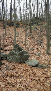
Here’s that part
again, important to me and my understanding of the Ceremonial Stone Landscape
that is visible evidence of that Indigenous Cultural Landscape that I see
around me rather than remnants of a mythical Golden Age of Stonewall Building
or linear piles of stones that are refuse from field clearing as various works
about New England Stone Walls assert:
“Their (Indigenous
Peoples who lived along the Housatonic – known by the names of contact era
placename settlements such as the Pootatuck, Pequonnock and Paugusset) rights
to it, it should also be said, seem to have been only such as attach to a mere
hunting ground. The Pootatucks, a small tribe at Woodbury excepted, no Indians
lived permanently in any part of what is now Litchfield county, until towards
the middle part of the seventeenth century (still page 99).”
Wearing my Cultural
Landscape reading glasses, I see the area that became the town of Harwinton as
a place between two homelands of Indigenous People – or the survivors of the
two groups that were devastated by Virgin Soil Epidemics, an estimated 10% of a
much larger population previous to the introduction of European diseases.
Claiming that “nobody lived there” is reminiscent of the Puritan concept of
Vacant Lands (Lands cleared by God’s Will) that Roger Williams argued against.
“The natives are very exact and punctual in the bounds of
their lands, belonging to this or that prince or people, even to a river,
brook, &c.” -Roger Williams, in his Key (CHAP. XVI. Of the Earth and
the Fruits thereof).
Williams defended
Indian Land Rights in a further exchange with Puritan leaders by saying, “they
hunted all the Countrey over, and for the expedition of their hunting voyages
they burnt up all the underwoods in the Countrey, once or twice a year, and
therefore as Noble men in England possessed great Parks, and the King, great
Forrests in England onely for their game, and no man might lawfully invade
their Propriety: So might the Natives challenge the like Propriety of the
Countrey here.”
The Puritans replied: “We did not conceive that it is a just
Title to so vast a Continent, to make no other improvement of millions of Acres
in it, but onely to burne it up for pastime,” as if survival was a kind of
recreation.
To state that it
was a “mere hunting ground” is really just a repeat of Mather’s words.
It’s also just as misleading
as to state that Indigenous burning of the landscape was a pastime. Indigenous
burning helped create and maintain the Cultural Landscape all over the western
hemisphere, as is well presented in Charles C. Mann’s books 1941 and 1493. That
“mere hunting ground” is perhaps better described as a vast sustainable garden,
ecotones of resources which human hands and minds actually increased in
productivity rather than depleting them.
And since that
link touches on fences, the “improvement” that established proper ownership of
land, again a Puritan invention turned into law, I found the recording of a
town meeting interesting since it mentions fence
viewers who would enforce
these laws and determine who was properly improving and thereby owning these
fenced in lands.
Att a Meeting of the inhabitants of the town of Harwiton,
December the 20, 1737
Voted that Ebnezer Hopkins and Antony Hopkin Be Surveyors of
High ways for this Town
Voted that Jonathan Brace and Thomas Bull be fence viewers
for this town for the year Ensuing
Voted that Samuel Barber and John Wilson Be fence viewers
for this town for the year Ensuing
Voted that Isral Marremoun be brander of horses and of hors
Kind* for the town of Harwinton for the year Ensuing
*There were, at that time, few enclosures. Horses ran at
large. Hence branding was necessary that stray animals might be reclaimed and
identified. The new settlements had each its own mark prescribed by the General
Court. (page 116)

Taking off the
Cultural Landscape Reading Glasses, back here on the Nonnewaug floodplain, I
think back to the early 1990’s when I first got started questioning and
searching for answers to this “stonewall business.” Gradually, after years of
observation as well as comparison to observations and documentation by both
avocational independent researchers and credentialed professionals, in other places,
I came to a sort of hypothesis, especially after reading Changes in the Land (in
which the idea of Indigenous stonework is a post contact phenomenon) and later
Manitou by James Mavor and Byron Dix (which questions that Post Contact/European
hypothesis), that certain qualities of these rows of stones seemed to make more
sense as fuel breaks that suggested a control method for Indigenous burning,
separating while yet connecting wetland resource zones from the floodplain
fields and extending into other upland zones of many kinds, riparian zones
bounded by zigzag rows of stones with brooklets and larger streams flowing
inside them.

“Bounded,” I just
wrote, recalling “bounds” is the way Roger Williams said it way back when, an
older English expression that is modernized (really just a little) into “boundary.”
Or so is Mr. Dictionary.com’s belief, calling bounds a noun, meaning
a limit or boundary (as in “the bounds of space and time,” “within the bounds
of his estate,” or even “within the bounds of reason.” It also means “something
that limits, confines, or restrains” or “territories on or near a boundary” as
well as “land within boundary lines.” {
http://www.dictionary.com/browse/bound}
But, if Williams
did see stone rows as the “bounds” of hunting grounds, or the resource zones of
all the “fruits” he lists in his “Key,” as the fuelbreaks used by Indians as
they safely and selectively burned their cultural landscape, he never wrote it
down in so many words.
Shortly after
this argument about ownership, however, early Fence Laws suddenly sprung up in the lands
appropriated by the Puritans– as did those early wooden fences, so easily and
quickly built, in fashion said to have possibly originated with Native American hunting fences and in one case around their cornfields, as
Claude C. Coffin wrote in a 1947 CT Archeological Society Bulletin article about
wooden and stone fish weirs along the Housatonic River.

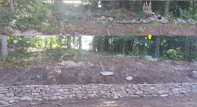
What could have
been easier that to add the rails over Indian fire breaks and claim the “voyd
places of the Countrey by the Law of Nature, (for Vacuum Domicilium cedit
occupanti:),” and claim the land for your very own? Indigenous made stonework,
already existing, that was turned into "proper" fences by adding the
"cross and rails" pictured above in an illustration by Eric Sloane in
Our Vanishing Landscape (page 30 - 1955). It’s the Native American (or Indigenous)
Iconography in those rows of stone that I continue to be surprised about and am
gratified to find is being recognized and talked about by the Most Likely Descendants
of Indigenous Peoples as they struggle to protect these features of the
Ceremonial Stone Landscape that is an element of the Anthropogenic Cultural
Landscape
There’s a section
later in in Chipman’s History, entitled “Indians in Harwinton” that again
suggests Indigenous People were merely hunting, camping once in a while (the
Town of Woodbury, when Nonnewaug Falls is mentioned in their yearly guide, at
one point did state that the “Indians camped nearby” – but that problem has
been resolved by leaving out any mention of Indians at all in town – other than calling
the sports teams at the local High School after the “Chief” as the Sachem of
the Nonnewaug Wigwams is most popularly known).
“As mentioned
previously (, in Note C, page 99), "the Western lands," what is now
Litchfield county, appear, at the time when the English first made settlement
in Connecticut, to have been owned and occupied by Indians as simply a
territory for hunting and occasional residence. As also there appears, the
Indians, to whom such ownership and occupancy of these lands pertained, were
mainly or wholly of the tribe which was at Farmington, that is, the Tunxis.”
I’m not entirely sure
that that statement is 100% true. I’d have to put the Cultural Landscape
Reading Glasses back on and look at the watersheds of Naugatuck, a tributary of
the Housatonic River, and Farmington Rivers. I strongly suspect the area was a
shared sort of zone, as in other places are known to be when viewed in a modern
day understanding of Cultural Landscape. I strongly suspect a friendly
agreement may have existed between the Housatonic/Naugatuck River People and those
that lived along the Farmington River Homeland – perhaps even the Connecticut
River since the Sachem (of?) Sequassen (also known as Sowheage, Sequin,
Sowheag) is mentioned in the “history of deeds,” Chipman also implying that “The
Windsor, Ct., Indians" seem to have gradually removed [first] to
Farmington, [then to] Salisbury and Sharon [, in Ct.], where in 1730 they
became united with the remnants of the Simsbury-, Farmington, Wethersfield and
other Connecticut River tribes; and finally, in 1763, [these all] were removed
to Stockbridge, Ms (Massachusetts). About the year 1786, by invitation of the Oneidas they
moved to Stockbridge, N. Y. Here, on a tract three miles long by two miles in
breadth, granted to them by the hospitable Oneidas, they, together with a
number from the Mohegan and other tribes of Connecticut, formed a tribe called
the Brothertons,” a whole other story, perhaps best described as a sort of
Connecticut version of (a/the) “Trail of Tears.”
Chipman’s History:
"
Eastern North America was not a “howling wilderness” as described by the early English settlers. It was a built landscape, managed by the first settlers of the land, its Indigenous peoples. Indigenous communities have long, rich histories that extend back to when they shared Mother Earth with mastodons and other extinct animals. Through those thousands of years, Native Americans became experts in their natural environments, a necessity for their physical survival as well as their spiritual obligation. Our first environmental stewards, Native American communities had long been managing their physical environments to enhance plant and animal populations as well as their human communities. Indigenous folklore and sacred stories promoted this ecological balance. This presentation provides a window into tribal history and culture before and after European settlement:" 


