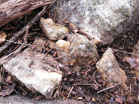
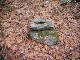
At the moment those zigzag segments of stones along the
small stream by Bunker Hill Road near the proposed Ashford Woods Subdivision
are under or at least obscured by snow cover. I’ll wander back in for another look soon, I hope, looking for some animal effigies stacked artistically in the "stone concentration."
In the meantime, I’m searching back into those Waterbury
Histories, looking for that amusing story about the Worm Fence That Kept Moving
in the Dark of the Night, somewhere on the border of Nichols Farm - and trying to envision
just where the “Rayls” of the Fence may have been, what they might have been
used for in what appears to have been probably used pasture land (although I'm more inclined to think of it as a fuel break around the stream's riparian zone with Indigenous Landscape Management by Fire in mind…
Were these early “hoog pounds" or "Hogfields?"
Mr. Bronson writes in a Waterbury History (and quotes an
old town record): “Jan. 21st, 1689-90, there were grants of land to many of the
proprietors, seven acres to each, the lots to be improved as
"hogfields" or hog enclosures. Into these the swine appear to have been turned, in the summer season, to root the
ground, to pick up the nuts and thus obtain their living. These
"fields" seem to have been east of the town, on and near Farmington
road, in the neighborhood of the long wigwam, Hog Pound, or Beaver Pond Brook,
and Turkey Hill. I quote a passage from the record:
“At the same meeting the proprietors granted to
samuell hickox sr seauen acrs of land on the hill on the west side of hoog
pound broke on the same condition richard porter had his jan 21 1689”
He
includes another quote from “The Record,” speaking about the early Common Fence
that enclosed what were most likely already cleared fields of the Indian
Village known as “Mattatuck” or “No Trees:”
“The common fence was
variously constructed according to the nature of the ground and the convenience
of materials. It was made of rails laid in the form of .the “worm fence,"
or of logs and poles, with the help of stakes. If stones were more abundant
than anything else, these were laid into a wall. I find the hedge fence spoken
of, its strength being increased by stakes. In some instances, a ditch was dug,
and its effect augmented by rails or a hedge upon the embankment.
The following order
relates to the "sufficiency" of the common fence.
In the spring season,
when vegetation began to start, it became the duty of each proprietor to put in
good repair his portion of the common fence. The proprietors each year, in
meeting, fixed upon the day beyond which the work should not be neglected. The
day chosen was usually between the tenth and fifteenth of March.
Early in the spring,
annually, there was a vote passed by the proprietors "to burn about the
common fence." I give an example:
March 6th 1709-10 - The proprietors agreed by voat that the
beating the Drum through the town ouer night shall be warning that the fence on
the west side is to be burnt about the next day and on the east side the day
following.
In obedience to this
summons, all the owners of the common fence sallied forth, each, I suppose, to
look after his own. Wherever the fence was made of combustible material, they
set fire to the dry leaves, grass and other rubbish in its immediate neighborhood,
preventing, by great watchfulness, its spreading to the woods, or destroying
the fence. This being done, the woods and fields were burnt over without
concern for the purpose of improving the pasturage. In this way, too, the
damage which might have resulted from accidental fires, not infrequent, was
prevented...
For many years after the settlement of the town, there were no
private fences except those which inclosed the home lots. Individuals relied on
the common fence to protect their crops. Lands lying without this fence were
for a time undivided. They were used by all for wood, timber, stone, pasturage,
&c., and were called the "commons." The cattle, in the pasturing
season, were kept in herds which were watched by a herdsman...
The meadows and the lands near the river were convenient,
required little clearing or expensive preparation, and were easily worked. On
these and their home lots, the people relied for their crops. In consequence of
the value of the lands which it embraced, the common field was an important
interest. The proprietors gave much of their time to its concerns. They framed
such regulations as were for the good of all. A major vote governed; not a
major vote of the proprietors, but of pounds of propriety. The Colonial
Assembly granted general powers, and prescribed the mode of exercising them…(The History of Waterbury, Connecticut; The Original Township Etc. - http://books.google.com/books/about/The_History_of_Waterbury_Connecticut.html?id=cUMOAAAAIAAJ)"
(Maybe you remember some posts about the Deer Park the Nichols were owners of:
"NICHOLS' PARK, THE PARK, THE PARK GATE, THE PARK FENCE, THE CRANK OF THE PARK—Before 1750 persons in the colony had erected parks or enclosures for keeping and preserving deer… It contained more than three hundred acres, and remains to this day a wild, rugged region, almost untouched by the hand of man."
The town and city of Waterbury, Connecticut - Page 693 by Sarah Johnson Prichard - Reference – 1896
(Used in a discussion here about “Bars” in Early Fences:
Or here where I find that mention of the moving fence, at the watering spot, that might or might not be that little stream:
"...Reuben Nichols lived very near the
Park, where the watering place now is. He also built a house on its western
edge —a part of it set into the ledge—and along which the Park fence ran.
Bethlehem pippins grew there. A somewhat celebrated apple tree of the above variety still stands not
far from the house. The rail fence, in an angle of which this tree stands, it is said was
frequently moved, so as to include the tree—the owner, on either side,
contending for its possession (sort of ruling out any sort of colonial row of stones being used, one might conclude - Tim). Orra Nichols, Gideon's daughter, was, perhaps,
the last descendant of the Nichols family who clung to the Park...( OLD HIGHWAYS AND STREETS. Page 549 "The
Town and City of Waterbury, Connecticut," by Sarah Johnson Prichard)”
Used at:
It’s
possible this may have been, maybe, a part or a border of it, along the Indian
Trail that became known as “BUNKER
HILL ROAD— (Which) Before 1720… was known as the "Upper Road to Woodbury." Later,
after Joseph Nichols settled near where John Atwood lives, it was called "the Road to Nichols' farm and Woodbury bounds." - ibid
And as promised, here's that stone row accented in brown from the earlier post:
With a little (or too much?) Imagination added:
More here below, perhaps?


