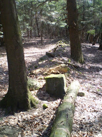
I checked in on "Rock Piles," Wednesday, March 18, 2009, as I do almost every day,
and found this post below:
"Madawaska River area in Ontario, Canada"
"Here is a link to the article "Nineteenth Century Aboriginal Farmers of the Madawaska River" by Bill Allen, Heritage One Research (1.48MB pdf document):
There is a photo on page 5 of stones on a glacial erratic."
https://www.ottawaoas.ca/Symposium%202005/Allen.pdf
Bill Allen writes:
"The 1871 Federal Census listed three families of Aboriginal origin living in the West Madawaska District in present day Algonquin Park (Library and Archives Canada 1871)...
I wondered where I might find evidence of the three Algonquin families. 1870’s maps gave me leads. William Bell’s 1871 timber map labelled what Bell called an "Indian Clearing" at the head of Galeairy Lake (Bell, 1871)...Niven’s 1878 mapping was accurate and specific so I soon rediscovered both the Sharbot and Franceway clearings, now long overgrown but with multiple cultural features. I had them registered as archaeological sites BiGn-03 (Peter Sharbot Homestead) and BjGo-16 (Franceway’s Clearing).
An Indian clearing? Members of the Algonquin Nations of this period were not usually depicted as farmers who cleared land or lived in fixed abodes. In both cases there was a terrace at a saddle between high wooded hills above the lake and a good view eastward to the canoe route passing the front door. In both cases birch have risen in the former clearings. In both cases large panels of birch bark have been removed from some trees that have scarred over (Figure 3).
In both clearings fieldstones were piled to one side, much as one finds in farms of the 1870’s elsewhere. However, unlike 1870’s farms elsewhere there has not been continuous occupation of the land, so the land is overgrown with mature trees. Historical records show that soon after Algonquin Park was formed in 1893 all 46 of Chief Peter Sharbot’s community were evicted from Nightingale and Lawrence, the two townships they had occupied since 1849 (Bennett 1895; Reed 1894; Reed 1895, White 1895)...
...At the Sharbot Homestead, I found many of the field stones piled on flat-topped glacial erratics (Figure 4), ostensibly to maximize the planting area in the clearing. Peter Decontie, Algonquin Sacred Firekeeper from Kitigan Zibi, Quebec, has begun initial analysis of these stone piles, noting alignments, shapes, number patterns and possible effigy outlines. It may be inappropriate to use the term "cairns" to describe such piles of stones in a farming setting with potential spiritual use. Hunting activity is evident in the former clearing too. Some erratics appear to have played a role in hiding hunters, channeling game or being a platform for steadying rifles. Attracted by hunters’ calls, large game may have moved through the saddle between the two hills and on downhill to the clearing where there were fewer obstructions. A test pit beside one flat topped erratic yielded a rare .44 calibre Henry rim-fired cartridge (Figure 5), a shell that was only manufactured between 1860 and 1872 (Allen 2005a). "

Figure 4. Stones on glacial erratic at BiGn-3. Photo by Bill Allen.
This photo reminds me of a stone at the end of my driveway:

I think there'ssome stones missing from Mr. Allen's "field stones piled on flat-topped glacial erratics." There once were just a few on top of the stone at the bottom of my driveway. I just picked up some at the base of the stones and put them back on the depressions most like them (like putting pieces of a puzzle together).


The stone at the end of my driveway is part of a zigzag stone row along a place of cleared fields where native People lived for more than ten years into the first European settlement as well as long before that...
 When I saw the first photo in Peter's post "Short stretches of wall - Gates Pond Rd Berlin, MA... , I thought about how I often find what I think of as "End Stones,", sometimes near water, at the end of many Linear Stone Rows that I think maybe of Native American origin. The one below is close to my house, as it looked before road reconstruction destroyed the point where the zigzag stone row met the linear row. The large end stone is by an intermittent stream along an ancient glacial lake shore on a large floodplain...


